SUMMARY
This is AI generated summarization, which may have errors. For context, always refer to the full article.
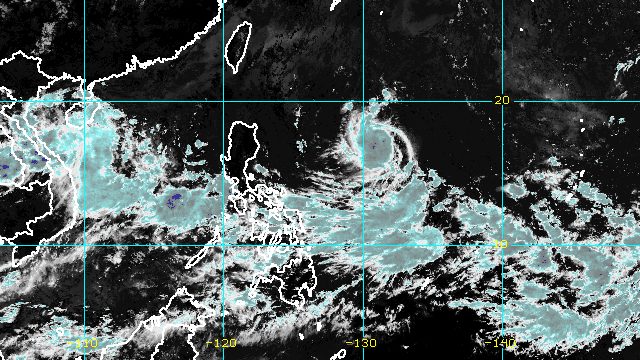
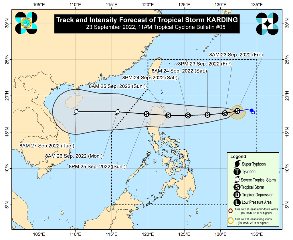
MANILA, Philippines – Tropical Storm Karding continued to accelerate while moving over the Philippine Sea on Friday morning, September 23.
The Philippine Atmospheric, Geophysical, and Astronomical Services Administration (PAGASA) said in its 11 am bulletin on Friday that Karding was located 1,085 kilometers east of Northern Luzon, moving west at 25 kilometers per hour from the previous 10 km/h.
The tropical storm is heading for the east coast of Northern Luzon, where it could make landfall on Sunday morning, September 25.
“After crossing the mountainous terrain of Northern Luzon throughout Sunday, the tropical cyclone will continue tracking over the West Philippine Sea,” added PAGASA.
So far, Karding continues to have maximum sustained winds of 65 km/h and gustiness of up to 80 km/h.
But it is projected to gradually intensify before hitting Northern Luzon, and could make landfall “as a high-end tropical storm or a low-end severe tropical storm.”
Karding may also slightly weaken as it crosses Northern Luzon’s rugged terrain, but PAGASA said it will probably still be a tropical storm by the time it emerges over the West Philippine Sea.
Since Karding has accelerated, rain from the tropical storm may begin on Saturday evening, September 24. Here is PAGASA’s updated rainfall forecast:
Saturday evening, September 24, until early Sunday morning, September 25
Light to moderate rain, with at times heavy rain
- Batanes
- Cagayan
- Isabela
Rest of Sunday, September 25, until early Monday morning, September 26
Moderate to heavy rain, with at times intense rain
- Cordillera Administrative Region
- Cagayan
- Isabela
- Ilocos Norte
- Ilocos Sur
- La Union
Light to moderate rain, with at times heavy rain
- rest of Cagayan Valley
- rest of Ilocos Region
- northern part of Aurora
The weather bureau warned that floods and landslides are possible.
PAGASA also said the southwest monsoon or hanging habagat, “partly influenced by Karding,” may bring occasional rain to most of Southern Luzon and the Visayas beginning Sunday.
Meanwhile, tropical cyclone wind signals could be raised as early as Friday night for the eastern parts of Northern Luzon and Central Luzon, so these areas can prepare in advance.
Signal No. 2 is the “most likely” highest wind signal. But the weather bureau is not ruling out the possibility of raising Signal No. 3, in case Karding becomes a severe tropical storm.
As for coastal conditions, the northeasterlies may cause moderate to rough seas in the northern and western seaboards of Northern Luzon by Saturday. Waves will be 1.2 to 3.5 meters high.
Then on Sunday, moderate to rough seas are seen to continue for the seaboards of Northern Luzon (waves 1.2 to 4 meters high) and could begin in the eastern seaboard of Central Luzon (waves 1.2 to 3 meters high) due to Karding. This may be risky for small vessels.
Karding is the Philippines’ 11th tropical cyclone for 2022.
It is also the third tropical cyclone for September, after Typhoon Inday (Muifa) and Super Typhoon Josie (Nanmadol). Inday and Josie did not make landfall in the country.
PAGASA expects 7 to 11 tropical cyclones to enter or develop inside the Philippine Area of Responsibility from September 2022 to February 2023. Per month, these are the weather bureau’s estimates:
- September 2022 – 2 or 3
- October 2022 – 2 to 4
- November 2022 – 2 or 3
- December 2022 – 1 or 2
- January 2023 – 0 or 1
- February 2023 – 0 or 1
– Rappler.com
Add a comment
How does this make you feel?


There are no comments yet. Add your comment to start the conversation.