SUMMARY
This is AI generated summarization, which may have errors. For context, always refer to the full article.
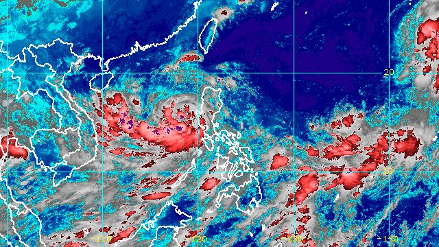
MANILA, Philippines – Typhoon Karding (Noru) continued to move away from Luzon early Monday morning, September 26, though a few areas are still seeing rain and some remain under tropical cyclone wind signals.
Karding was last spotted 190 kilometers west of Dagupan City, Pangasinan, still moving west northwest over the West Philippine Sea at 30 kilometers per hour (km/h).
It is heading toward Vietnam and will leave the Philippine Area of Responsibility (PAR) on Monday evening.
The Philippine Atmospheric, Geophysical, and Astronomical Services Administration (PAGASA) also said in its 8 am bulletin on Monday that Karding maintained its strength, with maximum sustained winds of 140 km/h and gustiness of up to 170 km/h.
Karding is still expected to bring rain until noon on Monday. Scattered floods and landslides remain possible.
Moderate to heavy rain, with at times intense rain
- Zambales
- Bataan
- Lubang Islands
Light to moderate rain, with at times heavy rain
- western part of Pangasinan
PAGASA had also issued a separate advisory at 5 am on Monday for the southwest monsoon or hanging habagat, which is bringing rain to the following areas:
Moderate to heavy rain
- Zambales
- Bataan
- Occidental Mindoro
- Palawan
Light to moderate rain, with at times heavy rain
- Metro Manila
- Calabarzon
- rest of Central Luzon
- Western Visayas
As Karding moved further away, only Signal Nos. 1 and 2 stayed in effect as of 8 am.
Signal No. 2
Gale-force winds (62 to 88 km/h), minor to moderate threat to life and property
- western part of Pangasinan (Bolinao, Bani, Alaminos City, Anda, Sual, Labrador, Mabini, Agno, Burgos, Dasol, Infanta, Bugallon, Lingayen, Aguilar)
- northern part of Zambales (Santa Cruz, Candelaria, Masinloc, Palauig, Iba)
Signal No. 1
Strong winds (39 to 61 km/h), minimal to minor threat to life and property
- La Union
- rest of Pangasinan
- southern part of Benguet (Sablan, La Trinidad, Itogon, Baguio City, Tuba, Kapangan, Tublay)
- rest of Zambales
- northern part of Bataan (Bagac, Balanga City, Abucay, Samal, Morong, Orani, Hermosa, Dinalupihan)
- Tarlac
- Pampanga
- western part of Nueva Ecija (Cabiao, San Isidro, Jaen, San Antonio, Lupao, Science City of Muñoz, Santo Domingo, Talavera, Aliaga, Zaragoza, Cuyapo, Talugtug, Nampicuan, Guimba, Licab, Quezon)
A gale warning remains in place, covering the western seaboards of Northern Luzon and Central Luzon, particularly Ilocos Sur, La Union, Pangasinan, Zambales, and Bataan. Seas are rough to very rough, with waves 2.8 to 4.5 meters high. PAGASA advised fishing boats not to sail and larger vessels to watch out for big waves.
The enhanced southwest monsoon may also cause moderate to rough seas in the western seaboards of Southern Luzon, the Visayas, and Mindanao. Waves could be 1.5 to 3 meters high, which may be risky for small vessels.

At its peak, Karding was a super typhoon with maximum sustained winds of 195 km/h.
Karding first made landfall as a super typhoon in Burdeos, Quezon, at 5:30 pm on Sunday, September 25, followed by another landfall as a typhoon in Dingalan, Aurora, at 8:20 pm.
It then crossed Nueva Ecija, Tarlac, and Zambales, before emerging over Zambales’ coastal waters early Monday.
Karding is the Philippines’ 11th tropical cyclone for 2022.
It is also the third tropical cyclone for September, after Typhoon Inday (Muifa) and Super Typhoon Josie (Nanmadol). Inday and Josie did not make landfall in the country.
PAGASA expects 7 to 11 tropical cyclones to enter or develop inside PAR from September 2022 to February 2023. Per month, these are the weather bureau’s estimates:
- September 2022 – 2 or 3
- October 2022 – 2 to 4
- November 2022 – 2 or 3
- December 2022 – 1 or 2
- January 2023 – 0 or 1
- February 2023 – 0 or 1
– Rappler.com
Add a comment
How does this make you feel?


There are no comments yet. Add your comment to start the conversation.