SUMMARY
This is AI generated summarization, which may have errors. For context, always refer to the full article.
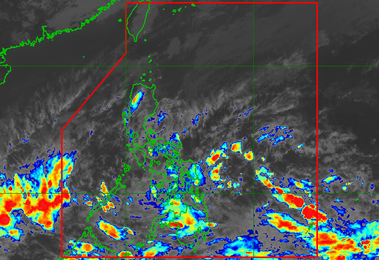
MANILA, Philippines – Scattered rain and thunderstorms will persist in parts of the Philippines due to the low pressure area (LPA) which is embedded along the intertropical convergence zone (ITCZ).
The Philippine Atmospheric, Geophysical, and Astronomical Services Administration (PAGASA) said in its 4 pm bulletin on Wednesday, April 6, that the LPA was already 130 kilometers east of Davao City or over the coastal waters of the municipality of Caraga in Davao Oriental province.
Rain from the LPA and the ITCZ will hit these areas in the next 24 hours:
- Visayas
- Mindanao
- Bicol
- Quezon
- Palawan
Affected areas must stay on alert for floods and landslides.
PAGASA Weather Specialist Ana Clauren said the LPA continues to have just a slim chance of developing into a tropical cyclone.
The weather bureau, however, is now monitoring a tropical depression that formed outside the Philippine Area of Responsibility (PAR).
The tropical depression was located 2,485 kilometers east of Mindanao on Wednesday afternoon, slowly moving west northwest.
It has maximum sustained winds of 45 kilometers per hour and gustiness of up to 55 km/h.
PAGASA is expected to provide updates on the tropical depression in the coming days. The weather bureau earlier said the Philippines could have zero to one tropical cyclone in April.
Meanwhile, the northeasterly surface windflow is bringing some rain to Cagayan Valley, the Ilocos Region, the Cordillera Administrative Region, and Aurora on Wednesday, but PAGASA said there would be “no significant impact.” – Rappler.com
Add a comment
How does this make you feel?


There are no comments yet. Add your comment to start the conversation.