SUMMARY
This is AI generated summarization, which may have errors. For context, always refer to the full article.
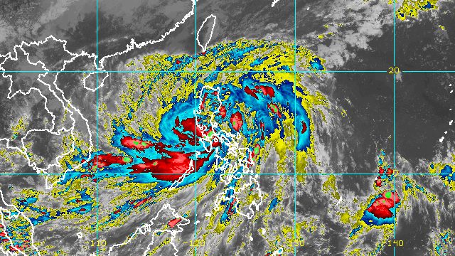
MANILA, Philippines – Severe Tropical Storm Paeng (Nalgae) made its fifth landfall in Sariaya, Quezon, at 1:40 pm on Saturday, October 29, then proceeded to cross Laguna.
Paeng was earlier expected to make its fifth landfall in San Juan, Batangas, which is adjacent to Sariaya.
The severe tropical storm’s first four landfalls were also on Saturday, in the following areas:
- Virac, Catanduanes – 1:10 am
- Caramoan, Camarines Sur – 1:40 am
- Buenavista, Quezon – 6 am
- Santa Cruz, Marinduque – 8:40 am
By 4 pm, Paeng was already in the vicinity of San Pablo City, Laguna, moving northwest at a slightly faster 20 kilometers per hour from the previous 15 km/h.
The Philippine Atmospheric, Geophysical, and Astronomical Services Administration (PAGASA) said in a briefing past 5 pm that the severe tropical storm is expected to cross the Cavite-Batangas area, then the southern part of Bataan for the rest of Saturday.
PAGASA Senior Weather Specialist Raymond Ordinario said Paeng would be closest to Metro Manila between 5 pm and 11 pm on Saturday.

So far, Paeng still has maximum sustained winds of 95 km/h, with gustiness of up to 160 km/h. It is now seen to maintain its strength while crossing Southern Luzon, instead of weakening into a tropical storm.
PAGASA added that Paeng may intensify once it emerges over the West Philippine Sea.
The weather bureau warned that rain will persist until Sunday, October 30. Floods and landslides can still occur.
Saturday evening, October 29
Heavy to intense rain, with at times torrential rain
- Metro Manila
- Calabarzon
- Marinduque
- Romblon
- Occidental Mindoro
- Oriental Mindoro
- northern part of Palawan including Calamian and Cuyo Islands
Moderate to heavy rain, with at times intense rain
- Camarines Norte
- Camarines Sur
- mainland Cagayan Valley
- Cordillera Administrative Region
- Central Luzon
- Western Visayas
Light to moderate rain, with at times heavy rain
- rest of Luzon
- rest of Visayas
Sunday, October 30
Moderate to heavy rain, with at times intense rain
- Zambales
- Bataan
- Ilocos Region
Light to moderate rain, with at times heavy rain
- Metro Manila
- Cordillera Administrative Region
- Mimaropa
- Calabarzon
- rest of Central Luzon
Tropical cyclone wind signals remain in effect as of 5 pm on Saturday, particularly in these areas:
Signal No. 3
Storm-force winds (89 to 117 km/h), moderate to significant threat to life and property
- Metro Manila
- Bataan
- southern part of Zambales (Olongapo City, Subic, Castillejos, San Antonio)
- northern and central parts of Quezon (Pitogo, Lucena City, Pagbilao, Infanta, Tiaong, Unisan, Plaridel, San Antonio, Candelaria, Lucban, Sampaloc, Padre Burgos, Sariaya, Tayabas City, Mauban, Dolores, General Nakar, Agdangan, Gumaca, Atimonan, Real, Macalelon, General Luna, Catanauan) including Polillo Islands
- Laguna
- Batangas
- Cavite
- Rizal
- northwestern part of Occidental Mindoro (Paluan, Abra de Ilog) including Lubang Islands
- northern part of Oriental Mindoro (San Teodoro, Puerto Galera, Baco, Calapan City, Naujan)
Signal No. 2
Gale-force winds (62 to 88 km/h), minor to moderate threat to life and property
- southern part of Aurora (San Luis, Baler, Dingalan, Maria Aurora)
- Bulacan
- Pampanga
- Tarlac
- rest of Zambales
- western part of Camarines Sur (Siruma, Tinambac, Milaor, Camaligan, Pili, San Fernando, Magarao, Minalabac, Naga City, Calabanga, Bombon, Canaman, Gainza, Sipocot, Del Gallego, Ragay, Lupi, Pasacao, Cabusao, Libmanan, Pamplona)
- rest of Oriental Mindoro
- rest of Occidental Mindoro
- Nueva Ecija
- Pangasinan
- Camarines Norte
- rest of Quezon
- Marinduque
- Romblon
Signal No. 1
Strong winds (39 to 61 km/h), minimal to minor threat to life and property
- Isabela
- Nueva Vizcaya
- Quirino
- La Union
- Kalinga
- Abra
- Benguet
- Ifugao
- Mountain Province
- Ilocos Sur
- rest of Aurora
- Catanduanes
- rest of Camarines Sur
- Albay
- Sorsogon
- Masbate including Ticao and Burias Islands
- northern part of Palawan (El Nido, Taytay, Dumaran, Araceli, Roxas, San Vicente) including Calamian Islands and Cuyo Islands
- Northern Samar
- northern part of Eastern Samar (San Policarpo, Oras, Arteche, Jipapad, Maslog, Dolores, Can-avid)
- northern part of Leyte (Tunga, San Miguel, Matag-ob, Calubian, Leyte, Carigara, Babatngon, Jaro, San Isidro, Santa Fe, Villaba, Palompon, Merida, Ormoc City, Isabel, Capoocan, Alangalang, Tabango, Tacloban City, Kananga, Barugo)
- Biliran
- northern and central parts of Samar (San Jorge, San Sebastian, Santa Rita, Villareal, Zumarraga, Matuguinao, Pinabacdao, Almagro, Calbayog City, Talalora, Jiabong, Pagsanghan, Catbalogan City, Gandara, Motiong, Santo Niño, Tagapul-an, San Jose de Buan, Santa Margarita, Tarangnan, Daram, Paranas, Hinabangan, Calbiga)
- northern and central parts of Cebu (Daanbantayan, Medellin, San Remigio, Tabogon, Bogo City, Borbon, Tabuelan, Sogod, Catmon, Tuburan, Carmen, Danao City, Asturias, Balamban, Compostela, Toledo City, Pinamungahan, Cebu City, Mandaue City, Consolacion, Liloan, Lapu-Lapu City, Aloguinsan, Minglanilla, Talisay City, Naga City, San Fernando, Carcar City, Barili) including Bantayan and Camotes Islands
- northern and central parts of Negros Occidental (Sagay City, Cadiz City, Escalante City, Manapla, Enrique B. Magalona, Victorias City, Silay City, Talisay City, Murcia, Bacolod City, Bago City, Pulupandan, Valladolid, La Carlota City, La Castellana, San Enrique, Pontevedra, Hinigaran, Moises Padilla, Isabela, San Carlos City, Salvador Benedicto, Calatrava, Toboso, Binalbagan, Himamaylan City)
- northern part of Negros Oriental (Canlaon City, Vallehermoso, La Libertad, Guihulngan City, Jimalalud, Tayasan)
- Guimaras
- Capiz
- Iloilo
- Aklan
- Antique
Meanwhile, the surge of the northeast monsoon or hanging amihan enhanced by Paeng is bringing strong winds to these areas:
- Batanes
- Babuyan Islands
- northern and eastern parts of mainland Cagayan
- Ilocos Norte
- northern part of Apayao

PAGASA also warned that there is a minimal to moderate risk of storm surges up to 2 meters high, which may cause floods in the “low-lying and exposed coastal areas” of the following:
- western part of Pangasinan
- Bataan
- Quezon
- Bulacan
- Metro Manila
- Cavite
- Batangas
- Marinduque
- western part of Camarines Sur
- Burias Island
In addition, a new gale warning was issued at 5 pm on Saturday, with Paeng continuing to affect the country’s coastal waters.
- seaboards of Central Luzon and Southern Luzon and western seaboard of Northern Luzon (Aurora, Zambales, Bataan, Pampanga, Bulacan, Metro Manila, Cavite, Batangas, Quezon including Polillo Islands, Occidental Mindoro including Lubang Islands, Oriental Mindoro, Marinduque, Romblon, Camarines Norte, Camarines Sur, Catanduanes, Albay, Sorsogon, Masbate including Burias and Ticao Islands, Ilocos Norte, Ilocos Sur, La Union, Pangasinan) – very rough to high seas, waves 4.5 to 8 meters high
- northern and eastern seaboards of Northern Luzon (Batanes, Cagayan including Babuyan Islands, Isabela) – very rough seas, waves 4.5 to 6 meters high
- seaboards of Visayas and Palawan (Aklan, Antique, Capiz, Iloilo, Guimaras, Negros Occidental, Negros Oriental, Cebu, Bohol, Siquijor, Northern Samar, Samar, Eastern Samar, Biliran, Palawan including Calamian, Cuyo, Cagayancillo, and Kalayaan Islands) – rough to very rough seas, waves 4 to 5.5 meters high
- eastern seaboards of Visayas and Mindanao (Leyte, Southern Leyte, Surigao del Norte including Siargao and Bucas Grande Islands, Dinagat Islands, Surigao del Sur, eastern coast of Davao Oriental) – rough to very rough seas, waves 2.8 to 4.5 meters high
“Rough to high sea conditions are risky for all types of sea vessels. Mariners are advised to remain in port or take shelter in port until winds and waves subside,” PAGASA said.
Paeng may leave the Philippine Area of Responsibility (PAR) on Monday, October 31. It is the country’s 16th tropical cyclone for 2022 and the fourth for October.
Aside from Paeng, the weather bureau is monitoring a tropical depression outside PAR.
The tropical depression was last spotted 1,460 kilometers east of northeastern Mindanao on Saturday afternoon, slowly moving west southwest.
It still has maximum sustained winds of 45 km/h and gustiness of up to 55 km/h.
PAGASA said the tropical depression may enter PAR on Monday or on Tuesday, November 1. It may not directly affect the Philippines, though the public should still monitor developments. – Rappler.com
Add a comment
How does this make you feel?


There are no comments yet. Add your comment to start the conversation.