SUMMARY
This is AI generated summarization, which may have errors. For context, always refer to the full article.
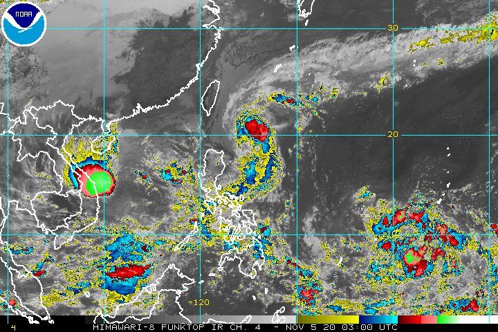
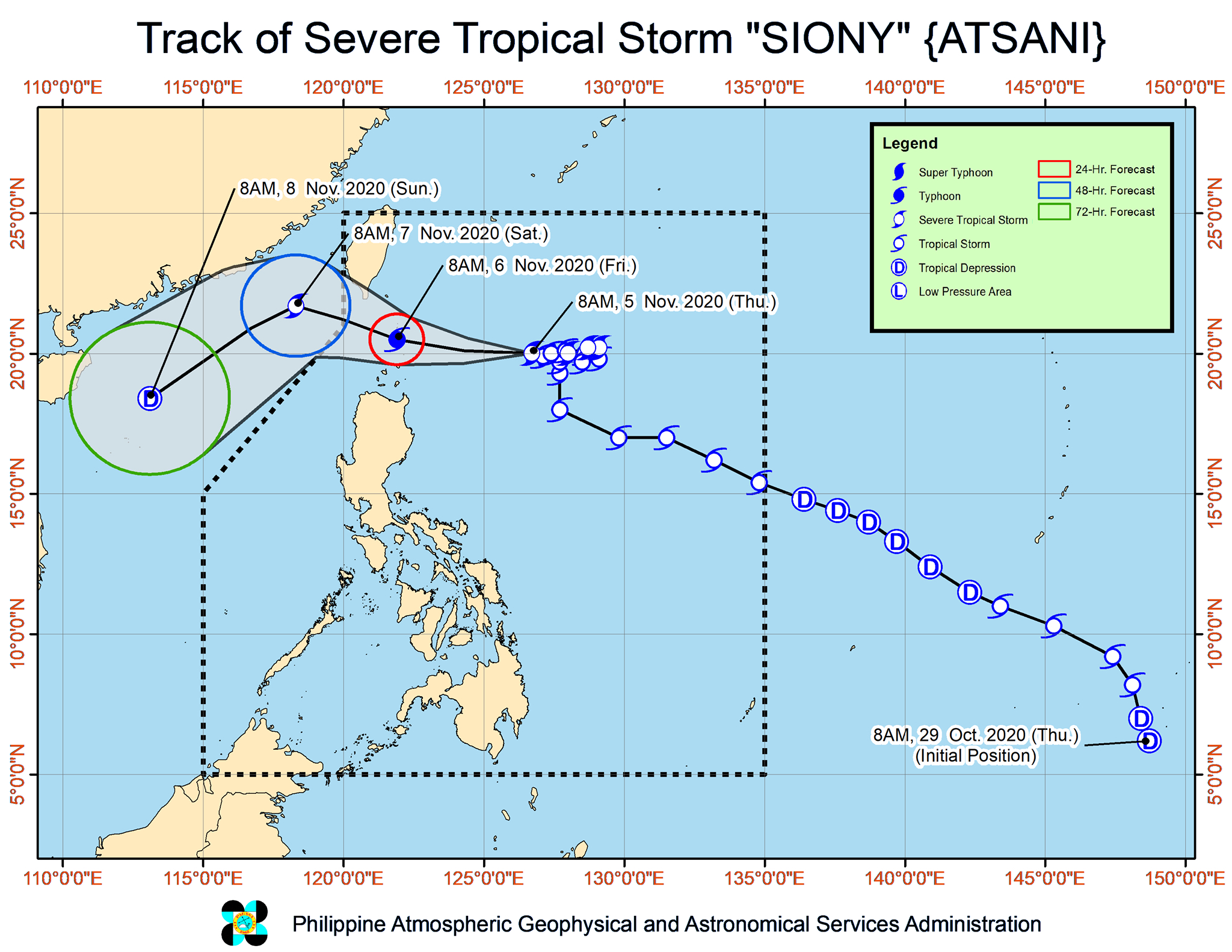
The northernmost areas of the Philippines are set to be affected by Severe Tropical Storm Siony (Atsani), which maintained its strength on Thursday morning, November 5.
In its 11 am bulletin on Thursday, the Philippine Atmospheric, Geophysical, and Astronomical Services Administration (PAGASA) said Siony is now 475 kilometers east of Basco, Batanes.
The severe tropical storm is moving west at 25 kilometers per hour (km/h), heading for the Luzon Strait, the waterway between Luzon and Taiwan.
There is a chance of landfall in Batanes or the Babuyan Islands on Friday morning, November 6. Siony may also just pass near the area, according to PAGASA, but residents are still advised to prepare. (READ: FAST FACTS: Tropical cyclones, rainfall advisories)
Siony still has maximum sustained winds of 95 km/h and gustiness of up to 115 km/h as of Thursday morning. But it may intensify into a typhoon with a peak intensity of 120 km/h by Friday morning, when it makes landfall or passes near Batanes and the Babuyan Islands.
Below is the list of areas under tropical cyclone wind signals as of 11 am on Thursday.
Signal No. 2
- Batanes
- Babuyan Islands
Signal No. 1
- northern part of mainland Cagayan (Santa Ana, Gonzaga, Lal-lo, Allacapan, Santa Teresita, Buguey, Camalaniugan, Aparri, Ballesteros, Abulug, Pamplona, Sanchez-Mira, Claveria, Santa Praxedes)
- northern part of Apayao (Santa Marcela, Luna, Calanasan)
- northern part of Ilocos Norte (Adams, Pagudpud, Bangui, Dumalneg, Burgos, Vintar, Pasuquin, Bacarra)
PAGASA said “the earliest onset of strong breeze to near gale conditions” in areas under Signal Nos. 1 and 2 would be between Thursday night and early Friday morning.
Then by Friday morning, “damaging gale- to storm-force winds” would begin to affect areas under Signal No. 2.
Note that tropical cyclone wind signals are issued in advance, so residents would have time to prepare for strong winds.
PAGASA said the highest possible tropical cyclone wind signal that could be raised due to Siony is Signal No. 3.
For now, while tropical cyclone winds have yet to be experienced, PAGASA said the northeasterlies will continue to bring strong breeze to near gale conditions to these areas:
- Batanes
- Babuyan Islands
- northern part of Ilocos Norte
- northern and eastern coastal areas of mainland Cagayan
Siony’s trough or extension is also expected to bring scattered rain in the next 24 hours. The rain will mostly be light to moderate, but may be heavy at times, in these areas:
- Pangasinan
- Central Luzon
- Metro Manila
- Calabarzon
- Mimaropa
- Bicol
- Visayas
- Mindanao
PAGASA warned that moderate to heavy rain due to Siony will begin affecting Batanes and the Babuyan Islands early Friday morning.
The affected areas must be on alert for possible floods and landslides.
The state weather bureau also warned that travel is risky in certain seaboards in the next 24 hours.
- areas under Signal Nos. 1 and 2 – rough to high seas (waves 3 to 7 meters high), risky for all vessels
- areas under a gale warning – rough to very rough seas (waves 2.5 to 5.5 meters high), risky for small vessels
There will also be moderate to rough seas, with waves 1.5 to 2.5 meters high, here:
- western seaboards of Central Luzon and Southern Luzon
- eastern seaboards of Visayas and Mindanao
PAGASA advised small vessels to take precautionary measures, and “inexperienced mariners” to avoid such waters.
Siony is expected to leave the Philippine Area of Responsibility (PAR) on Friday afternoon or evening.
By Saturday morning, November 7, it may speed up over the West Philippine Sea and head for the central or southern part of Vietnam, according to PAGASA.
After leaving PAR, Siony may also gradually weaken.
Meanwhile, PAGASA spotted a new low pressure area (LPA) outside PAR, at 1,920 kilometers east of the Visayas.
The state weather bureau said the LPA may enter PAR on Friday or Saturday.
But it is “less likely” to develop into a tropical depression in the next 24 hours. Updates are expected in the coming days.
Siony is already the Philippines’ 19th tropical cyclone for 2020.
An average of 20 tropical cyclones form within or enter PAR each year. (READ: LIST: PAGASA’s names for tropical cyclones in 2020)
These are PAGASA’s latest estimates for the number of tropical cyclones inside PAR in the next 6 months:
- November 2020 – 1 to 3
- December 2020 – 2 or 3
- January 2021 – 0 or 1
- February 2021 – 0 or 1
- March 2021 – 0 or 1
- April 2021 – 0 or 1
In early October, the state weather bureau warned Filipinos to expect more rain in the coming months due to the onset of La Niña. – Rappler.com
Add a comment
How does this make you feel?


There are no comments yet. Add your comment to start the conversation.