SUMMARY
This is AI generated summarization, which may have errors. For context, always refer to the full article.
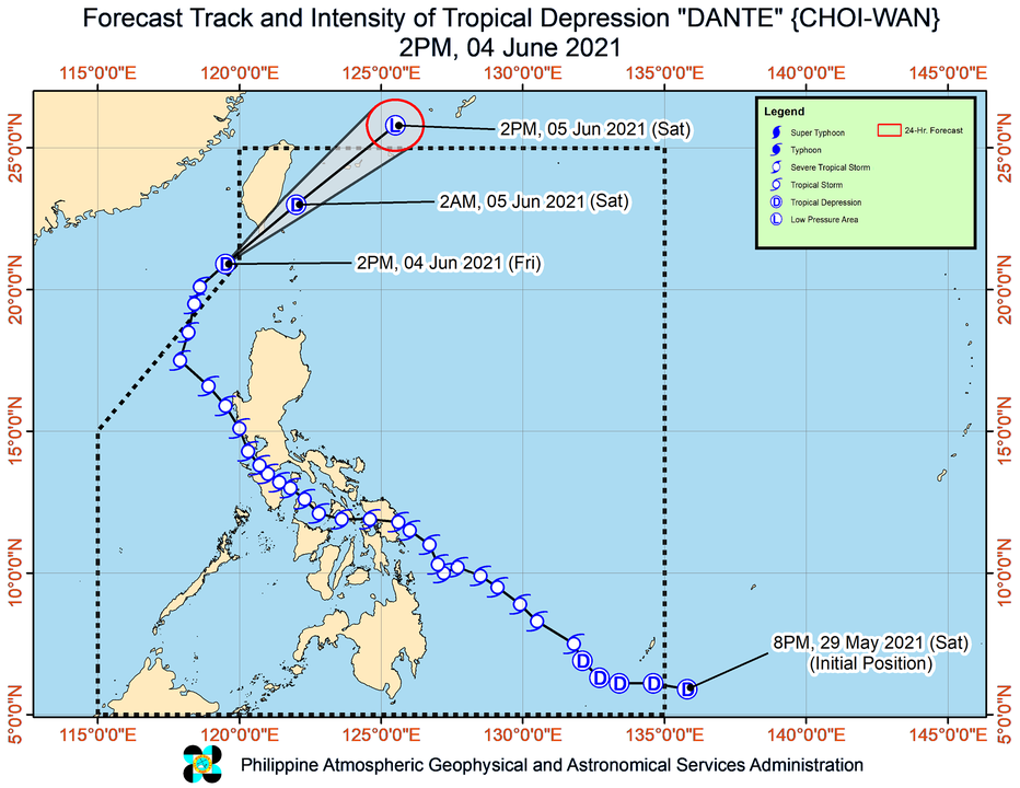
Dante (Choi-wan) weakened from a tropical storm into a tropical depression while outside the Philippine Area of Responsibility at 2 pm on Friday, June 4, then reentered PAR at 4 pm.
In a briefing past 5 pm on Friday, the Philippine Atmospheric, Geophysical, and Astronomical Services Administration (PAGASA) said Dante was 210 kilometers west northwest of Basco, Batanes, or 185 kilometers west of Itbayat, Batanes.
Signal No. 1 is now raised for the province of Batanes, which means it will experience strong winds due to Dante.
The tropical depression has maximum sustained winds of 55 kilometers per hour and gustiness of up to 70 km/h.
Dante is moving northeast at 20 kilometers per hour (km/h). It is expected to maintain that direction, heading for Taiwan, which is still within PAR.
PAGASA said Dante could pass near to or make landfall in the southern part of Taiwan, possibly in the Pingtung County area, on Friday evening.
Then the tropical depression is seen to continue moving northeast toward the East China Sea, and finally, leaving PAR again on Saturday afternoon, June 5.
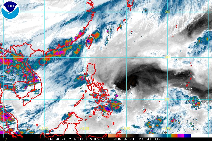
While over the East China Sea, Dante is also projected to transition into an extratropical cyclone. An extratropical cyclone is a “low pressure system which develops in latitudes outside the tropics,” according to the World Meteorological Organization. (READ: FAST FACTS: Tropical cyclones, rainfall advisories)
PAGASA also said on Friday afternoon that a gale warning remains in effect for the northern seaboard of Northern Luzon. Seas are rough, with waves 2.8 to 4 meters high.
The state weather bureau warned that travel is risky for small vessels, while “mariners without the proper experience should immediately seek safe harbor.”
Dante, the Philippines’ fourth tropical cyclone for 2021, first entered PAR at 1 am on Sunday, May 30. Its first exit was at 2 am on Friday, so its original stay was around five days.
As a tropical storm, Dante first affected parts of Mindanao, even before it hit land.
Then it made landfall eight times – the first in the Visayas and the rest in Luzon.
Tuesday, June 1
- Sulat, Eastern Samar – 8:30 pm
Wednesday, June 2
- Cataingan, Masbate – 1 am
- Balud, Masbate – 3:30 am
- Romblon, Romblon – 8 am
- San Agustin, Romblon – 8:50 am
- Pola, Oriental Mindoro – 2 pm
- Maricaban Island, Tingloy, Batangas – 7:20 pm
- Calatagan, Batangas – 8 pm
The National Disaster Risk Reduction and Management Council said on Friday it is verifying initial reports that Dante left at least six people dead, two injured, and three missing.
The country has an average of 20 tropical cyclones every year. (READ: LIST: PAGASA’s names for tropical cyclones in 2021)
For June to November, PAGASA estimates the following number of tropical cyclones inside PAR:
- June – 1 to 3
- July – 2 to 4
- August – 2 or 3
- September – 2 or 3
- October – 2 or 3
- November – 2 or 3
The state weather bureau declared the start of the rainy season on Friday. – Rappler.com
Add a comment
How does this make you feel?


There are no comments yet. Add your comment to start the conversation.