SUMMARY
This is AI generated summarization, which may have errors. For context, always refer to the full article.
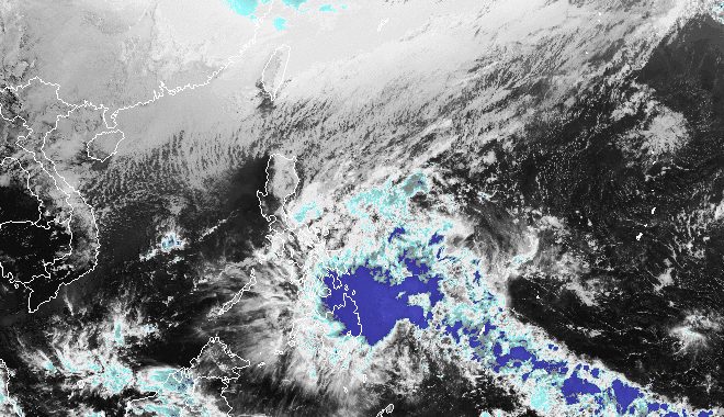
MANILA, Philippines – Tropical Depression Kabayan maintained its strength while still moving slowly toward Mindanao late Sunday afternoon, December 17.
Kabayan was last spotted 385 kilometers east of Davao City or 315 kilometers east southeast of Hinatuan, Surigao del Sur, said the Philippine Atmospheric, Geophysical, and Astronomical Services Administration (PAGASA) in its 5 pm bulletin on Sunday.
The tropical depression is slowly heading west. At its current pace, it could make landfall in Surigao del Sur or Davao Oriental on Sunday night or early Monday morning, December 18.
So far, Kabayan still has maximum sustained winds of 55 kilometers per hour and gustiness of up to 70 km/h.
PAGASA said Kabayan is “likely to maintain its strength until its initial landfall over Mindanao,” but there is also a chance of it intensifying into a tropical storm before hitting land.
Floods and landslides are likely in the following areas seeing rain from Kabayan:
Sunday afternoon, December 17, to Monday afternoon, December 18
- 100-200 millimeters (mm): Surigao del Sur, Surigao del Norte, Dinagat Islands, Southern Leyte
- 50-100 mm: Eastern Visayas, Davao Region, Northern Mindanao, rest of Caraga
Monday afternoon, December 18, to Tuesday afternoon, December 19
- 100-200 mm: Surigao del Sur, Surigao del Norte, Dinagat Islands, Southern Leyte
- 50-100 mm: Eastern Visayas, Central Visayas, Northern Mindanao, rest of Caraga
Earlier on Sunday, the weather bureau also warned that the shear line may trigger heavy rain in Bicol on Sunday and Monday. Floods and landslides are possible in the region as well.
ALSO ON RAPPLER
- Why a Filipina nun, ‘daughter’ of Mother Teresa, refuses to leave Gaza
- A year when Pinoy music thrived: Breakthrough OPM acts of 2023
- Thailand’s Chatnalin Chotjirawarachat is Miss Intercontinental 2023
- Alyssa Valdez glad to replace UAAP heartbreak in Araneta with new PVL title memory
Meanwhile, Signal No. 1 has been raised in more areas as of 5 pm on Sunday. Strong winds are expected due to Kabayan.
- Southern Leyte
- Leyte
- southern part of Samar (Basey, Santa Rita, Marabut, Talalora, Villareal, Pinabacdao)
- southern part of Eastern Samar (Maydolong, Borongan City, Quinapondan, Guiuan, Lawaan, Balangiga, Llorente, Giporlos, Salcedo, Balangkayan, General MacArthur, Hernani, Mercedes)
- Cebu including Camotes Islands
- Bantayan Islands
- Bohol
- Siquijor
- Dinagat Islands
- Surigao del Norte
- Surigao del Sur
- northern part of Davao Oriental (Cateel, Boston, Baganga, Manay, Caraga)
- Agusan del Norte
- Misamis Oriental
- Camiguin
- Bukidnon
- Agusan del Sur
- Davao de Oro
- Misamis Occidental
- Lanao del Norte
- Lanao del Sur
- northern and central parts of Davao del Norte (Santo Tomas, New Corella, Braulio E. Dujali, Panabo City, Asuncion, Tagum City, Talaingod, Carmen, Kapalong, San Isidro)
- Davao City
- northern part of Cotabato (Arakan, Carmen, Banisilan, Alamada, President Roxas, Kabacan, Matalam, Antipas, Magpet)
- northern part of Maguindanao (Buldon, Barira, Matanog)
PAGASA also said the surge of the northeast monsoon or amihan will cause gusty conditions on Sunday and Monday in Batanes, Babuyan Islands, Ilocos Norte, Ilocos Sur, Aurora, Bataan, Bulacan, Rizal, Quezon, Lubang Island, Marinduque, Cuyo Islands, Bicol, Visayas, northern and eastern parts of mainland Cagayan, eastern parts of Isabela and Nueva Ecija, and parts of the Cordillera Administrative Region, Zambales, Pampanga, Cavite, Occidental Mindoro, and Oriental Mindoro.
Due to Kabayan and the surge of the northeast monsoon, another gale warning was issued at 5 pm on Sunday for coastal waters along the seaboard of Northern Luzon and the eastern seaboards of the Visayas and Mindanao. Travel is risky for small vessels.
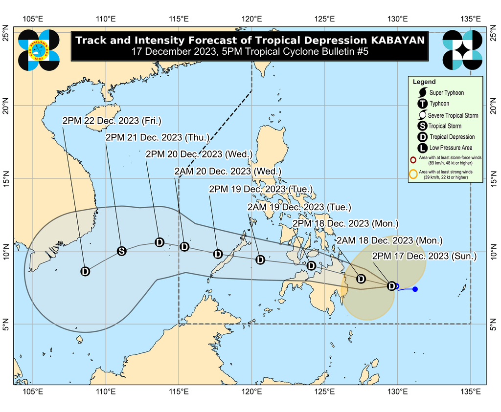
After its expected landfall, Kabayan is seen to “cross the rugged terrain of Mindanao” then emerge over the Bohol Sea or the Sulu Sea on Monday morning or afternoon.
“Due to frictional effects associated with landfall, Kabayan is forecast to weaken over land and the possibility of being downgraded into a low pressure area while over land or after emerging over the sea is not ruled out – although in such a case, redevelopment may still occur over the Sulu Sea,” PAGASA said.
Kabayan could then move across the Sulu Sea, south of Cuyo Islands, until early Tuesday morning, December 19. Then it might make another landfall in the central or southern part of Palawan by Tuesday morning, before finally emerging over the Philippine Sea by noon or early afternoon that day.
“Afterwards, Kabayan may pass near or over Kalayaan Islands in the West Philippine Sea,” PAGASA added.
The weather bureau stressed that “the projected track and intensity of the tropical depression remain subject to change, given its nature and strength.”
Kabayan is the Philippines’ 11th tropical cyclone for 2023 and the first for December.
PAGASA previously estimated that one or two tropical cyclones could form within or enter the Philippine Area of Responsibility in December. – Rappler.com
Add a comment
How does this make you feel?


There are no comments yet. Add your comment to start the conversation.