SUMMARY
This is AI generated summarization, which may have errors. For context, always refer to the full article.
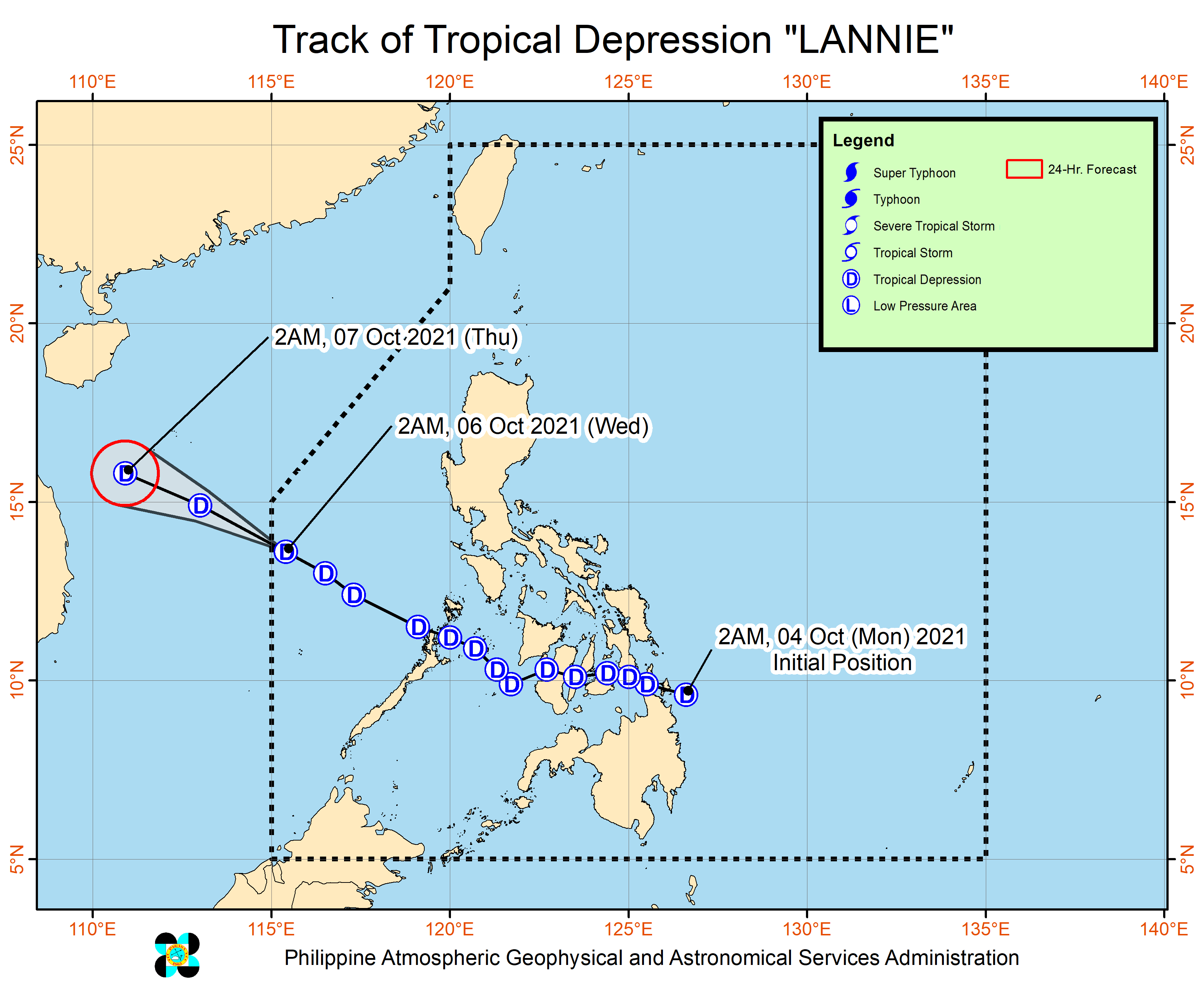
Tropical Depression Lannie was about to leave the Philippine Area of Responsibility (PAR) early Wednesday morning, October 6, but there is a low pressure area (LPA) which could enter within the day.
Tropical Depression Lannie
The Philippine Atmospheric, Geophysical, and Astronomical Services Administration (PAGASA) said in its 5 am bulletin on Wednesday that Lannie was already 670 kilometers west of Calapan City, Oriental Mindoro.
The tropical depression is moving west northwest at 25 kilometers per hour (km/h) and may exit PAR within two to three hours.
It still has maximum sustained winds of 45 km/h and gustiness of up to 55 km/h. (READ: FAST FACTS: Tropical cyclones, rainfall advisories)
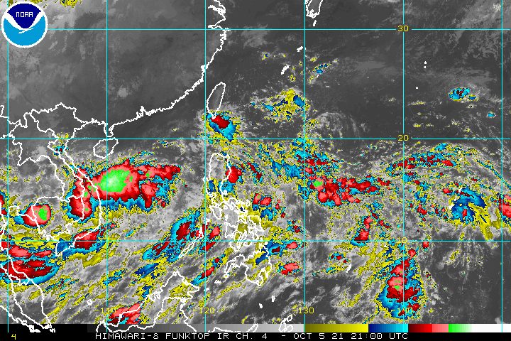
Only Lannie’s trough or extension continues to affect the western part of Mimaropa, bringing scattered rain showers and thunderstorms early Wednesday.
Signal No. 1, the only tropical cyclone wind signal raised due to Lannie, had been lifted at 11 am on Tuesday, October 5.
But on Wednesday, there will be occasional gusts in extreme Northern Luzon due to the enhanced easterlies or warm winds coming from the Pacific Ocean. Similar conditions are expected in coastal and mountainous areas along the western parts of Central Luzon and Southern Luzon due to the enhanced southwesterlies.
PAGASA also issued a gale warning on Wednesday for the seaboards of Northern Luzon and the western seaboards of Southern Luzon. Hazardous sea conditions are seen due to Lannie as well as the enhanced easterlies and southwesterlies. Waters are rough to very rough, with waves 2.8 to 4.5 meters high.
Fishing boats and other small vessels are advised not to sail, while larger vessels should watch out for big waves, said the weather bureau.
In the remaining western seaboards of Luzon and in the eastern seaboard of the Philippines, moderate to rough seas will persist. Travel is risky for small vessels.
Lannie had made landfall 10 times:
Monday, October 4
- Bucas Grande Island, Socorro, Surigao del Norte – 4:30 am
- Cagdianao, Dinagat Islands – 5 am
- Liloan, Southern Leyte – 7:30 am
- Padre Burgos, Southern Leyte – 8 am
- Mahanay Island, Talibon, Bohol – 12:30 pm
- Banacon Island, Jetafe, Bohol – 12:45 pm
- San Fernando, Cebu – 1:45 pm
- Guihulngan City, Negros Oriental – 3:30 pm
Tuesday, October 5
- Iloc Island, Linapacan, Palawan – 6:15 am
- El Nido, Palawan – 6:45 am
Low pressure area
Meanwhile, the LPA was located 1,525 kilometers east of the Visayas before dawn on Wednesday.
It may enter PAR on Wednesday evening, according to PAGASA Weather Specialist Aldczar Aurelio.
The weather bureau said the LPA could develop into a tropical depression, and would be given the local name Maring inside PAR.
Detailed forecasts are expected in the coming days.
Lannie is the Philippines’ 12th tropical cyclone for 2021. It is also the first tropical cyclone for the month of October, coming right in the middle of the filing of certificates of candidacy for the 2022 elections. It did not cause massive disruption in the COC filing.
An average of 20 tropical cyclones form within or enter PAR each year. (READ: LIST: PAGASA’s names for tropical cyclones in 2021)
These are PAGASA’s latest estimates for the next six months:
2021
- October – 2 or 3
- November – 2 or 3
- December – 1 or 2
2022
- January – 0 or 1
- February – 0 or 1
- March – 0 or 1
The weather bureau is also monitoring the possible emergence of La Niña in the fourth quarter of 2021. – Rappler.com
Add a comment
How does this make you feel?


There are no comments yet. Add your comment to start the conversation.