SUMMARY
This is AI generated summarization, which may have errors. For context, always refer to the full article.
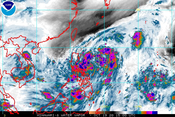
The state weather bureau warned of strong winds and heavy rain in the next 24 hours as Tropical Depression Pepito continued to move over the Philippine Sea late Monday evening, October 19.
In a bulletin released past 11 pm on Monday, the Philippine Atmospheric, Geophysical, and Astronomical Services Administration (PAGASA) said Pepito is already 305 kilometers east of Virac, Catanduanes.
The tropical depression is still moving west northwest at 20 kilometers per hour (km/h), heading for the Northern Luzon-Central Luzon area.
PAGASA has now specified the provinces where Pepito could make landfall – either Aurora or Isabela, possibly on Tuesday evening, October 20, or early Wednesday morning, October 21.
Pepito maintained its strength late Monday evening, with maximum winds of 55 km/h and gustiness of up to 70 km/h. It may either hit land as a tropical depression, or intensify into a tropical storm before making landfall. Then, after crossing Luzon, it could strengthen further into a severe tropical storm by Thursday, October 22.
Even more areas were placed under Signal No. 1 as of 11 pm on Monday, including Metro Manila. Below is the complete list.
- Isabela
- Quirino
- Nueva Vizcaya
- Kalinga
- Mountain Province
- Ifugao
- Benguet
- La Union
- Pangasinan
- Aurora
- Nueva Ecija
- Tarlac
- Zambales
- Bulacan
- Pampanga
- Bataan
- Metro Manila
- Rizal
- northern part of Quezon (General Nakar, Infanta, Real) including Polillo Island
- extreme northern part of Camarines Norte (Vinzons)
- Catanduanes
PAGASA said “high winds (strong to near gale)” will be experienced in areas under Signal No. 1 within 36 hours of the time the wind signal was first raised.
The state weather bureau added that “high to gale-force winds with occasional gusts” due to the northeasterly surface windflow will be experienced in these areas:
- Batanes
- Babuyan Islands
- coastal and/or mountainous areas of mainland Cagayan, Apayao, Ilocos Norte, and Ilocos Sur
PAGASA also updated its rainfall forecast for Tuesday. It again reminded areas set to be affected by Pepito to be on alert for possible floods and landslides.
Moderate to heavy rain
- Bicol
- Quezon
- Aurora
- mainland Cagayan
- Isabela
- Northern Samar
Light to moderate rain, with at times heavy rain
- rest of Calabarzon
- rest of Central Luzon
- rest of Cagayan Valley
- Metro Manila
- Cordillera Administrative Region
- Romblon
- Marinduque
- Samar
- Eastern Samar
- Zamboanga Peninsula
- Bangsamoro Autonomous Region in Muslim Mindanao
- Northern Mindanao
- Caraga
Meanwhile, a gale warning remains in effect for the seaboards of the following provinces, due to rough to very rough seas with waves 2.8 to 5 meters high:
- Batanes
- Cagayan
- Isabela
- Ilocos Norte
- Ilocos Sur
PAGASA also warned of similar conditions in seaboards of areas under Signal No. 1, where waves could reach 2.5 to 4.5 meters high. Travel is risky, especially for those using small vessels.
There are also moderate to rough seas, with waves 1.5 to 3 meters high, in these seaboards:
- western and eastern seaboards of Southern Luzon
- eastern seaboards of Eastern Visayas, Caraga, and Davao Region
Precautionary measures are needed for small vessels, said PAGASA. It added that “inexperienced mariners should avoid navigating in these conditions.”
Based on its latest forecast track, Pepito could leave the Philippine Area of Responsibility (PAR) by Thursday evening.
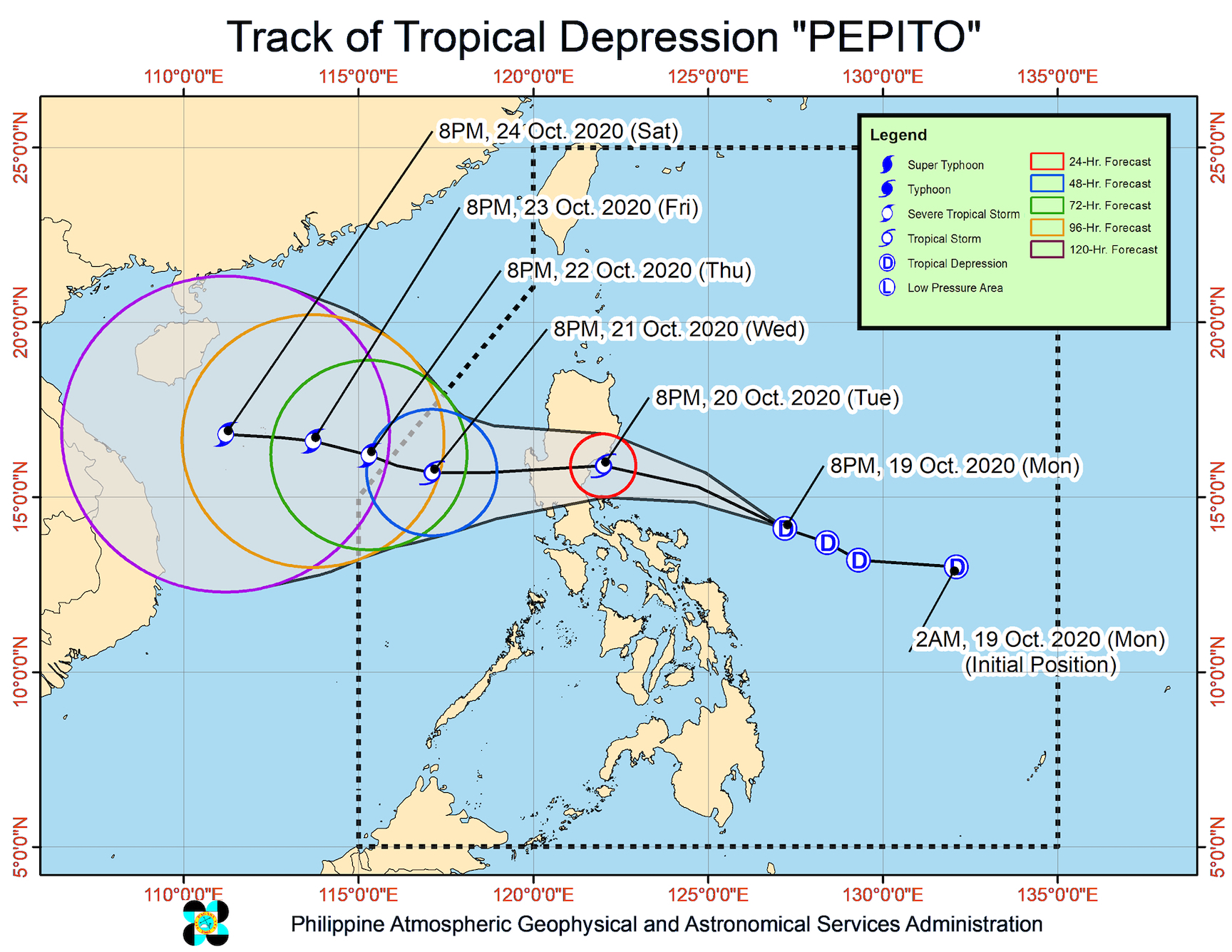
Pepito is the Philippines’ 16th tropical cyclone for 2020, and the 3rd for October.
An average of 20 tropical cyclones form within or enter PAR each year. (READ: LIST: PAGASA’s names for tropical cyclones in 2020)
PAGASA gave the following estimates for the number of tropical cyclones inside PAR in the next 6 months:
- October 2020 – 2 or 3
- November 2020 – 1 or 2
- December 2020 – 1 or 2
- January 2021 – 1 or 2
- February 2021 – 0 or 1
- March 2021 – 0 or 1
Last October 2, the state weather bureau warned Filipinos to expect more rain in the coming months due to the onset of La Niña. – Rappler.com
Add a comment
How does this make you feel?


There are no comments yet. Add your comment to start the conversation.