SUMMARY
This is AI generated summarization, which may have errors. For context, always refer to the full article.
More areas were placed under Signal No. 1 due to Tropical Depression Quinta on Saturday afternoon, October 24.
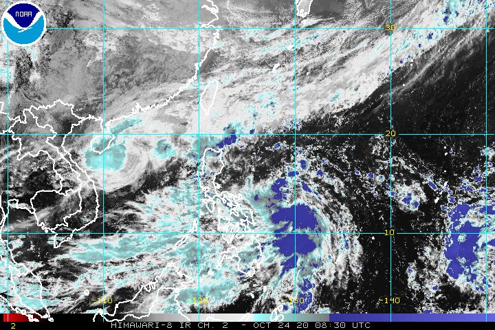
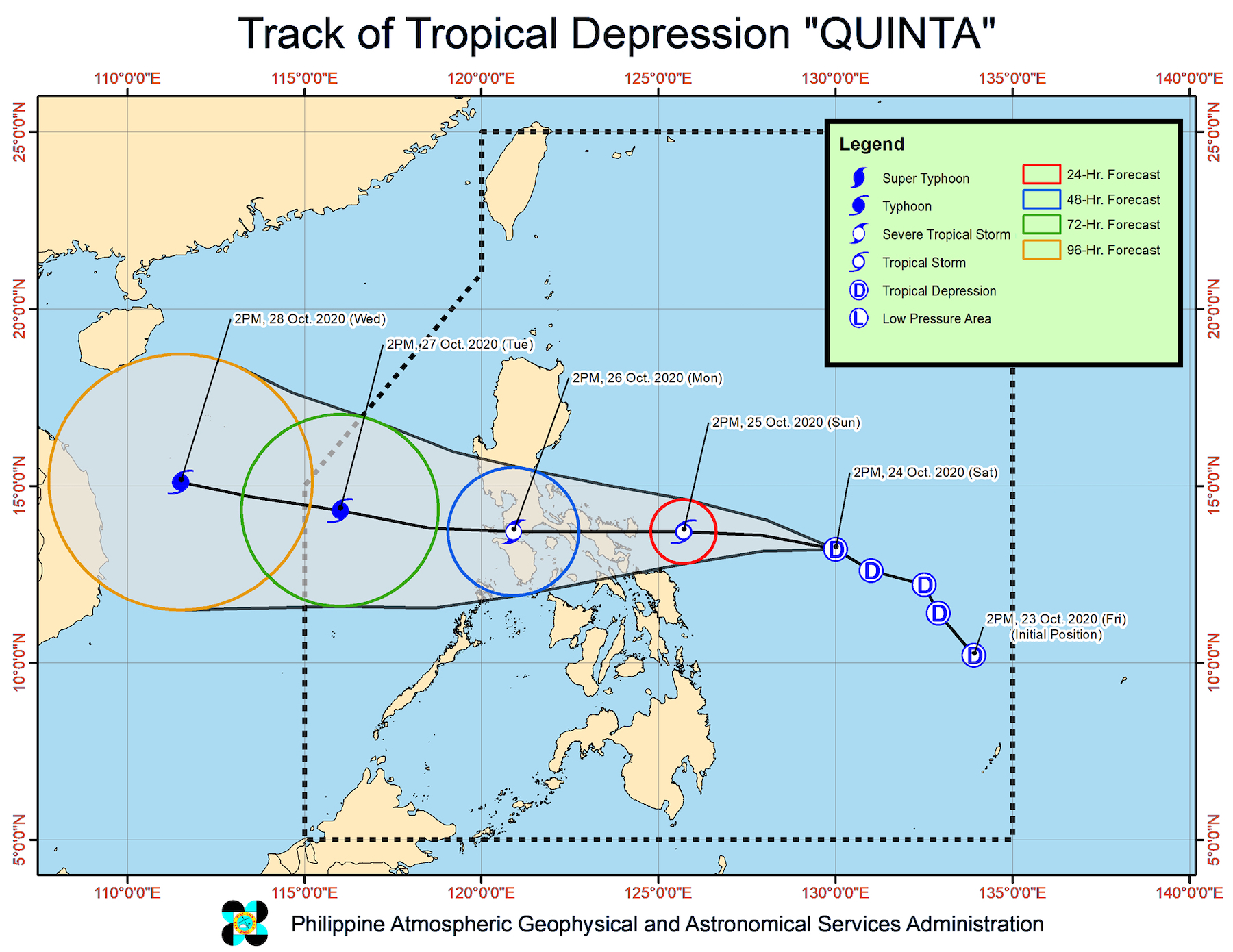
In an online briefing past 5 pm on Saturday, the Philippine Atmospheric, Geophysical, and Astronomical Services Administration (PAGASA) said Quinta is now 610 kilometers east of Juban, Sorsogon.
The tropical depression slowed down, moving west northwest at 20 kilometers per hour (km/h) from the previous 30 km/h.
Though it is slower, Quinta remains on track to make landfall in the region of Bicol between Sunday evening, October 25, and early Monday morning, October 26, then cross Southern Luzon on Monday. Metro Manila may be affected.
So far, Quinta continues to have maximum winds of 55 km/h and gustiness of up to 70 km/h. But it is seen to strengthen into a tropical storm within 12 hours, and then into a severe tropical storm before it hits land.
After crossing land, it could then become a typhoon over the West Philippine Sea. (READ: FAST FACTS: Tropical cyclones, rainfall advisories)
These are the areas under Signal No. 1 as of 5 pm on Saturday:
- Marinduque
- Camarines Norte
- Camarines Sur
- Catanduanes
- Albay
- Sorsogon
- northern part of Masbate (Mobo, Uson, Milagros, Masbate City, Baleno, Mandaon, Balud, Aroroy, Dimasalang) including Ticao and Burias Islands
- southern part of Quezon (Atimonan, Pagbilao, Padre Burgos, Agdangan, Unisan, Plaridel, Gumaca, Pitogo, Lopez, Macalelon, General Luna, Catanauan, Mulanay, Buenavista, San Narciso, San Andres, San Francisco, Guinayangan, Calauag, Tagkawayan, Quezon, Alabat, Perez)
- Northern Samar
PAGASA warned that strong to near gale-force winds will be felt in areas under Signal No. 1 within 36 hours from the time the tropical cyclone wind signal was first raised.
Strong to gale-force winds from a northeasterly surge will also persist in the following areas:
- Batanes
- Babuyan Islands
- northern coastal areas of Ilocos Norte and mainland Cagayan
Quinta is not yet near land. But its trough or extension, along with the trough of Severe Tropical Storm Saudel – formerly Pepito when it was still inside the Philippine Area of Responsibility (PAR) – will continue to trigger rain from Saturday evening until Sunday morning. Saudel is now 860 kilometers west of Northern Luzon and still heading for Vietnam.
Light to moderate rain, with at times heavy rain
- Mimaropa
- Bicol
- Quezon
- Visayas
- Zamboanga Peninsula
- Bangsamoro Autonomous Region in Muslim Mindanao
- Northern Mindanao
- Caraga
A stationary front linked to the northeasterly surge is also causing rain in the areas listed below. The World Meteorological Organization defines a front as “a boundary or transition zone between two air masses of different density and thus (usually) of different temperature.”
Moderate to heavy rain
- Batanes
- Cagayan
- northern part of Apayao
- northern part of Ilocos Norte
A gale warning remains in effect for these seaboards due to rough to very rough seas, with waves 2.8 to 6 meters high:
- seaboards of Northern Luzon
- western seaboards of Central Luzon, Batangas, Occidental Mindoro, and northern part of Palawan including Calamian and Kalayaan Islands
Moderate to rough seas, with waves 1.5 to 2.5 meters high, will also be experienced in these seaboards:
- western seaboard of southern part of Palawan
- eastern seaboards of Central Luzon and Southern Luzon
“Inexperienced mariners should avoid navigating in these conditions,” PAGASA said.
Based on its latest forecast track, Quinta might leave PAR on Tuesday, October 27.
Quinta is the Philippines’ 17th tropical cyclone for 2020, and the 4th for October.
An average of 20 tropical cyclones form within or enter PAR each year. (READ: LIST: PAGASA’s names for tropical cyclones in 2020)
These are PAGASA’s latest estimates for the number of tropical cyclones inside PAR in the next 6 months:
- November 2020 – 1 to 3
- December 2020 – 2 or 3
- January 2021 – 0 or 1
- February 2021 – 0 or 1
- March 2021 – 0 or 1
- April 2021 – 0 or 1
Last October 2, the state weather bureau warned Filipinos to expect more rain in the coming months due to the onset of La Niña. – Rappler.com
Add a comment
How does this make you feel?


There are no comments yet. Add your comment to start the conversation.