SUMMARY
This is AI generated summarization, which may have errors. For context, always refer to the full article.
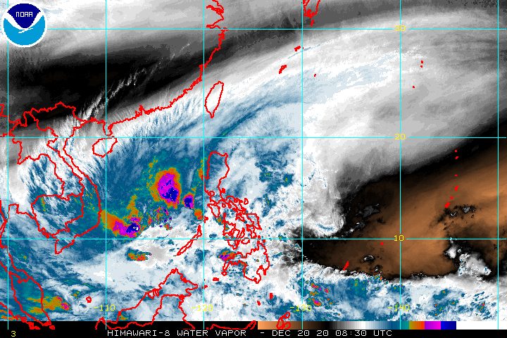
Tropical Depression Vicky left the Philippine Area of Responsibility (PAR) at 2 pm on Sunday, December 20.
But the tail-end of a frontal system is still affecting the eastern parts of Central Luzon and Southern Luzon, while the northeast monsoon or hanging amihan is affecting Northern Luzon.
In its 5 pm bulletin on Sunday, the Philippine Atmospheric, Geophysical, and Astronomical Services Administration (PAGASA) said Vicky was already 70 kilometers southeast of Kalayaan, Palawan, outside PAR.
It is moving west at 15 kilometers per hour (km/h), with maximum sustained winds of 55 km/h and gustiness of up to 70 km/h.
Vicky is likely to strengthen into a tropical storm in the next 12 hours, and would be known by the international name Krovanh.
Though Vicky is now outside PAR, Signal No. 1 remains up in the Kalayaan Islands, where “strong breeze to near gale conditions” are expected as the tropical depression is nearby.
PAGASA added that gusty conditions may persist in most of Luzon due to the surge of the northeast monsoon.
The weather systems affecting Luzon are bringing more rain as well until Monday, December 21. Parts of Luzon are advised to stay on alert for floods and landslides.
Sunday evening, December 20
Moderate to heavy rain, with at times intense rain
- mainland Cagayan Valley
- Apayao
- Kalinga
- Mountain Province
- Ifugao
- Aurora
- Quezon
- Bicol
- northern part of Palawan including Calamian Islands and Kalayaan Islands
Light to moderate rain, with at times heavy rain
- Babuyan Islands
- rest of Cordillera Administrative Region
Monday, December 21
Moderate to heavy rain
- Babuyan Islands
- mainland Cagayan Valley
- Aurora
- Apayao
- Kalinga
- Mountain Province
- Ifugao
- northern part of Quezon
Light to moderate rain, with at times heavy rain
- Batanes
- Kalayaan Islands
- rest of Cordillera Administrative Region
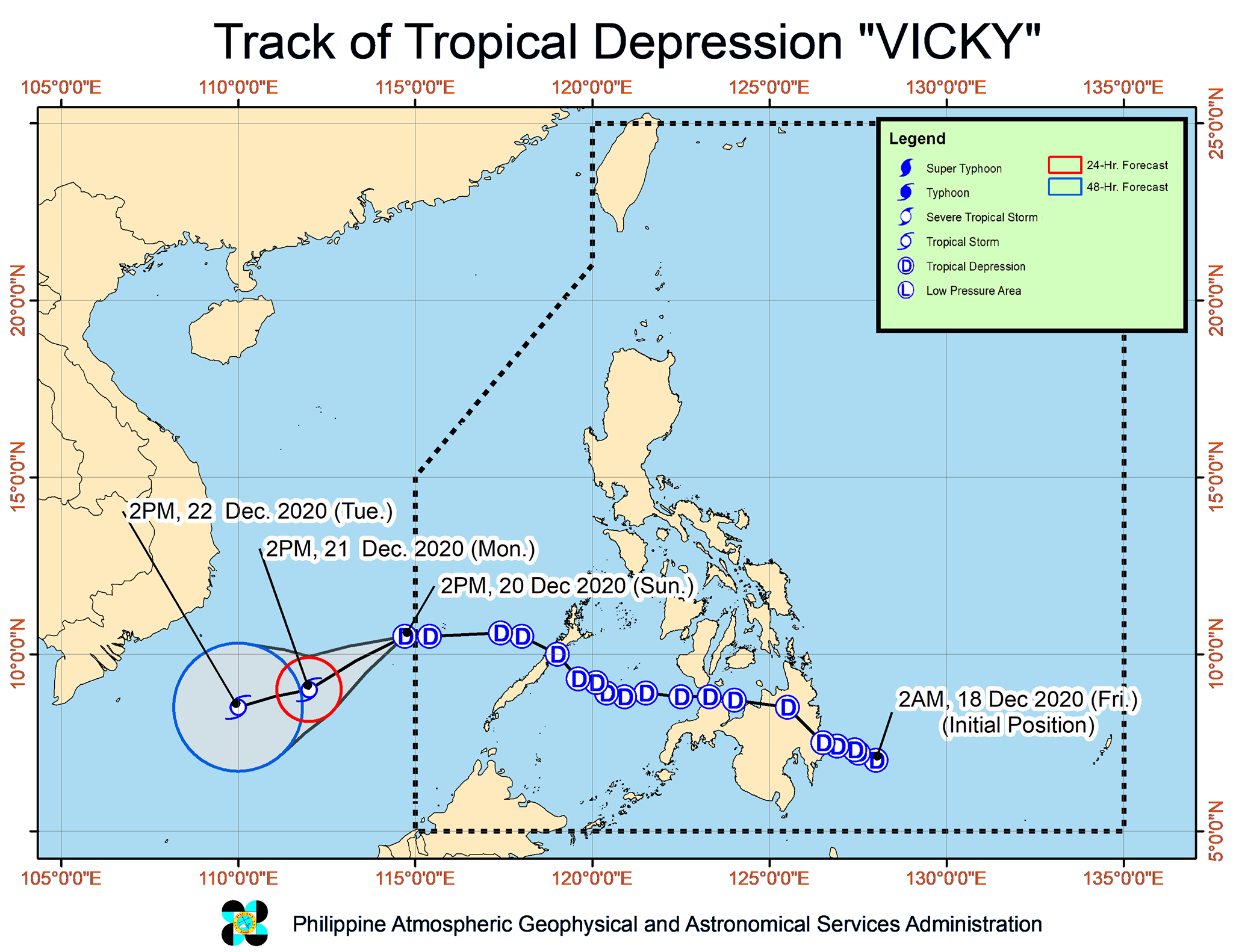
Vicky was the Philippines’ 22nd tropical cyclone for 2020 – exceeding the yearly average of 20 – and the 1st for December. (READ: LIST: PAGASA’s names for tropical cyclones in 2020)
It had made landfall twice in the country:
- Baganga, Davao Oriental – 2 pm, Friday, December 18
- Puerto Princesa City, Palawan – 8 pm, Saturday, December 19
PAGASA Senior Weather Specialist Chris Perez said in an online briefing that the country is seen to remain free of tropical cyclones at least in the next 2 to 3 days.
For December 2020 and January-June 2021, these are PAGASA’s estimates for tropical cyclones inside PAR:
- December 2020 – 1 or 2
- January 2021 – 0 or 1
- February 2021 – 0 or 1
- March 2021 – 0 or 1
- April 2021 – 0 or 1
- May 2021 – 0 or 1
- June 2021 – 1 or 2
La Niña has been underway since October, causing more rain than usual in the country. – Rappler.com
Add a comment
How does this make you feel?


There are no comments yet. Add your comment to start the conversation.