SUMMARY
This is AI generated summarization, which may have errors. For context, always refer to the full article.
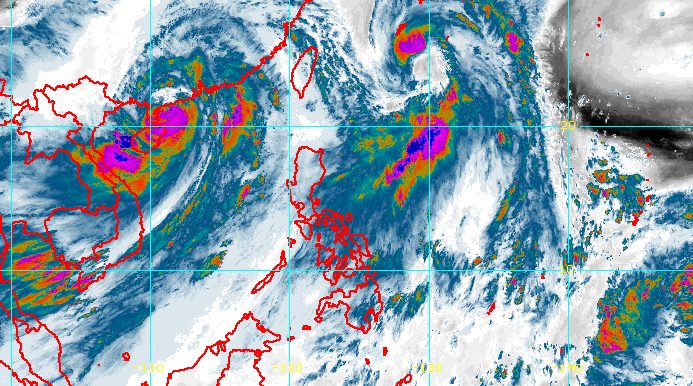
MANILA, Philippines – Tropical Storm Domeng (Aere) left the Philippine Area of Responsibility (PAR) on Saturday morning, July 2.
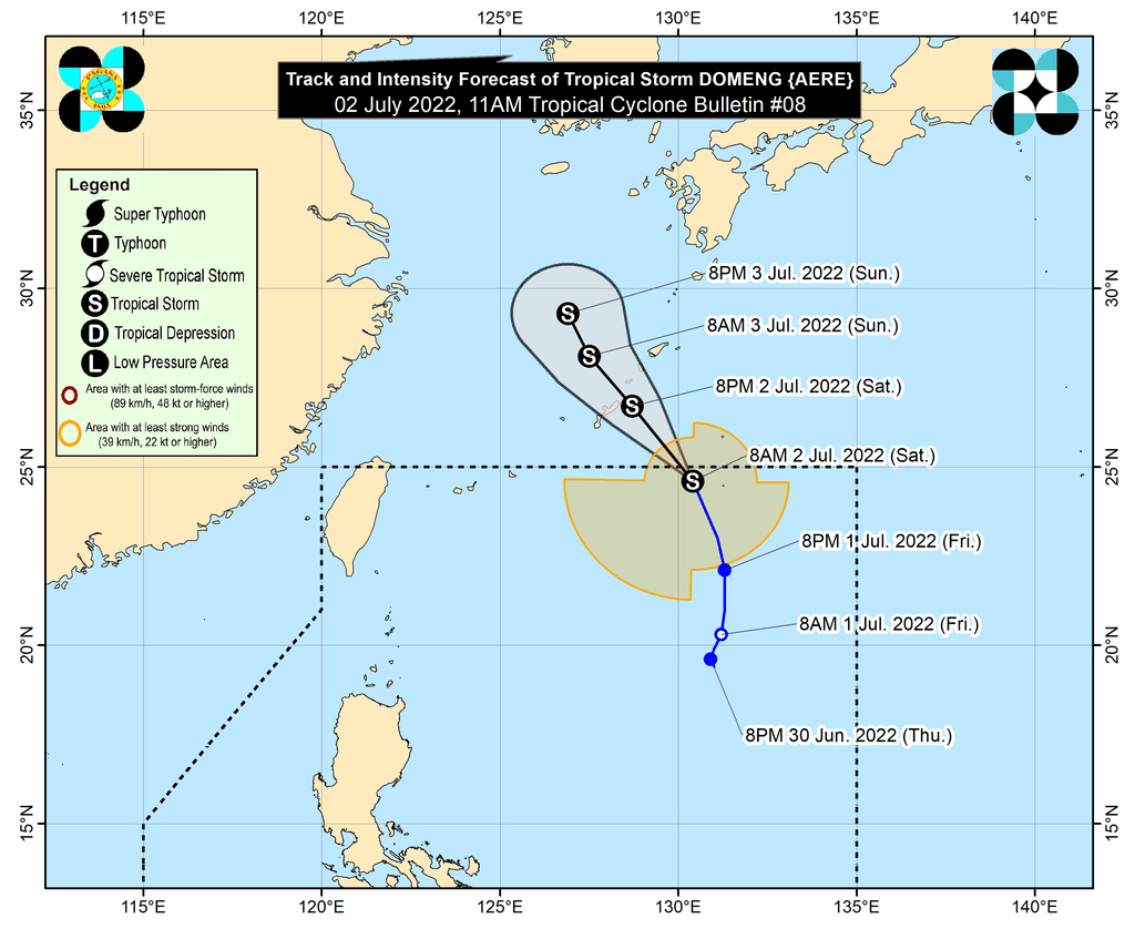
In a bulletin issued 11 am on Saturday, the Philippine Atmospheric, Geophysical, and Astronomical Services Administration (PAGASA) said Domeng was already 990 kilometers east northeast of extreme Northern Luzon.
It accelerated on its way out of PAR, moving north northwest at 30 kilometers per hour (km/h).
PAGASA said the tropical storm is expected to head northwest and pass very close to or over Japan’s Ryukyu Islands on Saturday evening, before turning north northwest on Sunday, July 3, over the East China Sea.
At the time of its exit, Domeng had maximum sustained winds of 85 km/h and gustiness of up to 105 km/h. It is likely to remain a tropical storm in the next 36 hours, PAGASA said.
Domeng stayed far from Philippine landmass and did not directly affect the country, but it enhanced the southwest monsoon or hanging habagat.
The southwest monsoon has since weakened, according to the weather bureau.
Meanwhile, Caloy (Chaba), which left PAR last Wednesday, June 29, intensified from a severe tropical storm into a typhoon on Saturday morning. It is over 1,000 kilometers west of extreme Northern Luzon.
Caloy also did not make landfall in the Philippines and only enhanced the southwest monsoon.
Caloy and Domeng were the country’s third and fourth tropical cyclones for 2022. So far, no other potential weather disturbance is being monitored.
PAGASA expects 11 to 15 tropical cyclones to enter or develop inside PAR from July to December. Per month, these are the weather bureau’s estimates:
- July – 2 or 3
- August – 2 or 3
- September – 2 or 3
- October – 2 to 4
- November – 2 or 3
- December – 1 or 2
– Rappler.com
Add a comment
How does this make you feel?


There are no comments yet. Add your comment to start the conversation.