SUMMARY
This is AI generated summarization, which may have errors. For context, always refer to the full article.
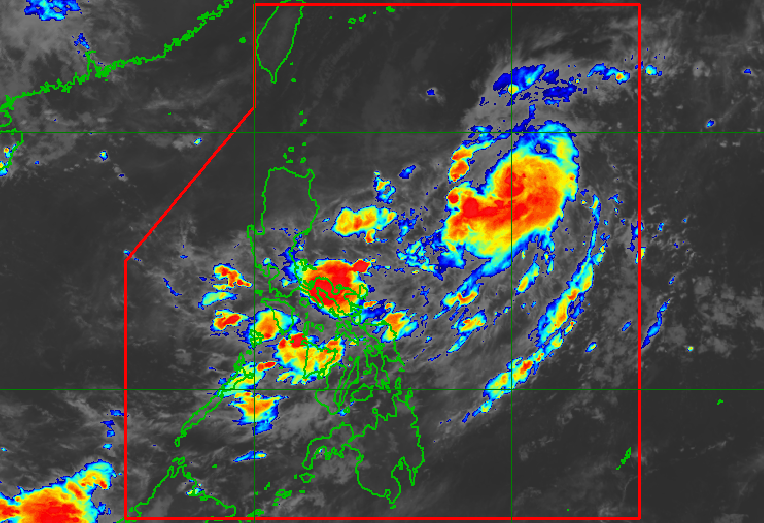
MANILA, Philippines – While Tropical Storm Inday (Muifa) is not expected to make landfall in the Philippines, its trough or extension is bringing rain showers to several areas in Luzon and the Visayas on Friday, September 9.
In its 5 am bulletin on Friday, the Philippine Atmospheric, Geophysical, and Astronomical Services Administration (PAGASA) said Inday was located 870 kilometers east of Central Luzon, still over the Philippine Sea.
The tropical storm decelerated, slowly moving west northwest.
Inday also slightly intensified, with maximum sustained winds of 85 kilometers per hour and gustiness of up to 105 km/h.
PAGASA said Inday is projected to strengthen further into a severe tropical storm on Friday and then into a typhoon on Saturday, September 10.
Inday’s trough will cause scattered rain showers and thunderstorms in the following areas on Friday:
- Bicol
- Panay Island (Aklan, Antique, Capiz, Iloilo)
- Eastern Samar
- Northern Samar
- Samar
- Quezon
- Occidental Mindoro
- Oriental Mindoro
- Marinduque
- Romblon
The weather bureau warned that flash floods and landslides are possible during periods of moderate to heavy rain.
The rest of the country will only have localized thunderstorms on Friday, unrelated to the trough of the tropical storm.
PAGASA said it remains unlikely for tropical cyclone wind signals to be raised due to Inday.
The tropical storm, however, could trigger moderate to rough seas in Batanes (waves 2 to 4 meters high) and Babuyan Islands (waves 1.5 to 3 meters high) starting mid- to late Saturday. Conditions may be risky for small vessels.
PAGASA expects Inday to move generally northwest over the Philippine Sea until Sunday, September 11, then turn north northwest or north over the sea east of Taiwan while slowing down.
It may finally leave the Philippine Area of Responsibility (PAR) by early Wednesday, September 14.

Inday is the Philippines’ ninth tropical cyclone for 2022 and the first for September.
PAGASA expects 7 to 11 tropical cyclones to enter or develop inside PAR from September 2022 to February 2023. Per month, these are the weather bureau’s estimates:
- September 2022 – 2 or 3
- October 2022 – 2 to 4
- November 2022 – 2 or 3
- December 2022 – 1 or 2
- January 2023 – 0 or 1
- February 2023 – 0 or 1
– Rappler.com
Add a comment
How does this make you feel?


There are no comments yet. Add your comment to start the conversation.