SUMMARY
This is AI generated summarization, which may have errors. For context, always refer to the full article.
Vicky strengthened from a tropical depression into a tropical storm outside the Philippine Area of Responsibility (PAR) at 8 pm on Sunday, December 20.
It now has the international name Krovanh, which the Philippine Atmospheric, Geophysical, and Astronomical Services Administration (PAGASA) said is a name contributed by Cambodia.
Though Vicky left PAR at 2 pm on Sunday, it is still affecting the Kalayaan Islands in Palawan, which is why PAGASA continues to monitor the tropical storm. (READ: FAST FACTS: Tropical cyclones, rainfall advisories)
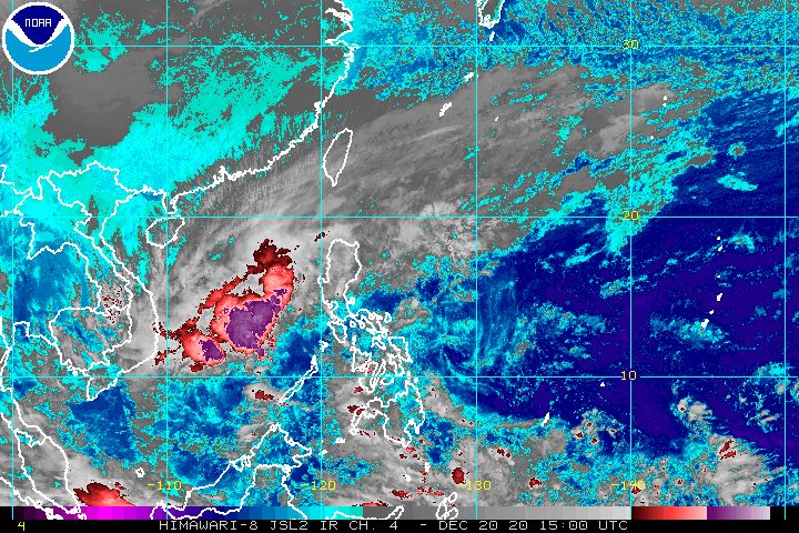
As of late Sunday evening, Vicky was located 85 kilometers south southwest of Kalayaan, moving west at a slightly faster 20 kilometers per hour (km/h) from the previous 15 km/h.
It now has maximum sustained winds of 65 km/h and gustiness of up to 80 km/h, from the previous 55 km/h and 70 km/h, respectively.
The tropical cyclone wind signal for the Kalayaan Islands has been upgraded to Signal No. 2 from 1.
PAGASA said strong to gale-force winds due to Vicky and the surge of the northeast monsoon or hanging amihan are expected in the following areas:
- Kalayaan Islands
- Batanes
- Babuyan Islands
- northern parts of Cagayan, Apayao, and Ilocos Norte
Meanwhile, there may also be occasional gusty conditions in the eastern parts of these areas:
- mainland Cagayan
- Isabela
- Aurora
- Quezon
- Palawan including Calamian Islands
In terms of rainfall, PAGASA issued the updated forecast below for Monday, December 21. Aside from Vicky, the tail-end of a frontal system and the northeast monsoon have been bringing rain the past few days.
Moderate to heavy rain
- Kalayaan Islands
- eastern part of mainland Cagayan Valley
- Aurora
- northern part of Quezon
Light to moderate rain, with at times heavy rain
- rest of mainland Cagayan Valley
- Babuyan Islands
- rest of Quezon
- Apayao
- Kalinga
- Mountain Province
- Ifugao
More floods and landslides remain possible in Northern Luzon and Central Luzon.
PAGASA also warned that the surge of the northeast monsoon enhanced by Vicky will make sea travel risky, especially for small vessels.
Rough to high seas (waves 3 to 6 meters high)
- entire seaboard of Northern Luzon
Rough to very rough seas (waves 2.8 to 4.5 meters high)
- seaboard of Central Luzon
- eastern seaboard of northern part of Quezon including northern and eastern waters of Polillo Islands
- seaboard of Camarines Norte
- northern seaboard of Camarines Sur
- northern and eastern seaboards of Catanduanes
- seaboard of Lubang Island
- western seaboard of Palawan including Calamian and Kalayaan Islands
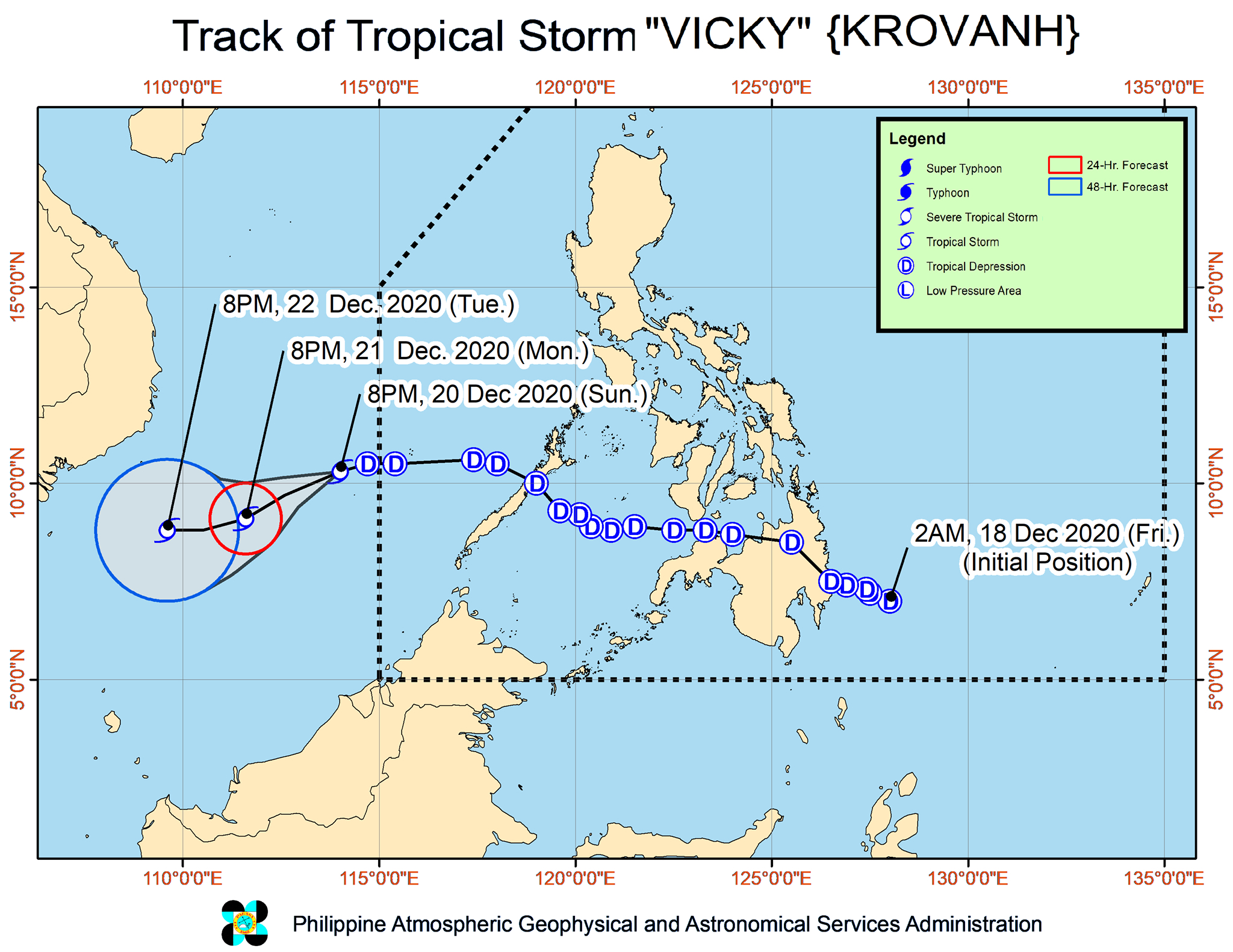
Vicky was the Philippines’ 22nd tropical cyclone for 2020 – exceeding the yearly average of 20 – and the 1st for December. (READ: LIST: PAGASA’s names for tropical cyclones in 2020)
It had made landfall twice in the country:
- Baganga, Davao Oriental – 2 pm, Friday, December 18
- Puerto Princesa City, Palawan – 8 pm, Saturday, December 19
For December 2020 and January-June 2021, these are PAGASA’s estimates for tropical cyclones inside PAR:
- December 2020 – 1 or 2
- January 2021 – 0 or 1
- February 2021 – 0 or 1
- March 2021 – 0 or 1
- April 2021 – 0 or 1
- May 2021 – 0 or 1
- June 2021 – 1 or 2
La Niña has been underway since October, causing more rain than usual in the country. – Rappler.com
Add a comment
How does this make you feel?


There are no comments yet. Add your comment to start the conversation.