SUMMARY
This is AI generated summarization, which may have errors. For context, always refer to the full article.
There are no more tropical cyclone wind signals in effect due to Typhoon Bising (Surigae), as Signal No. 1 was lifted for the remaining areas in Northern Luzon on Thursday afternoon, April 22.
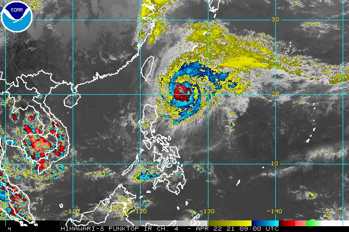
The Philippine Atmospheric, Geophysical, and Astronomical Services Administration (PAGASA) said in its 5 pm bulletin on Thursday that Bising was already 390 kilometers east of Basco, Batanes.
The typhoon slightly accelerated, moving north northeast or away from land at 15 kilometers per hour (km/h) from the previous 10 km/h.
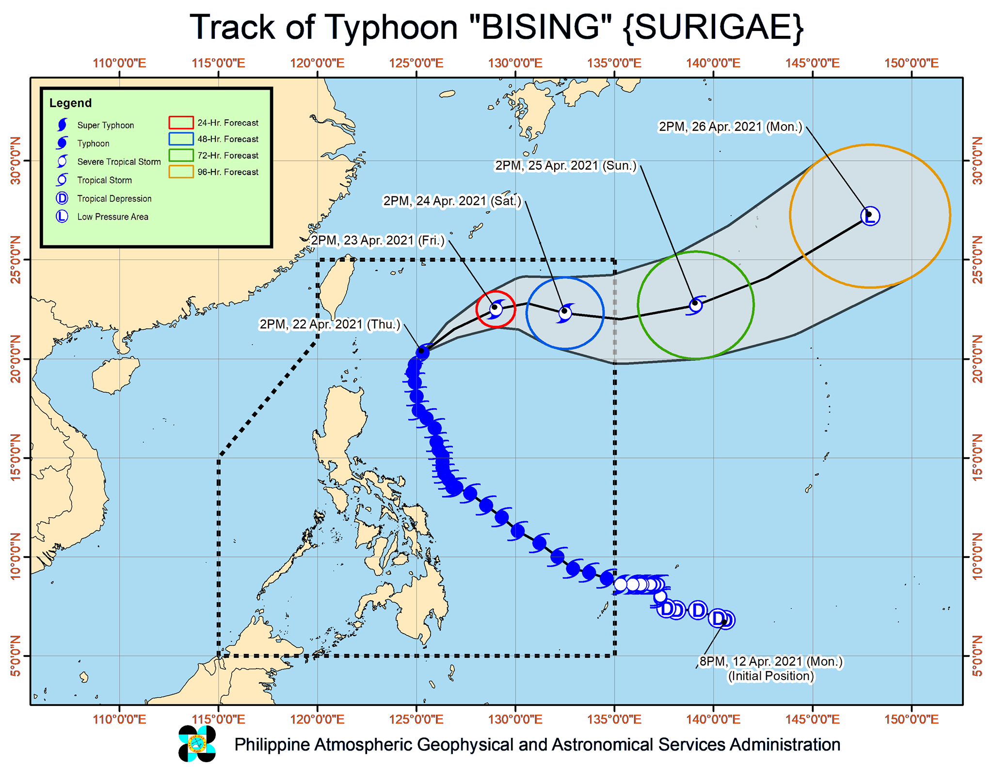
PAGASA expects Bising to move northeast until Friday morning, April 23, before turning east southeast or east on Friday afternoon.
It could finally leave the Philippine Area of Responsibility (PAR) on Saturday evening, April 24, or early Sunday morning, April 25.
As of Thursday afternoon, Bising continued to have maximum sustained winds of 150 km/h and gustiness of up to 185 km/h.
But it could be downgraded to a severe tropical storm by Friday and a tropical storm by Saturday, and later into an extratropical cyclone – a low pressure system – outside PAR on Monday, April 26. (READ: FAST FACTS: Tropical cyclones, rainfall advisories)
Bising did not make landfall in the Philippines, but it brought heavy rain that caused floods and landslides.
The National Disaster Risk Reduction and Management Council said on Thursday it is validating reports that Bising left at least 4 people dead and 13 others injured.
While there are no more areas under tropical cyclone wind signals, PAGASA said the northeasterly wind flow enhanced by Bising will bring strong breeze to near-gale conditions to the coastal and mountainous areas of Ilocos Norte, Apayao, and Cagayan until Friday.
Bising and the enhanced northeasterly wind flow will also continue to have an impact on coastal waters.
Rough to high seas
Travel is risky for all vessels
- northern and eastern seaboards of Northern Luzon (waves 2.5 to 7 meters high)
Rough seas
Travel is risky for small vessels, while inexperienced mariners “should immediately seek safe harbor”
- seaboard of Aurora and seaboards of the extreme northern part of Quezon including the northern and eastern seaboards of Polillo Islands (waves 2.5 to 4 meters high)
Moderate to rough seas
Small vessels and inexperienced mariners should avoid venturing out to sea
- eastern seaboard of Bicol and western seaboard of Northern Luzon (waves 1.5 to 3 meters high)
Bising is the Philippines’ second tropical cyclone for 2021. The country usually gets an average of 20 tropical cyclones each year. (READ: LIST: PAGASA’s names for tropical cyclones in 2021)
For the next 6 months, PAGASA estimates the following number of tropical cyclones inside PAR:
- April – 0 or 1
- May – 0 or 1
- June – 1 or 2
- July – 1 to 3
- August – 2 or 3
- September – 2 or 3
– Rappler.com
Add a comment
How does this make you feel?


There are no comments yet. Add your comment to start the conversation.