SUMMARY
This is AI generated summarization, which may have errors. For context, always refer to the full article.
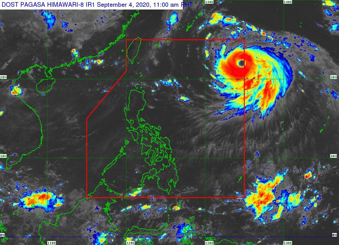
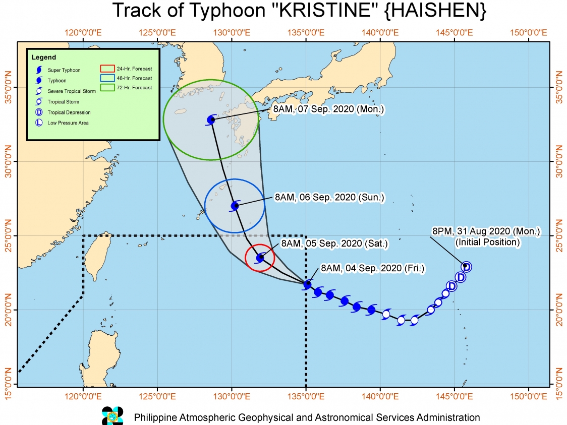
The typhoon with the international name Haishen entered the Philippine Area of Responsibility (PAR) at 9 am on Friday, September 4. It was given the local name Kristine.
The Philippine Atmospheric, Geophysical, and Astronomical Services Administration (PAGASA) said Typhoon Kristine (Haishen) is 1,340 kilometers east of extreme Northern Luzon, far from the country’s landmass.
The typhoon is moving northwest at 15 kilometers per hour (km/h), which means it will only stay near the PAR’s northeastern boundary. It is not expected to make landfall in the Philippines.
Kristine is expected to leave PAR between Saturday evening, September 5, and early Sunday morning, September 6. After exiting, it will head for the southern part of Japan and the Korean Peninsula, according to PAGASA.
So far, Kristine has maximum winds of 185 km/h and gustiness of up to 230 km/h. But PAGASA said the typhoon is “undergoing rapid intensification at the moment,” and may reach its peak intensity of around 205 to 215 km/h on Sunday.
There are no areas under tropical cyclone wind signals since Kristine is far from land.
The typhoon is “unlikely to directly affect the weather condition in the country throughout the forecast period,” added PAGASA.
But Kristine could cause rough to very rough waters in the northern and eastern seaboards of Northern Luzon beginning Friday night or Saturday morning. PAGASA warned that sea travel would be risky. (READ: FAST FACTS: Tropical cyclones, rainfall advisories)
Kristine is the Philippines’ 11th tropical cyclone for 2020, and the 1st for September.
An average of 20 tropical cyclones form within or enter PAR each year. Only around half of these make landfall. (READ: LIST: PAGASA’s names for tropical cyclones in 2020)
PAGASA gave the following estimates for the number of tropical cyclones inside PAR in the next 6 months:
- September 2020 – 2 or 3
- October 2020 – 2 or 3
- November 2020 – 1 or 2
- December 2020 – 1 or 2
- January 2021 – 1 or 2
- February 2021 – 0 or 1
PAGASA declared the start of the rainy season on June 12. – Rappler.com
Add a comment
How does this make you feel?


There are no comments yet. Add your comment to start the conversation.