SUMMARY
This is AI generated summarization, which may have errors. For context, always refer to the full article.
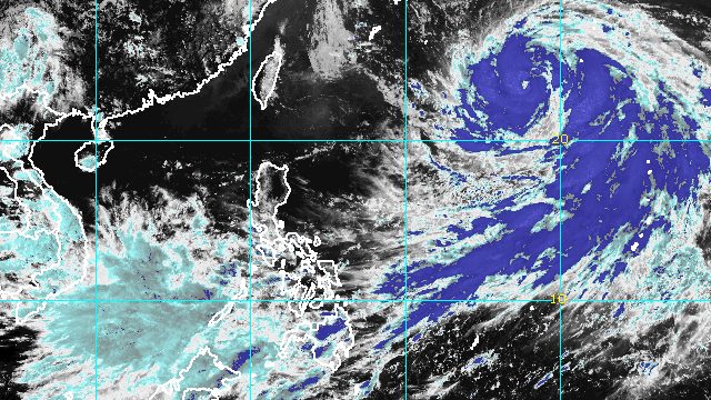
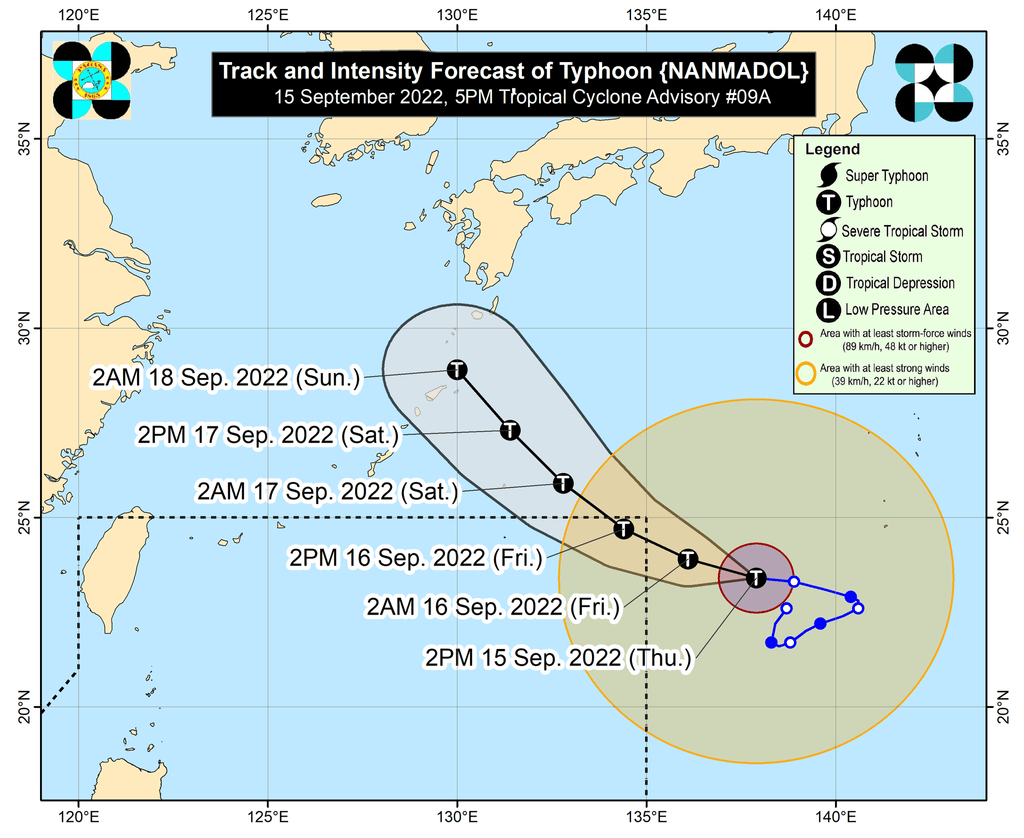
MANILA, Philippines – Nanmadol rapidly intensified from a severe tropical storm into a typhoon at 2 pm on Thursday, September 15, while still outside the Philippine Area of Responsibility (PAR).
Its maximum sustained winds increased from 110 kilometers per hour to 120 km/h, the Philippine Atmospheric, Geophysical, and Astronomical Services Administration (PAGASA) said in an advisory at 5 pm on Thursday.
Nanmadol’s gustiness is now up to 150 km/h from the previous 135 km/h.
“Further intensification is forecast to occur throughout the forecast period,” PAGASA said.
Nanmadol was last spotted 1,670 kilometers east northeast of extreme Northern Luzon. The typhoon continues to move west northwest at 15 km/h, a direction it is expected to maintain until Friday, September 16, before it turns northwest on Saturday, September 17.
Nanmadol remains on track to enter PAR by Thursday evening or Friday morning. Its local name will be Josie.
The typhoon will only stay near the PAR northeastern corner, far from Philippine landmass. But it is enhancing the southwest monsoon or hanging habagat, which will continue to trigger rain in the following areas:
- Palawan
- Occidental Mindoro
- Oriental Mindoro
- Western Visayas
- Zamboanga Peninsula
- Basilan
- Sulu
- Tawi-Tawi
The weather bureau also said gusty conditions may be felt in these areas due to the southwest monsoon:
- Mimaropa
- Bicol
- Visayas
- northern and western parts of Mindanao
Nanmadol or the potential Josie would be the Philippines’ 10th tropical cyclone for 2022.
It would also be the second tropical cyclone for September, after Typhoon Inday (Muifa), which did not make landfall.
PAGASA expects 7 to 11 tropical cyclones to enter or develop inside PAR from September 2022 to February 2023. Per month, these are the weather bureau’s estimates:
- September 2022 – 2 or 3
- October 2022 – 2 to 4
- November 2022 – 2 or 3
- December 2022 – 1 or 2
- January 2023 – 0 or 1
- February 2023 – 0 or 1
– Rappler.com
Add a comment
How does this make you feel?


There are no comments yet. Add your comment to start the conversation.