SUMMARY
This is AI generated summarization, which may have errors. For context, always refer to the full article.
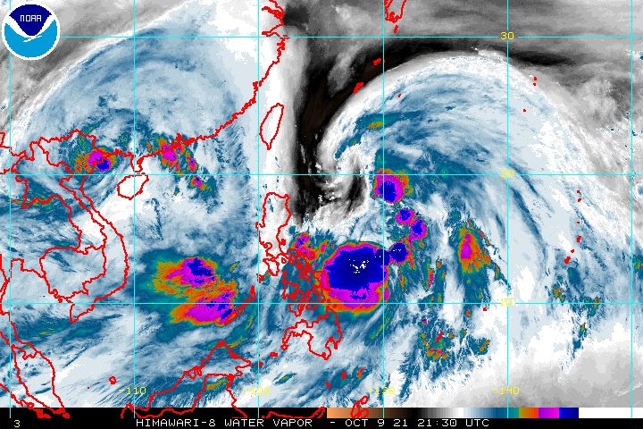
Tropical Storm Maring (Kompasu) continued to absorb the remnants of Tropical Depression Nando early Sunday, October 10, with their merger expected to be completed in 6 to 12 hours.
Nando had weakened into a low pressure area or remnant low on Saturday evening, October 9.
Maring was last spotted 665 kilometers east of Virac, Catanduanes, slowing down from 30 kilometers per hour to only 10 km/h as it moved north.
The tropical storm still has maximum sustained winds of 85 km/h and gustiness of up to 105 km/h.
After the merger, Maring is expected to strengthen into a severe tropical storm within 24 to 36 hours, or by Monday, October 11, at the latest. (READ: FAST FACTS: Tropical cyclones, rainfall advisories)
In its 5 am bulletin on Sunday, Philippine Atmospheric, Geophysical, and Astronomical Services Administration (PAGASA) placed more areas under Signal No. 1, which means strong winds are expected:
- Catanduanes
- Batanes
- Cagayan including Babuyan Islands
- northeastern part of Isabela (Santa Maria, Cabagan, Tumauini, San Pablo, Maconacon, Divilacan, Palanan, Ilagan City, San Mariano)
- Eastern Samar
- eastern part of Northern Samar (San Roque, Pambujan, Las Navas, Catubig, Laoang, Mapanas, Lapinig, Gamay, Palapag, Mondragon, Silvino Lobos)
- eastern part of Samar (Matuguinao, San Jose de Buan, Hinabangan, Paranas)
- Dinagat Islands
- Surigao del Norte
Occasional gusts are also possible in coastal and mountainous areas of the regions below, even if they are not under a tropical cyclone wind signal. This is due to Maring’s “expansive wind field” and “the gradual enhancement of the southwesterlies and northeasterlies,” said PAGASA.
- extreme Northern Luzon
- Mimaropa
- Bicol
- Visayas
- Caraga
- Northern Mindanao
The weather bureau warned that the enhanced southwesterlies will also bring moderate to heavy rain to these areas on Sunday:
- Western Visayas
- Palawan
- Occidental Mindoro
Maring, meanwhile, may trigger rain in varying degrees. Affected areas must be on alert for isolated to scattered floods and landslides.
Moderate to heavy rain
- Eastern Samar
- Catanduanes
Light to moderate rain, with at times heavy rain
- rest of Visayas
- rest of Bicol
- Caraga
A gale warning was issued at 5 am on Sunday for the eastern seaboards of the Philippines due to Maring and the northeasterly wind flow. Waters are rough to very rough, with waves 2.8 to 4.5 meters high.
PAGASA advised fishing boats and other small vessels not to sail, while larger vessels must watch out for big waves.
In the remaining seaboards of Luzon and the Visayas and in the northern seaboard of Mindanao, waters remain moderate to rough. Travel is risky for small vessels.
On Sunday morning and afternoon, Maring is projected to accelerate and move north northwest over the Philippine Sea, “notwithstanding the possibility of short-term erratic motion” as it fully merges with what’s left of Nando, according to PAGASA.
Then Maring would turn west northwest toward extreme Northern Luzon, move over the Luzon Strait, and pass close to or over the Babuyan Islands between Monday evening and Tuesday morning, October 12.
Landfall in mainland Luzon, however, is not being ruled out.
Finally, Maring could move over the West Philippine Sea beginning Tuesday and leave the Philippine Area of Responsibility (PAR) on Tuesday afternoon.
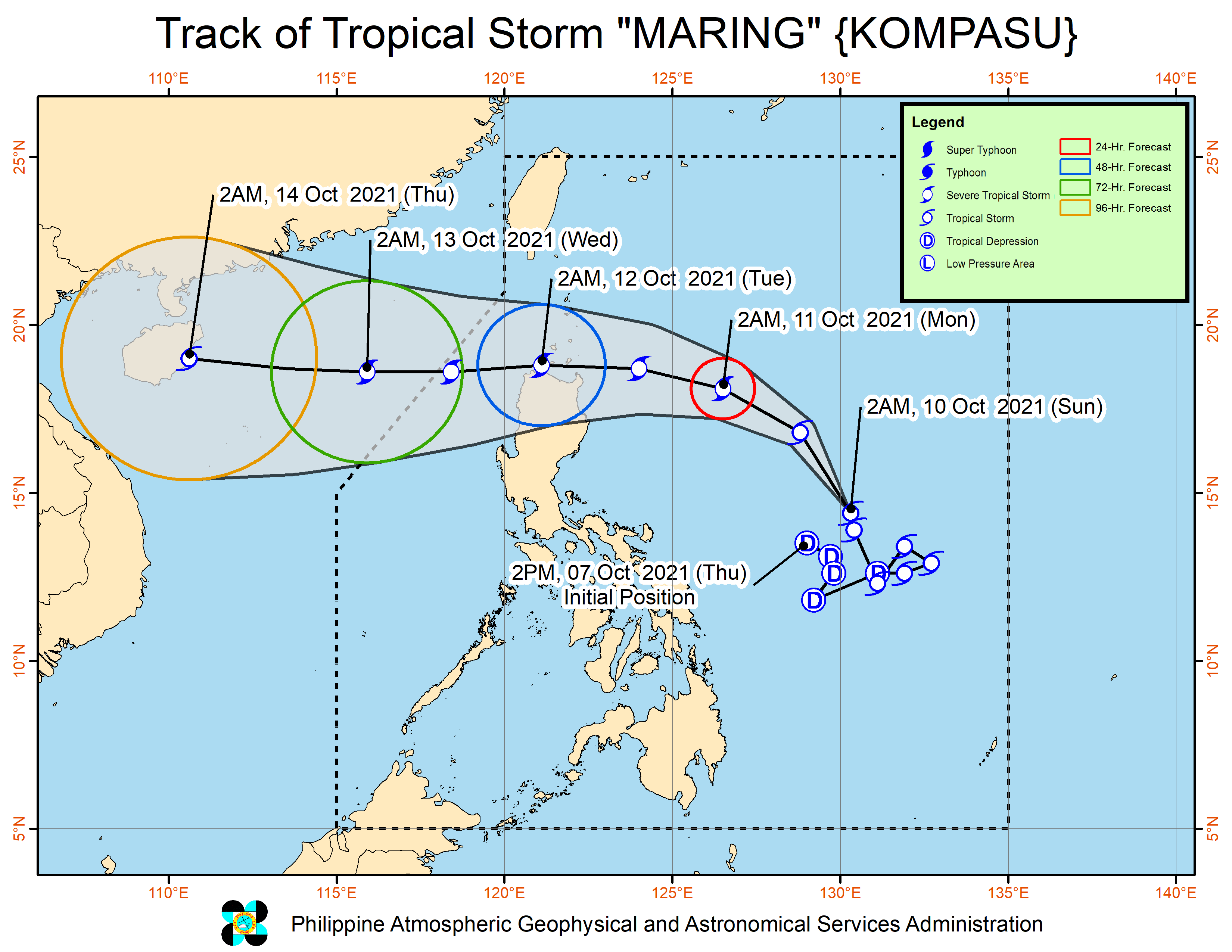
Maring is the Philippines’ 13th tropical cyclone for 2021 and the second for October, while Nando was the country’s 14th for the year and the third for the month.
An average of 20 tropical cyclones form within or enter PAR each year. (READ: LIST: PAGASA’s names for tropical cyclones in 2021)
These are PAGASA’s latest estimates for the next six months:
2021
- October – 2 or 3
- November – 2 or 3
- December – 1 or 2
2022
- January – 0 or 1
- February – 0 or 1
- March – 0 or 1
The weather bureau is also monitoring the possible emergence of La Niña in the fourth quarter of 2021. – Rappler.com
Add a comment
How does this make you feel?


There are no comments yet. Add your comment to start the conversation.