SUMMARY
This is AI generated summarization, which may have errors. For context, always refer to the full article.
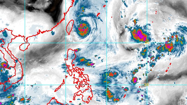
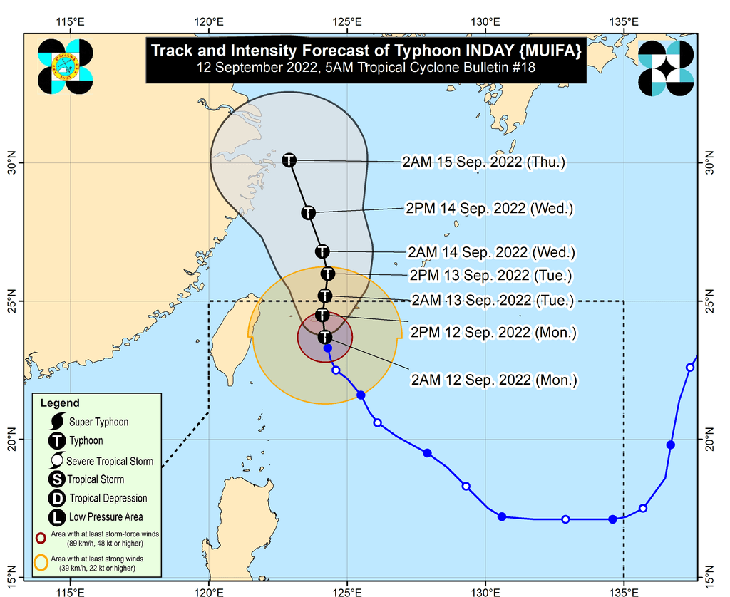
MANILA, Philippines – Typhoon Inday (Muifa) slightly weakened as it approached Japan’s Yaeyama Islands, a group of islands still located within the Philippine Area of Responsibility (PAR), in the early hours of Monday, September 12.
Inday’s maximum sustained winds decreased from 165 kilometers per hour to 155 km/h, the Philippine Atmospheric, Geophysical, and Astronomical Services Administration (PAGASA) said in a bulletin issued at 5 am on Monday.
The typhoon’s gustiness went down to 190 km/h from the previous 205 km/h.
Inday was located 425 kilometers northeast of Itbayat, Batanes, still moving north northwest at only 10 km/h.
It is expected to pass close to or make landfall in Yaeyama Islands on Monday morning or afternoon, before leaving PAR on Monday evening or early Tuesday morning, September 13.
The typhoon has stayed away from Philippine landmass, with only its trough or extension bringing scattered rain showers in the past days. It had also enhanced the southwest monsoon or hanging habagat.
As Inday continues to move away from the country, weather is expected to be generally fair on Monday, with only isolated rain showers or thunderstorms.
PAGASA added that it is now unlikely for tropical cyclone wind signals to be raised due to Inday. The weather bureau earlier said this could be possible for extreme Northern Luzon.
But gusty conditions may be felt in extreme Northern Luzon from Monday to Wednesday, September 14, “due to the channeling of the typhoon circulation in the Luzon Strait.”
PAGASA also issued a new gale warning for the seaboards of Batanes and Babuyan Islands at 5 am on Monday. Seas remain rough, with waves 2.8 to 4 meters high.
The weather bureau advised fishing boats and other small vessels not to sail, and larger vessels to watch out for big waves.
Moderate to rough seas may also be seen in the eastern seaboard and the rest of the northern seaboard of Northern Luzon, with waves 1.2 to 3 meters high. Conditions could be risky for small vessels.
PAGASA sees Inday gradually weakening further due to the “cooler waters” of the sea east of Taiwan and the East China Sea, “and increasing vertical wind shear along its projected path.”
Vertical wind shear refers to “the condition produced by a change in wind velocity (speed and/or direction) with height,” as defined by the Canadian Hurricane Centre. It also explains that “vertical wind shear can weaken or destroy a tropical cyclone by interfering with the symmetric nature and organization of the deep convection around the cyclone center.”
Inday is the Philippines’ ninth tropical cyclone for 2022 and the first for September.
Meanwhile, PAGASA is still monitoring a low pressure area (LPA) outside PAR.
The LPA was last spotted 1,995 kilometers east northeast of extreme Northern Luzon before dawn on Monday.
PAGASA Weather Specialist Aldczar Aurelio said the LPA is not seen to enter PAR. It may head for Japan.
PAGASA expects 7 to 11 tropical cyclones to enter or develop inside PAR from September 2022 to February 2023. Per month, these are the weather bureau’s estimates:
- September 2022 – 2 or 3
- October 2022 – 2 to 4
- November 2022 – 2 or 3
- December 2022 – 1 or 2
- January 2023 – 0 or 1
- February 2023 – 0 or 1
– Rappler.com
Add a comment
How does this make you feel?


There are no comments yet. Add your comment to start the conversation.