SUMMARY
This is AI generated summarization, which may have errors. For context, always refer to the full article.
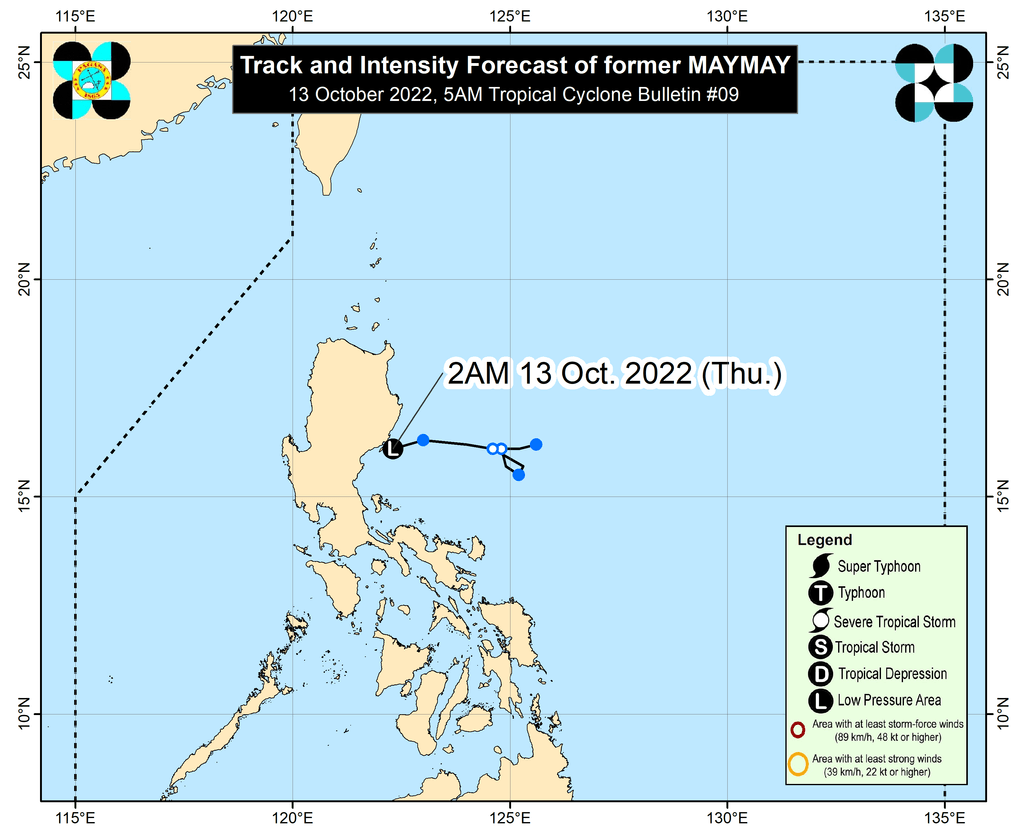
MANILA, Philippines – The weather bureau warned that the threat of heavy rain persists even as Tropical Depression Maymay weakened into a low pressure area (LPA) at 2 am on Thursday, October 13.
The LPA that used to be Maymay was located over the coastal waters of Casiguran, Aurora, the Philippine Atmospheric, Geophysical, and Astronomical Services Administration (PAGASA) said in a bulletin issued at 5 am on Thursday.
It is moving west southwest at 15 kilometers per hour, and may cross more areas in Luzon, where it could dissipate within 12 hours due to the “frictional effects.”
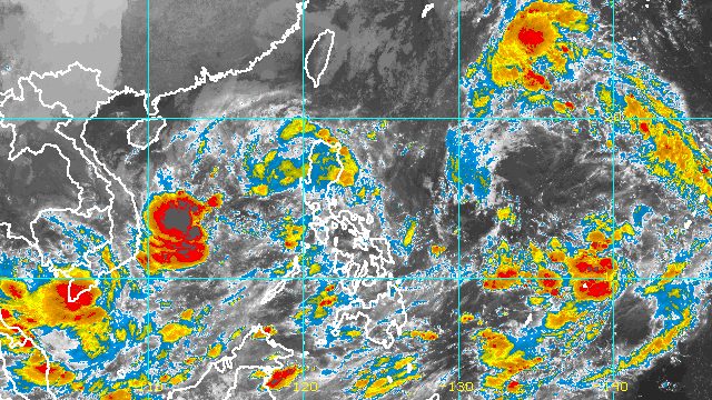
In the meantime, the LPA and the shear line are still bringing rain to parts of Northern Luzon. The shear line is the point where the northeasterly surface windflow and the easterlies meet.
Below is PAGASA’s updated rainfall forecast for Thursday until early Friday morning, October 14.
Moderate to heavy rain, with at times intense rain
- Cagayan
- Isabela
- Apayao
Light to moderate rain, with at times heavy rain
- rest of Cagayan Valley
- rest of Cordillera Administrative Region
Scattered to widespread floods and landslides can still occur.
The rest of the country will only have localized thunderstorms on Thursday, unrelated to the LPA or the shear line.
There are no more areas under Signal No. 1, but PAGASA said occasional gusts may persist in these areas due to the enhanced northeasterly surface windflow:
- Batanes
- Cagayan
- Cordillera Administrative Region
- Ilocos Region
Also due to the surge of the northeasterly surface windflow, a new gale warning was issued at 5 am on Thursday. Rough to very rough seas will continue in the following seaboards:
- seaboards of Northern Luzon and Central Luzon (Batanes, Cagayan, Isabela, Aurora, Ilocos Norte, Ilocos Sur, La Union, Pangasinan, Zambales) – waves 3.4 to 5.5 meters high
- eastern seaboard of Southern Luzon (eastern coast of Polillo Island) – waves 2.8 to 4.5 meters high
PAGASA advised fishing boats and other small vessels not to sail, and larger vessels to watch out for big waves.
The weather bureau added that moderate to rough seas will persist in the western seaboards of Central Luzon and Southern Luzon. Waves are 1.5 to 3.5 meters high, making conditions risky for small vessels.
Maymay was the Philippines’ 13th tropical cyclone for 2022 and the first for October.
Meanwhile, the other LPA inside the Philippine Area of Responsibility (PAR) was located 535 kilometers west of Coron, Palawan, before dawn on Thursday.
PAGASA Weather Specialist Benison Estareja said the LPA is projected to leave PAR on Thursday. Outside PAR, it is likely to develop into a tropical depression.
Also outside PAR, there are two tropical depressions still being monitored.
The first tropical depression was last spotted 1,765 kilometers east of Northern Luzon, moving west northwest at 15 km/h.
It continues to have maximum sustained winds of 45 km/h and gustiness of up to 55 km/h.
Estareja said the tropical depression could enter PAR on Thursday morning or afternoon, and move toward extreme Northern Luzon. It would be given the local name Neneng.
The potential Neneng may intensify into a tropical storm on Friday. Estareja also warned that there could be rapid intensification, which means it may strengthen further into a severe tropical storm or even a typhoon as it approaches extreme Northern Luzon.
If it becomes a tropical storm, Signal No. 2 could eventually be raised for extreme Northern Luzon. Nearby areas in Northern Luzon may be placed under Signal No. 1.
Rough to very rough seas in the northern and eastern seaboards of Luzon may be seen starting Friday.
Heavy rain could begin in extreme Northern Luzon on Saturday, October 15.
As for the second tropical depression outside PAR, it was located 3,060 kilometers east of Southern Luzon, slowly moving east northeast or away from PAR.
It also has maximum sustained winds of 45 km/h and gustiness of up to 55 km/h.
PAGASA expects 5 to 9 tropical cyclones to enter or develop inside PAR from October 2022 to March 2023. Per month, these are the weather bureau’s estimates:
- October 2022 – 2 to 4
- November 2022 – 2 or 3
- December 2022 – 1 or 2
- January 2023 – 0 or 1
- February 2023 – 0 or 1
- March 2023 – 0 or 1
– Rappler.com
Add a comment
How does this make you feel?


There are no comments yet. Add your comment to start the conversation.