SUMMARY
This is AI generated summarization, which may have errors. For context, always refer to the full article.
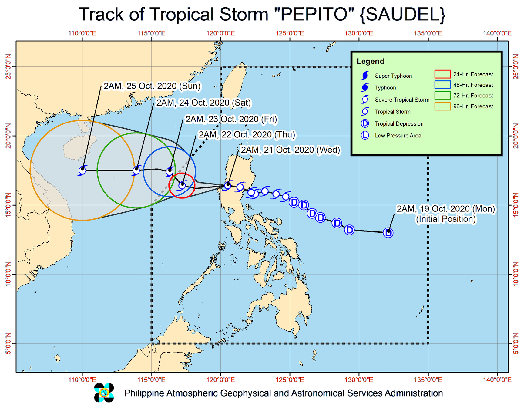
Tropical Storm Pepito (Saudel) crossed the rugged terrain of Northern Luzon after making landfall in Aurora, said the state weather bureau before dawn on Wednesday, October 21.
In its 5 am bulletin on Wednesday, the Philippine Atmospheric, Geophysical, and Astronomical Services Administration (PAGASA) said Pepito is already over the Lingayen Gulf, at 40 kilometers north northwest of Dagupan City, Pangasinan.
The tropical storm is moving west northwest at a relatively fast 30 kilometers per hour (km/h), heading for the West Philippine Sea.
Pepito has maximum winds of 75 km/h and gustiness of up to 115 km/h, but it is expected to intensify over the West Philippine Sea and become a severe tropical storm by Thursday afternoon or evening, October 22. (READ: FAST FACTS: Tropical cyclones, rainfall advisories)
Tropical cyclone wind signals remain raised in parts of Luzon as of 5 am on Wednesday. Some areas, like Metro Manila, are no longer under a tropical cyclone wind signal.
Signal No. 2 (winds of 60 to 120 km/h)
- Ilocos Sur
- La Union
- Pangasinan
- Benguet
- Tarlac
- northern part of Zambales (Iba, Palauig, Masinloc, Candelaria, Santa Cruz, Botolan, Cabangan)
Signal No. 1 (winds of 30 to 60 km/h)
- Ilocos Norte
- Kalinga
- Abra
- Ifugao
- Mountain Province
- southern part of Isabela (Palanan, San Mariano, Benito Soliven, Naguilian, Gamu, Burgos, San Manuel, Aurora, Cabatuan, Luna, Reina Mercedes, Cauayan City, Dinapigue, San Guillermo, Angadanan, Alicia, San Mateo, Ramon, San Isidro, Echague, San Agustin, Jones, Santiago City, Cordon)
- Quirino
- Nueva Vizcaya
- Aurora
- Bulacan
- Pampanga
- rest of Zambales
- Bataan
“Gale-force winds and high (strong to near gale) winds” will be experienced in areas under Signal Nos. 1 and 2, warned PAGASA.
“High to gale-force winds” will also prevail in the rest of Northern Luzon, especially in coastal and mountainous areas, but due to the northeasterly surface windflow.
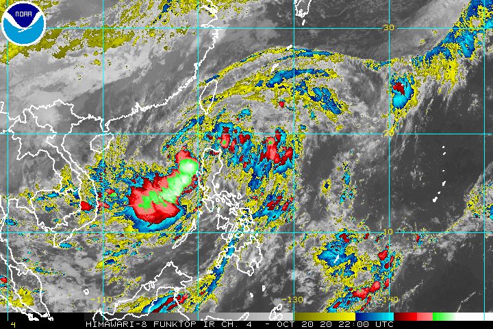
Rain from Pepito will persist as well, so residents of Luzon must stay on alert for floods and landslides. Below is PAGASA’s latest rainfall forecast for Wednesday.
Moderate to heavy rain
- Batanes
- Cagayan
- Ilocos Norte
- Pangasinan
- La Union
- Apayao
- Benguet
- Zambales
- Bataan
- Occidental Mindoro
- Calamian Islands
Light to moderate rain, with at times heavy rain
- rest of Luzon
PAGASA also said rough to very rough seas, with waves 2.5 to 5.5 meters high, will be experienced in areas where tropical cyclone wind signals and a gale warning are in effect. Travel is risky, especially for small vessels, in these seaboards:
- entire seaboards of Northern Luzon and Central Luzon
- seaboard of northern Quezon including Polillo Island
- western seaboards of Batangas, Occidental Mindoro (including Lubang Islands), and Palawan (including Calamian and Kalayaan Islands)
Moderate to rough seas, with waves 1.5 to 3 meters high, are expected in the eastern seaboards of the following:
- southern part of Quezon
- Bicol
- Eastern Visayas
- Caraga
- Davao Region
PAGASA advised small vessels to take precautionary measures. It added that “inexperienced mariners should avoid navigating in these conditions.”
Pepito could exit the Philippine Area of Responsibility (PAR) on Thursday morning or afternoon.
Beginning Friday, October 23, it may accelerate and turn west toward the central part of Vietnam, said PAGASA.
Meanwhile, PAGASA continues to monitor a tropical depression outside PAR, which is now 1,880 kilometers east northeast of extreme Northern Luzon.
This tropical depression maintained its strength, with maximum winds of 55 km/h and gustiness of up to 70 km/h.
It remains almost stationary or hardly moving, and is still unlikely to enter PAR, according to PAGASA.
Pepito is the Philippines’ 16th tropical cyclone for 2020, and the 3rd for October.
An average of 20 tropical cyclones form within or enter PAR each year. (READ: LIST: PAGASA’s names for tropical cyclones in 2020)
PAGASA gave the following estimates for the number of tropical cyclones inside PAR in the next 6 months:
- October 2020 – 2 or 3
- November 2020 – 1 or 2
- December 2020 – 1 or 2
- January 2021 – 1 or 2
- February 2021 – 0 or 1
- March 2021 – 0 or 1
Last October 2, the state weather bureau warned Filipinos to expect more rain in the coming months due to the onset of La Niña. – Rappler.com
Add a comment
How does this make you feel?


There are no comments yet. Add your comment to start the conversation.