SUMMARY
This is AI generated summarization, which may have errors. For context, always refer to the full article.
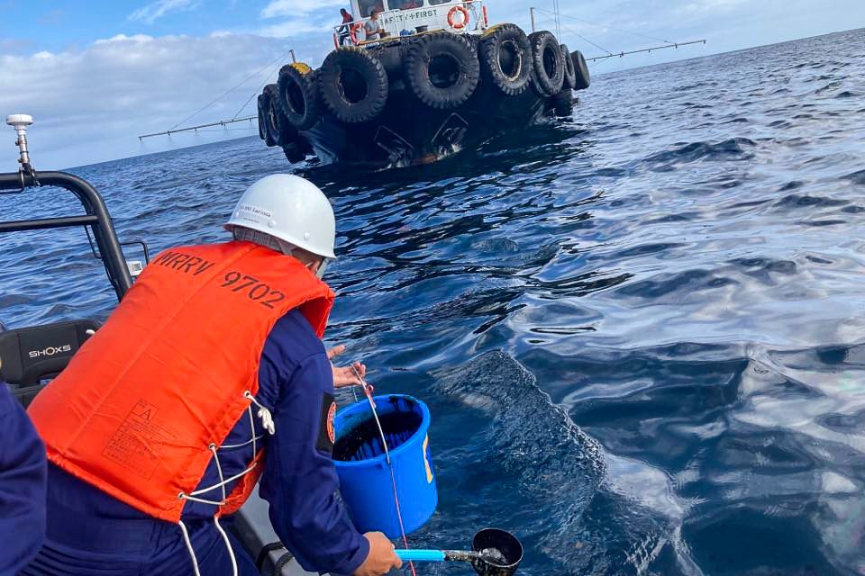
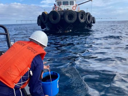
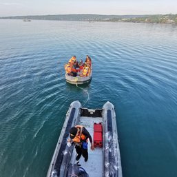
MANILA, Philippines – A tanker carrying 800,000 liters of industrial oil capsized off the coast of Naujan, Oriental Mindoro, on February 28, 2023.
It was on its way from Limay, Bataan, to Iloilo when it was slammed by strong waves near Tablas Island.
MT Princess Empress submerged two days after, according to the Philippine Coast Guard (PCG).
Authorities are now on high alert for the oil spill. (BOOKMARK: LIVE UPDATES: Authorities race to contain Oriental Mindoro oil spill)
What are the affected areas?
According to the PCG and the Department of Environment and Natural Resources (DENR), the oil spill has affected the following municipalities in Oriental Mindoro, as of Friday, March 3:
- Mansalay
- Pola
- Pinamalayan
- Gloria
- Bansud
- Bongabong
- Roxas
- Naujan
Since Friday, however, the PCG in Western Visayas has been on alert due to reports that oil patches believed to be from the MT Princess Empress have been spotted in Antique.
How many people are affected?
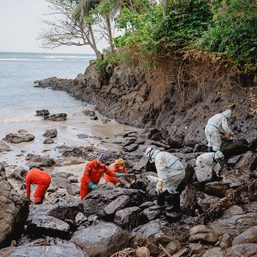
In Pola, one of the three worst-hit towns in Oriental Mindoro, the mayor said over 4,000 families living near the shoreline had been evacuated to higher ground due to the foul smell emanating from the oil spill.
Rappler is awaiting official figures from the other localities, as well as from government agencies assisting the residents.
How extensive is the oil spill?
Initial findings by the DENR estimated the length of the oil slick to be 25 kilometers trending NE-SW, and most of the oil is confined in a narrow band of approximately 300 to 500 meters. The potential for the oil to reach northern Palawan has also been discussed.
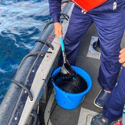
What agencies are in charge of the clean-up?
The DENR created Task Force Naujan Oil Spill, led by Environment Undersecretary and chief of staff Marilou Erni, who served as the corporate ground response coordinator during the Guimaras oil spill in 2006.
DENR Secretary Antonia Loyzaga on Friday, March 3, led the aerial surveillance and site assessment of the oil spill with Undersecretary for Integrated Environmental Science Carlos Primo David, and Professor Fernando Siringan of the University of the Philippines Marine Science Institute (UP-MSI).
Private companies – including Shell, Petron, and Prime Energy – have reached out to the DENR to offer their expertise in the response efforts.
What’s at stake?
Findings showed that within the 40-kilometer radius, approximately 591 hectares of coral reefs, 1,626 hectares of mangroves, and 362 hectares of seagrass or seaweeds can be potentially affected.
There are also 21 locally managed marine protected areas located in the city of Calapan (4), towns of Naujan (3), Pola (7), Pinamalayan (4), and Gloria (2) in Oriental Mindoro, and the town of Gasan (1) in Marinduque. The coastal areas of the municipality of Pola are observed the most affected as of March 3.
Meanwhile, the UP-MSI said that over 24,000 hectares of coral reef – an area one and a half times the size of Quezon City – may be in danger from the oil spill. This potentially affected area spans from Bulalacao, Oriental Mindoro, all the way to San Jose, Occidental Mindoro.
Where’s the ship?
As of Friday, March 3, authorities have not yet determined the ship’s exact location.
The MT Princess Empress must be immediately located to project future flow of oil and potentially impacted areas, according to the DENR.
The National Mapping and Resource Information Authority, an attached agency of the DENR, will deploy two ships, namely BRP Hydrographer Ventura and BRP Hydrographer Presbitero, for multibeam survey in order to locate the sunken vessel.
The DENR Biodiversity Management Bureau developed a potential impact map based on the last known location of MT Princess Empress, which is within the vicinity of the Verde Island Passage, the globally recognized center of marine shorefish biodiversity.
What are the challenges in containing the oil spill?
Aside from the difficulties of locating the ship, strong winds are preventing the containment efforts.
According to Oriental Mindoro Governor Humerlito Dolor, the oil spill boom – temporary floating barriers used to contain marine spills – can’t be deployed because of the strong winds.
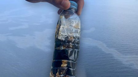
As of March 3, residents of Pola have resulted to using water containers and coconut husks to get oil out of the shore. – Rappler.com
Add a comment
How does this make you feel?


There are no comments yet. Add your comment to start the conversation.