SUMMARY
This is AI generated summarization, which may have errors. For context, always refer to the full article.
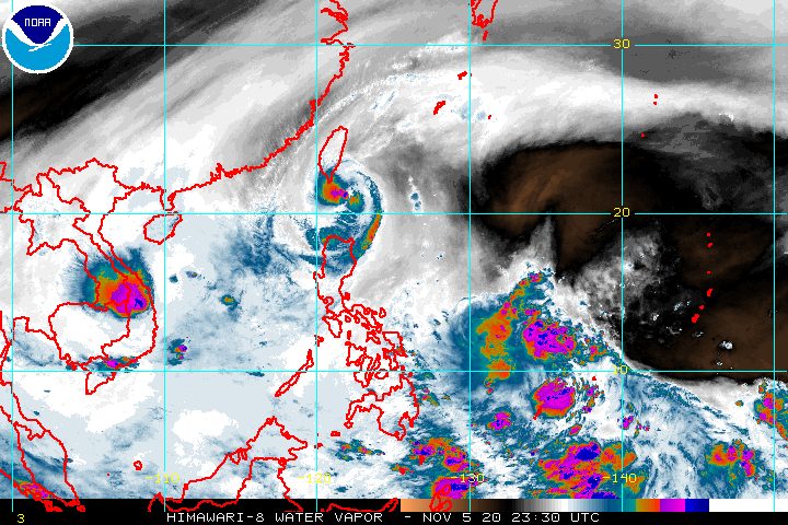
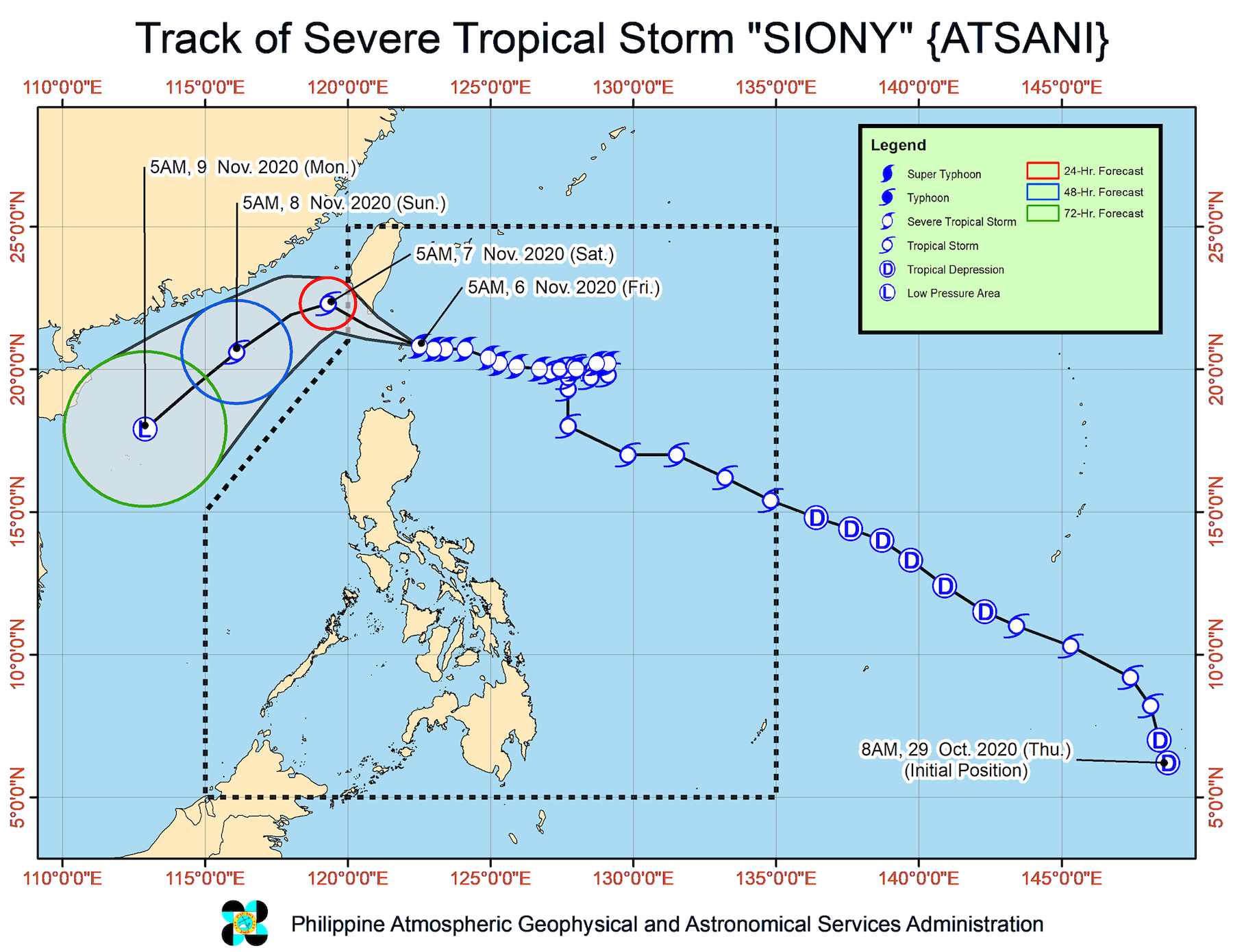
The center of Severe Tropical Storm Siony (Atsani) crossed Misanga Island in Itbayat, Batanes, at around 7:50 am on Friday, November 6.
The Philippine Atmospheric, Geophysical, and Astronomical Services Administration (PAGASA) said in a bulletin released past 8 am on Friday that Siony is now 30 kilometers east northeast of Itbayat.
The severe tropical storm is moving west at 20 kilometers per hour (km/h) and will pass over the sea off the southern coast of Taiwan within 12 hours, according to PAGASA.
Its maximum sustained winds had slightly decreased to 95 km/h before dawn on Friday, with gustiness at 115 km/h. On Thursday evening, November 5, it had maximum sustained winds of 100 km/h and gustiness of up to 125 km/h.
PAGASA said Siony is now forecast to either maintain its current strength of 95 km/h or slightly intensify back to 100 km/h within the next 24 hours. (READ: FAST FACTS: Tropical cyclones, rainfall advisories)
The same areas remain under tropical cyclone wind signals as of 8 am on Friday.
Signal No. 2
- Batanes
- Babuyan Islands
Signal No. 1
- northern part of mainland Cagayan (Santa Ana, Gonzaga, Lal-lo, Allacapan, Santa Teresita, Buguey, Camalaniugan, Aparri, Ballesteros, Abulug, Pamplona, Sanchez-Mira, Claveria, Santa Praxedes)
- northern part of Apayao (Santa Marcela, Luna, Calanasan)
- northern part of Ilocos Norte (Adams, Pagudpud, Bangui, Dumalneg, Burgos, Vintar, Pasuquin, Bacarra)
PAGASA said areas under Signal No. 2 continue to experience damaging gale- to storm-force winds, while those under Signal No. 1 have strong breeze to near gale conditions.
On Friday, moderate to heavy rain due to Siony will also persist in areas under Signal No. 2. Light to moderate rain – possibly heavy at times – will continue in areas under Signal No. 1 as well. Heavy rain may trigger floods and landslides.
PAGASA added that in the next 24 hours, there is still a “minimal to moderate risk” of storm surges up to 2 meters high in the coastal areas of Batanes and the Babuyan Islands.
Travel remains risky in certain seaboards in the next 24 hours.
- areas under Signal Nos. 1 and 2 – rough to high seas (waves 3 to 8 meters high), risky for all vessels
- areas under a gale warning – rough to very rough seas (waves 3 to 4.5 meters high), risky for small vessels
There will also be moderate to rough seas, with waves 1.5 to 3 meters high, here:
- western seaboard of Central Luzon
- eastern seaboards of Southern Luzon, Visayas, and Mindanao
PAGASA advised small vessels to take precautionary measures, and “inexperienced mariners” to avoid such waters.
Siony is expected to leave the Philippine Area of Responsibility (PAR) on Friday evening.
By Saturday, November 7, it may move toward the Paracel Islands area in the South China Sea.
After leaving PAR, Siony may also weaken. By Monday, November 9, it could already be downgraded to a low pressure area (LPA).
Meanwhile, the LPA outside PAR being monitored by PAGASA is now 1,200 kilometers east of Mindanao.
It could enter PAR on Friday afternoon or evening, then possibly reach Eastern Visayas on Saturday afternoon or evening.
The LPA may also develop into a tropical depression within 48 hours. If it does, it would be given the local name Tonyo.
Siony is already the Philippines’ 19th tropical cyclone for 2020.
An average of 20 tropical cyclones form within or enter PAR each year. (READ: LIST: PAGASA’s names for tropical cyclones in 2020)
These are PAGASA’s latest estimates for the number of tropical cyclones inside PAR in the next 6 months:
- November 2020 – 1 to 3
- December 2020 – 2 or 3
- January 2021 – 0 or 1
- February 2021 – 0 or 1
- March 2021 – 0 or 1
- April 2021 – 0 or 1
In early October, the state weather bureau warned Filipinos to expect more rain in the coming months due to the onset of La Niña. – Rappler.com
Add a comment
How does this make you feel?


There are no comments yet. Add your comment to start the conversation.