SUMMARY
This is AI generated summarization, which may have errors. For context, always refer to the full article.
MANILA, Philippines – The weather bureau raised Signal No. 1 for parts of extreme Northern Luzon on Thursday afternoon, September 1, due to Super Typhoon Henry (Hinnamnor).
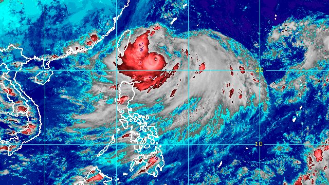
Henry was already 400 kilometers east northeast of Itbayat, Batanes, still moving south southwest but at a slower pace of 15 kilometers per hour, from 25 km/h in the morning.
The super typhoon slightly weakened, with its maximum sustained winds decreasing to 185 km/h from 195 km/h, and its gustiness down to 230 km/h from 240 km/h.
Signal No. 1 is now raised in Batanes and the northeastern part of Babuyan Islands, specifically Babuyan Island. Strong winds are expected.
The Philippine Atmospheric, Geophysical, and Astronomical Services Administration (PAGASA) is not ruling out the possibility of raising Signal No. 2.
Extreme Northern Luzon is also seeing rain from Henry:
Thursday evening, September 1
- moderate to heavy rain in Batanes
- light to moderate rain, with at times heavy rain, in Babuyan Islands
Friday, September 2
- moderate to heavy rain in Batanes and Babuyan Islands
Early Saturday morning to afternoon, September 3
- moderate to heavy rain in Batanes
- light to moderate rain, with at times heavy rain, in Babuyan Islands
Isolated to scattered floods and landslides are possible.
Henry may also enhance the southwest monsoon or hanging habagat, which could trigger rain in the western part of Luzon starting Friday, September 2.
Meanwhile, another gale warning was issued at 5 pm on Thursday, covering the northern and eastern seaboards of Northern Luzon, particularly Batanes, Cagayan including Babuyan Islands, and the northern coast of Ilocos Norte.
In areas under the gale warning, seas are rough to very rough, with waves 2.8 to 5 meters high. PAGASA advised small vessels not to sail and large vessels to watch out for big waves.
From Thursday evening to Friday, moderate to rough seas may be seen in the eastern seaboards of Isabela, Central Luzon, Southern Luzon, and the Visayas, too. Waves could be 1.2 to 4 meters high, making conditions risky for small vessels.
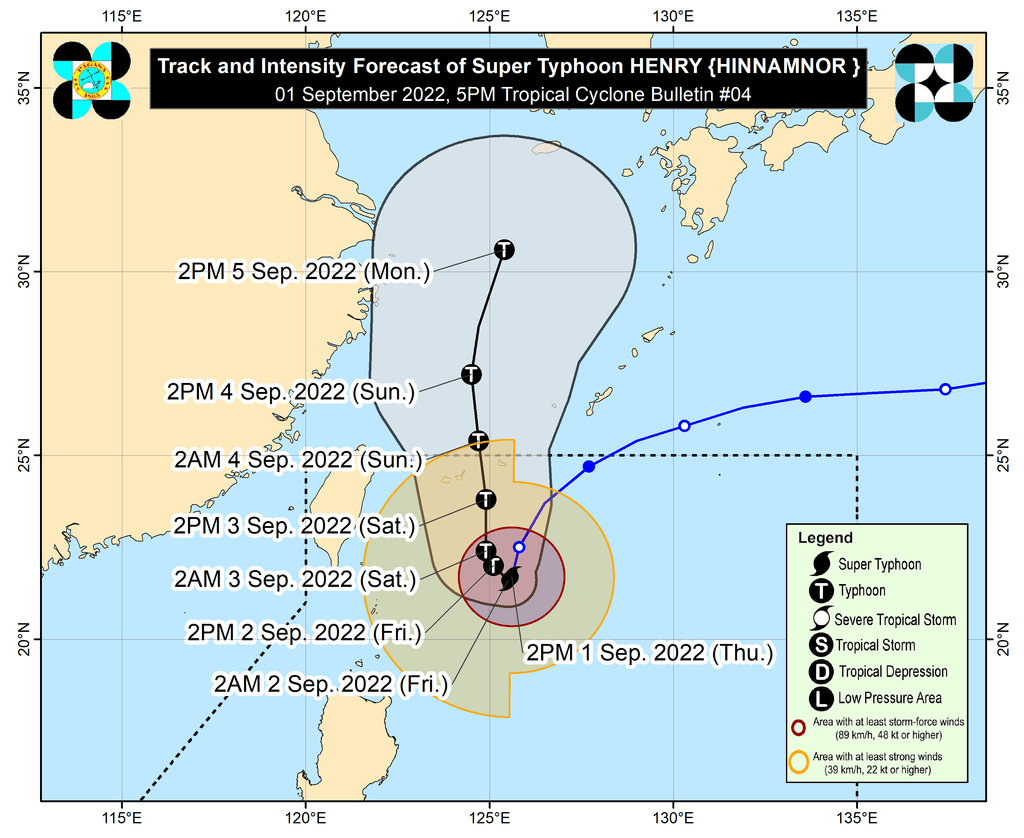
PAGASA said Henry is projected to become almost stationary beginning Thursday evening or early Friday morning. It may also weaken gradually during this period.
Then Henry could begin moving slowly northwest on Friday afternoon, before speeding up toward the north on Saturday, September 3.
It may exit the Philippine Area of Responsibility (PAR) as a typhoon on Saturday evening or Sunday morning, September 4.
Henry is the Philippines’ eighth tropical cyclone for 2022. It absorbed the remnant low that used to be Tropical Depression Gardo, the country’s seventh tropical cyclone for the year.
PAGASA expects 7 to 11 tropical cyclones to enter or develop inside PAR from September 2022 to February 2023. Per month, these are the weather bureau’s estimates:
- September 2022 – 2 or 3
- October 2022 – 2 to 4
- November 2022 – 2 or 3
- December 2022 – 1 or 2
- January 2023 – 0 or 1
- February 2023 – 0 or 1
– Rappler.com
Add a comment
How does this make you feel?


There are no comments yet. Add your comment to start the conversation.