SUMMARY
This is AI generated summarization, which may have errors. For context, always refer to the full article.

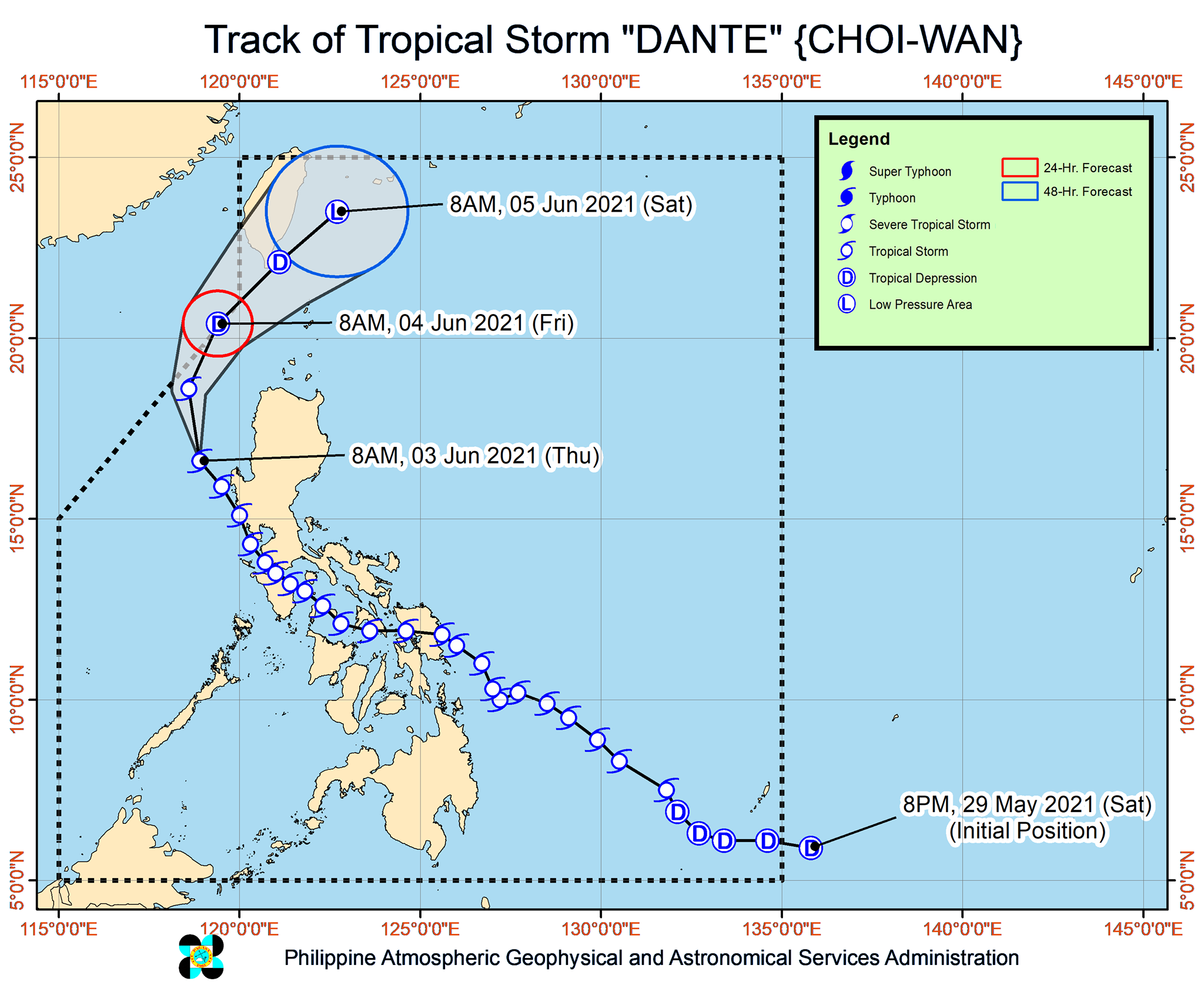
All rainfall warnings and tropical cyclone wind signals were lifted late Thursday morning, June 3, with Tropical Storm Dante (Choi-wan) over the West Philippine Sea and moving away from land.
The Philippine Atmospheric, Geophysical, and Astronomical Services Administration (PAGASA) said in its 11 am bulletin on Thursday that Dante was already 205 kilometers west northwest of Dagupan City, Pangasinan, or
190 kilometers west southwest of Sinait, Ilocos Sur.
The tropical storm is moving northwest at the same speed of 35 kilometers per hour (km/h).
PAGASA said Dante will be moving north northwest or north for the rest of Thursday, before turning north northeast on Friday morning, June 4, and northeast on Friday afternoon or evening, at which point it would already be over the Bashi Channel in the Luzon Strait.
Dante maintained its strength late Thursday morning, with maximum sustained winds of 65 km/h and gustiness of up to 90 km/h. It is expected to remain a tropical storm on Thursday, but could weaken into a tropical depression on Friday and into a remnant low on Saturday, June 5.
Dante earlier dumped heavy rain in parts of Mindanao, the Visayas, and Luzon, triggering floods and landslides. Signal Nos. 1 and 2 were also raised.
The tropical storm had made landfall eight times – the first in the Visayas and the rest in Luzon.
Tuesday, June 1
- Sulat, Eastern Samar – 8:30 pm
Wednesday, June 2
- Cataingan, Masbate – 1 am
- Balud, Masbate – 3:30 am
- Romblon, Romblon – 8 am
- San Agustin, Romblon – 8:50 am
- Pola, Oriental Mindoro – 2 pm
- Maricaban Island, Tingloy, Batangas – 7:20 pm
- Calatagan, Batangas – 8 pm
Even before hitting land, however, Dante was already affecting Mindanao.
The National Disaster Risk Reduction and Management Council said on Thursday it is verifying initial reports that Dante left at least four people dead – two of them in the Davao Region and the other two in Soccsksargen.
Seven others were reported missing – four fishermen from Western Visayas, two swept away by flash floods in Eastern Visayas, and one in the Davao Region.
Two were also reported injured, both from the Davao Region.
As Dante moves away, however, a gale warning is still in effect for the northern and western seaboards of Northern Luzon. Waves may be 2.6 to 4.5 meters high, making travel risky for small vessels.
Moderate to rough seas will also be experienced in the western seaboard of Northern Luzon, with waves 1.5 to 3.5 meters high. PAGASA advised small vessels to take precautionary measures and inexperienced mariners to avoid sailing.
Dante is the Philippines’ fourth tropical cyclone for 2021. The country has an average of 20 tropical cyclones every year. (READ: LIST: PAGASA’s names for tropical cyclones in 2021)
For June to November, PAGASA estimates the following number of tropical cyclones inside the Philippine Area of Responsibility:
- June – 1 to 3
- July – 2 to 4
- August – 2 or 3
- September – 2 or 3
- October – 2 or 3
- November – 2 or 3
The state weather bureau is expected to declare the onset of the rainy season and the southwest monsoon or hanging habagat within the first half of June. – Rappler.com
Add a comment
How does this make you feel?


There are no comments yet. Add your comment to start the conversation.