SUMMARY
This is AI generated summarization, which may have errors. For context, always refer to the full article.
MANILA, Philippines – Tropical Storm Domeng (Aere) accelerated over the Philippine Sea on Friday evening, July 1, and is expected to leave the Philippine Area of Responsibility (PAR) in a matter of hours.
The Philippine Atmospheric, Geophysical, and Astronomical Services Administration (PAGASA) said in its 11 pm bulletin on Friday that Domeng was already 995 kilometers east of extreme Northern Luzon, moving north at 20 kilometers per hour from the previous 15 km/h.
The tropical storm had strengthened earlier on Friday afternoon. It has maximum sustained winds of 75 km/h and gustiness of up to 90 km/h.
Given Domeng’s distance from land, it has no direct effect on the Philippines. There are no areas under tropical cyclone wind signals.
Meanwhile, Severe Tropical Storm Caloy (Chaba), which is outside PAR, was last spotted 930 kilometers west of extreme Northern Luzon. Caloy left PAR last Wednesday, June 29.
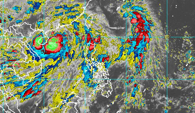
But Domeng and Caloy have been enhancing the southwest monsoon or hanging habagat.
In a separate advisory issued 11 pm on Friday, PAGASA said the effect of the southwest monsoon is weakening. But it may still cause scattered rain and thunderstorms, expected to be light to moderate, in these areas on Saturday, July 2:
- Ilocos Region
- Batanes
- Babuyan Islands
- Zambales
- Bataan
- Occidental Mindoro
- Kalayaan Islands
Occasionally gusty conditions will still be experienced in the following areas:
- extreme Northern Luzon
- northern and western parts of Luzon
- western part of Visayas
Rough to very rough seas, with waves 2.8 to 4.5 meters high, are also expected in the western seaboard of Luzon, particularly in these provinces:
- Ilocos Norte
- Ilocos Sur
- La Union
- Pangasinan
- Zambales
- Bataan
- western coast of Occidental Mindoro including Lubang Island
- western coast of Palawan including Kalayaan Island
PAGASA advised small vessels not to venture out into sea, and large vessels to watch out for big waves.
The remaining seaboards of Northern Luzon have moderate to rough seas, with waves 1.2 to 4 meters high. It may be risky for small vessels to travel.
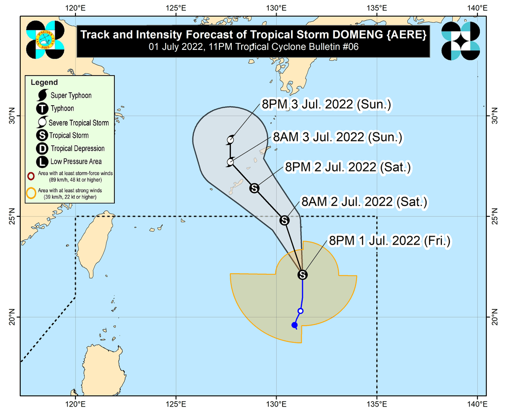
Domeng is projected to exit PAR on Saturday morning or afternoon.
PAGASA said the tropical storm could pass very close to or over Japan’s Ryukyu Islands on Saturday evening, and turn north northwest on Sunday, July 3, as it moves over the East China Sea.
Domeng might also intensify into a severe tropical storm within 36 hours.
Domeng is the Philippines’ fourth tropical cyclone for 2022, while Caloy was the third.
PAGASA expects 11 to 15 tropical cyclones to enter or develop inside PAR from July to December. Per month, these are the weather bureau’s estimates:
- July – 2 or 3
- August – 2 or 3
- September – 2 or 3
- October – 2 to 4
- November – 2 or 3
- December – 1 or 2
– Rappler.com
Add a comment
How does this make you feel?


There are no comments yet. Add your comment to start the conversation.