SUMMARY
This is AI generated summarization, which may have errors. For context, always refer to the full article.
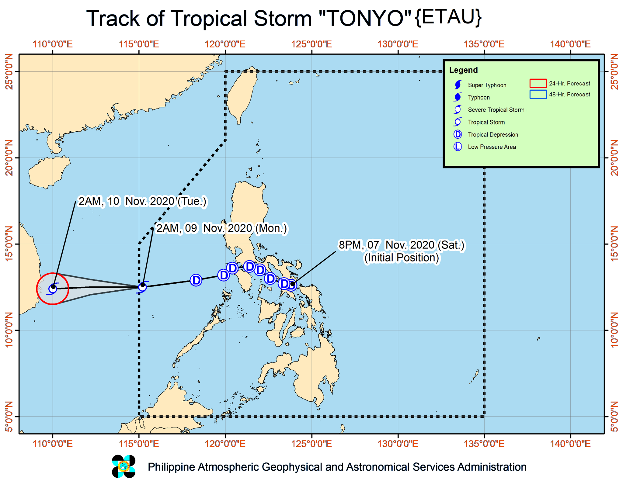
Tonyo intensified from a tropical depression into a tropical storm at 2 am on Monday, November 9, then left the Philippine Area of Responsibility (PAR) at 4 am.
As Tonyo intensified into a tropical storm, it was given the international name Etau. Tropical cyclones get international names when they reach tropical storm status.
The Philippine Atmospheric, Geophysical, and Astronomical Services Administration (PAGASA) said in its 5 am bulletin on Monday that Etau, a name contributed by the United States, is a Palauan word that means “storm cloud.”
As Tonyo left PAR at 4 am, it was located 710 kilometers west of Calapan City, Oriental Mindoro, over the West Philippine Sea.
PAGASA said the tropical storm is moving west at 30 kilometers per hour (km/h), heading for the southern part of Vietnam, where it is likely to make landfall on Tuesday morning or afternoon, November 10.
Tonyo’s maximum winds increased to 65 km/h from the previous 55 km/h, while its gustiness is now at 80 km/h from the previous 70 km/h. (READ: FAST FACTS: Tropical cyclones, rainfall advisories)
It earlier hit Masbate, Marinduque, Batangas, Oriental Mindoro, and Occidental Mindoro. No casualties have been reported.
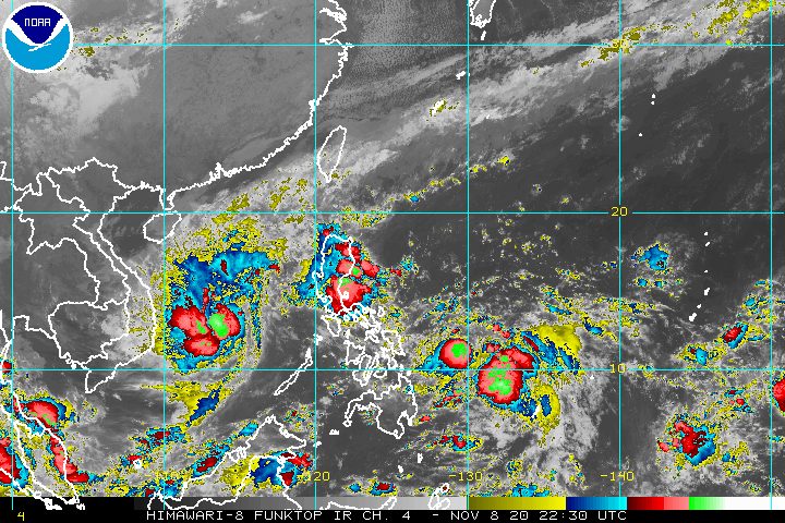
Though Tonyo is already outside PAR, PAGASA said the tropical storm continues to affect the Kalayaan Islands in the West Philippine Sea. It is causing moderate to heavy rain there, as well as “occasional gusty conditions,” said the state weather bureau.
Tonyo and the remaining tropical cyclone inside PAR, Tropical Depression Ulysses, are also enhancing the easterlies or winds coming from the east. The enhanced easterlies will bring rain to parts of Luzon and of the Visayas on Monday, with floods and landslides possible.
Moderate to heavy rain
- Babuyan Islands
- mainland Cagayan Valley
- Cordillera Administrative Region
- Ilocos Norte
- Aurora
- northern part of Quezon including Polillo Island
Light to moderate rain, with at times heavy rain
- rest of Ilocos Region
- rest of Central Luzon
- rest of Calabarzon
- Metro Manila
- Bicol
- Eastern Visayas
Tonyo is also enhancing the northeast monsoon or hanging amihan, which will continue to bring strong to gale-force winds to these areas:
- Batanes
- Babuyan Islands
- Ilocos Norte
- Apayao
- northern part of mainland Cagayan
Travel remains risky, especially for small vessels, in seaboards where rough to very rough seas will be experienced in the next 24 hours.
Due to Tonyo (waves 2.5 to 4.5 meters high)
- seaboards of Kalayaan Islands
Due to enhanced northeast monsoon (waves 2.5 to 5 meters high)
- seaboards of Batanes, Babuyan Islands, Ilocos Norte, Ilocos Sur, La Union, Pangasinan, and Zambales
- northern seaboards of mainland Cagayan
There will also be moderate to rough waters in certain seaboards.
Due to Tonyo (waves 1.5 to 2.5 meters high)
- western seaboards of Bataan, Batangas, Occidental Mindoro including Lubang Island, and Palawan including Calamian Islands
Meanwhile, before dawn on Monday, Ulysses was located 800 kilometers east of Surigao City, Surigao del Norte, moving north at 15 km/h.
PAGASA earlier said the tropical depression is heading for Bicol, where it is likely to make landfall on Wednesday, November 11.
Ulysses maintained its strength early Monday, with maximum sustained winds of 45 km/h and gustiness of up to 55 km/h. But the state weather bureau previously warned it could become a typhoon before it reaches land.
There are no tropical cyclone wind signals raised due to Ulysses yet since it remains far from the country.
PAGASA’s next bulletin on the tropical depression will be issued 11 am on Monday.
Tonyo was the Philippines’ 20th tropical cyclone for 2020, while Ulysses is the 21st – already above the yearly average of 20. (READ: LIST: PAGASA’s names for tropical cyclones in 2020)
For the next 6 months, these are PAGASA’s estimates for tropical cyclones inside PAR:
- November 2020 – 1 to 3
- December 2020 – 2 or 3
- January 2021 – 0 or 1
- February 2021 – 0 or 1
- March 2021 – 0 or 1
- April 2021 – 0 or 1
Since October, La Niña has been underway, which means there is more rain than usual.
Then in November, the northeast monsoon began, signaling “surges of cold temperatures.”
PAGASA warned that La Niña may enhance the northeast monsoon, which could trigger floods and landslides. – Rappler.com
Add a comment
How does this make you feel?


There are no comments yet. Add your comment to start the conversation.