SUMMARY
This is AI generated summarization, which may have errors. For context, always refer to the full article.
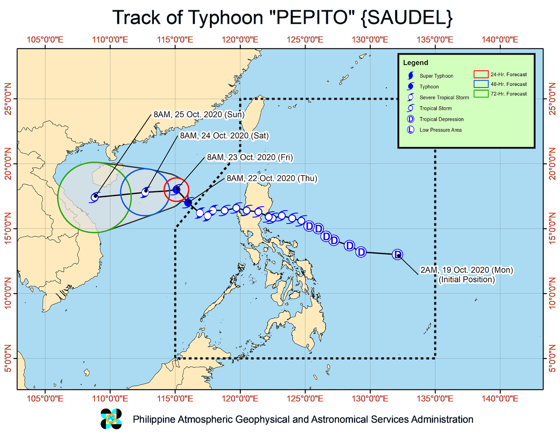
Pepito (Saudel) left the Philippine Area of Responsibility (PAR) as a severe tropical storm at 7:30 am on Thursday, October 22, then intensified into a typhoon at 8 am.
The Philippine Atmospheric, Geophysical, and Astronomical Services Administration (PAGASA) announced these developments in a bulletin at 11 am.
PAGASA said Pepito was already 485 kilometers west northwest of Dagupan City, Pangasinan, or 480 kilometers west of Sinait, Ilocos Sur, as of late Thursday morning.
The typhoon is moving northwest at 20 kilometers per hour (km/h). PAGASA said it is expected to turn west beginning Friday, October 23, and then make landfall in the central part of Vietnam by Sunday, October 25.
After its exit from PAR, Pepito’s maximum winds increased to 120 km/h and its gustiness is now up to 150 km/h. According to PAGASA, the typhoon may reach its peak intensity on Friday. (READ: FAST FACTS: Tropical cyclones, rainfall advisories)
Pepito had made landfall as a tropical storm in San Ildefonso Peninsula in Casiguran, Aurora, at 9 pm on Tuesday, October 20. It then crossed Northern Luzon, bringing strong winds and heavy rain that caused floods.
Pepito was the Philippines’ 16th tropical cyclone for 2020, and the 3rd for October. PAGASA earlier forecast up to 3 tropical cyclones in October.
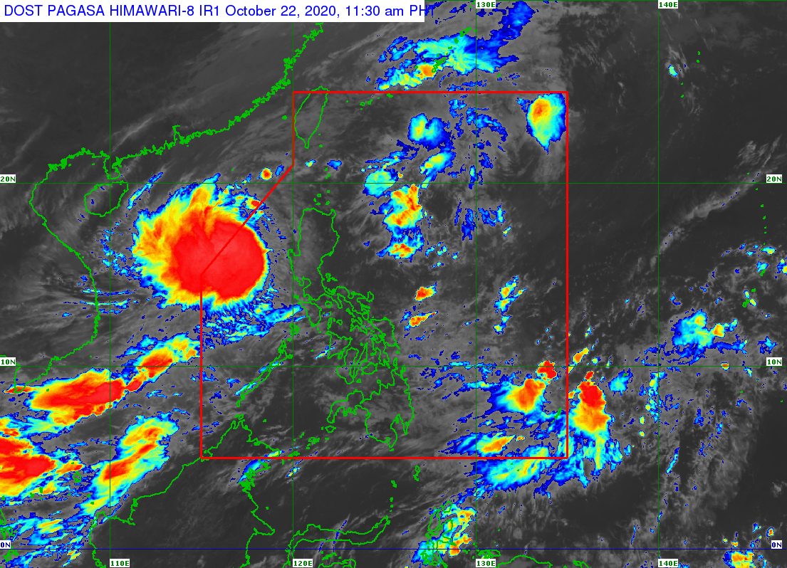
Though Pepito is now outside PAR, its trough or extension may still cause light to moderate rain in some provinces on Thursday – listed below. The rain could become heavy at times, warned PAGASA, which may cause floods or landslides.
- Batanes
- Pangasinan
- Zambales
- Bataan
- Occidental Mindoro
- Palawan
PAGASA added that “high winds to gale-force winds with occasional gusts” due to Pepito will still affect Northern Luzon and Central Luzon, particularly their western sections as well as coastal and mountainous areas.
A gale warning also remains in effect for the following seaboards due to rough to very rough seas, with waves 2.8 to 5.5 meters high:
- northern and western seaboards of Northern Luzon
- western seaboards of Central Luzon, Batangas, Occidental Mindoro (including Lubang Island), and Palawan (including Calamian and Kalayaan Islands)
PAGASA stressed that sea travel is risky, especially for small vessels.
In the eastern seaboards of Luzon, moderate to rough seas are expected, with waves 1.5 to 2.5 meters high. The state weather bureau said “inexperienced mariners should avoid navigating in these conditions.”
Following Pepito, PAGASA is monitoring a low pressure area (LPA) outside PAR, located 1,200 kilometers east of Mindanao as of Thursday morning.
The state weather bureau said the LPA is likely to enter PAR on Friday, and may develop into a tropical depression during the weekend. Updates will be given in the coming days.
Meanwhile, the tropical depression outside PAR that PAGASA has also been monitoring already weakened into an LPA at 8 am on Thursday.
It is now 1,870 kilometers east northeast of extreme Northern Luzon, and remains less likely to enter PAR, said PAGASA.
The next tropical cyclone that enters or forms inside PAR would be the Philippines’ 17th for 2020. It would be locally named Quinta.
An average of 20 tropical cyclones form within or enter PAR each year. (READ: LIST: PAGASA’s names for tropical cyclones in 2020)
These are PAGASA’s latest estimates for the number of tropical cyclones inside PAR in the next 6 months:
- November 2020 – 1 to 3
- December 2020 – 2 or 3
- January 2021 – 0 or 1
- February 2021 – 0 or 1
- March 2021 – 0 or 1
- April 2021 – 0 or 1
Last October 2, the state weather bureau warned Filipinos to expect more rain in the coming months due to the onset of La Niña. – Rappler.com
Add a comment
How does this make you feel?


There are no comments yet. Add your comment to start the conversation.