SUMMARY
This is AI generated summarization, which may have errors. For context, always refer to the full article.
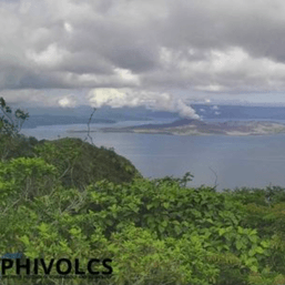
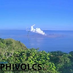
How can volcanologists monitor Taal Volcano‘s activity even when high-risk areas surrounding it are evacuated? They make informed decisions about Taal and its alert levels with a little help from space.
The Philippine Institute of Volcanology and Seismology (Phivolcs) uses data from the European Union’s (EU) Copernicus and Galileo space programs together with monitoring systems on the ground in order to evaluate Taal Volcano’s condition and alert status.
Copernicus is the EU’s Earth observation program that uses satellite and non-space-based data on the ground and at sea. There are seven Copernicus satellite missions – called “Sentinels” – in orbit that measure certain parameters of the land, sea, and atmosphere. On the other hand, Galileo is the EU’s Global Satellite Navigation System (also called the “European GPS”), which provides accurate positioning and timing information.
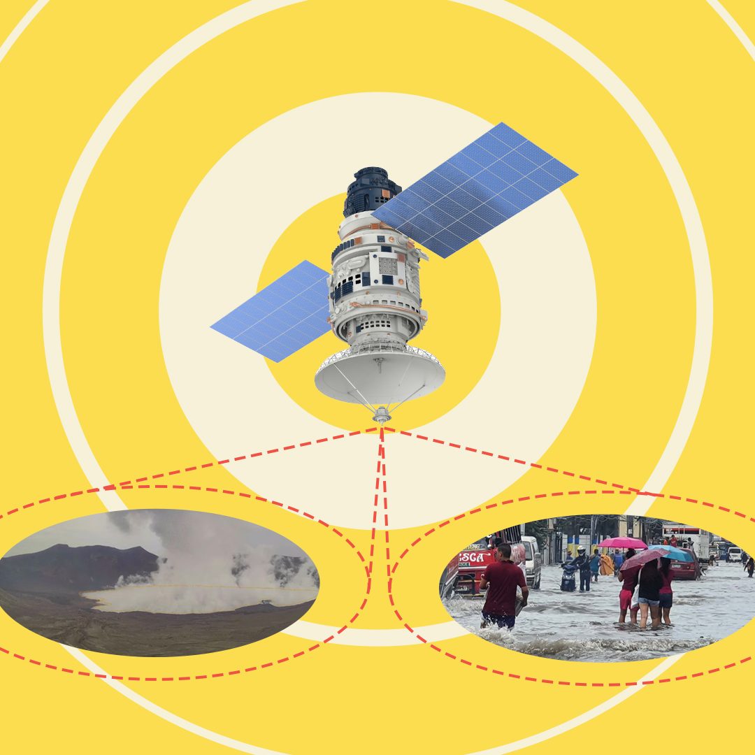
The EU Space Programme’s data is used not only to monitor volcanic eruptions, but also typhoons and the Earth’s activity during the COVID-19 pandemic. The data helps experts make decisions as events occur, produce hazard maps, identify areas that might be affected, and monitor recovery. Here are some ways they’ve been used in the past.
Monitoring volcanic activity
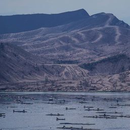
Phivolcs uses Sentinel-1’s radar imaging and GPS network to analyze Taal Volcano Island and the caldera surrounding it. These tools measure large-scale ground deformations in the area, which is helpful in understanding the broad movement of the magma system and monitoring the resupply of magma from deeper sources to shallower levels beneath Taal.
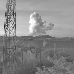
Assessing ashfall damage
After Taal Volcano’s phreatic or steam-driven eruption on January 12, 2020, ashfall reached Calabarzon and Metro Manila, settling on parked vehicles and vegetation.
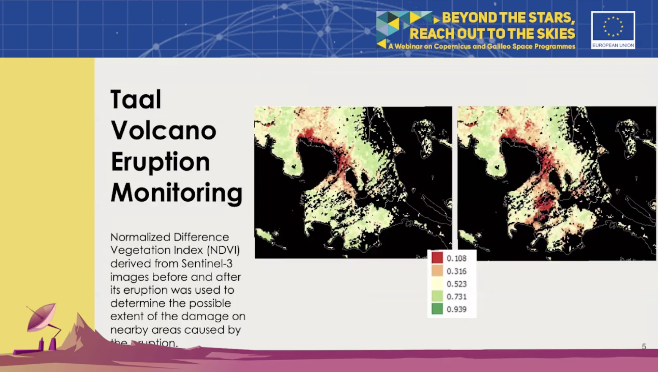
In the screenshot above, the image on the left was taken before the 2020 eruption and the one on the right was taken after. The screenshot was taken from the EU’s June 25 webinar on its Copernicus and Galileo space programs.
According to Joel Marciano, director-general of Philippine Space Agency, the two satellite images show the normalized difference vegetation index (NDVI) – a way of measuring the health of vegetation – surrounding Taal Volcano. The significant drop in NDVI in the southwest area of Taal Volcano after the eruption indicates possible agricultural damage due to ashfall, as the ash would have covered the vegetation so that it wouldn’t be detected or even caused the vegetation to die.
In an email to Rappler, Phivolcs said that the Copernicus’ multi-spectral satellite images are also used for volcanic impact assessment and hazard mapping. These images help monitor ashfall dispersion and its deposits, changes in vegetation and appearance of the volcano, and hotspots where the temperature of the crater can be calculated.
Flood assessment
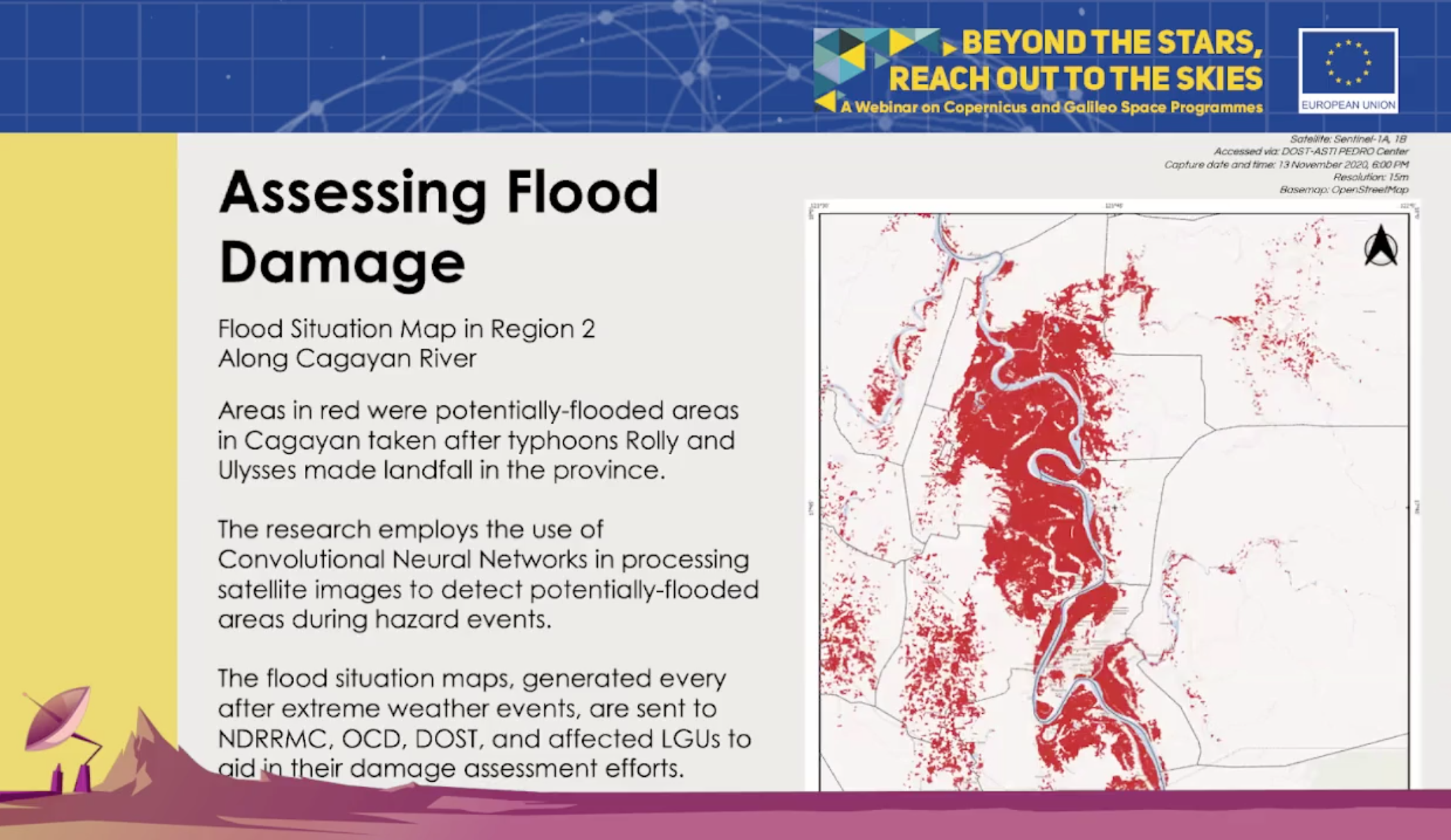
Copernicus data is used to detect potentially flooded areas after a typhoon, and it is used by local government units to assess damage to an area. In the image below, the areas marked in red are the potentially flooded areas in Cagayan after Super Typhoon Rolly (Goni) and Typhoon Ulysses (Vamco) made landfall. An area is said to be flooded when the backscatter reflections change from a high to a low value, which suggests that the surface might be submerged in water.
Measuring air quality
Copernicus can also help local experts monitor air quality in the Philippines. This is useful for the volcanologists at Phivolcs who are monitoring the sulfur dioxide that is released during the degassing of the magmatic system beneath volcanoes like Taal.
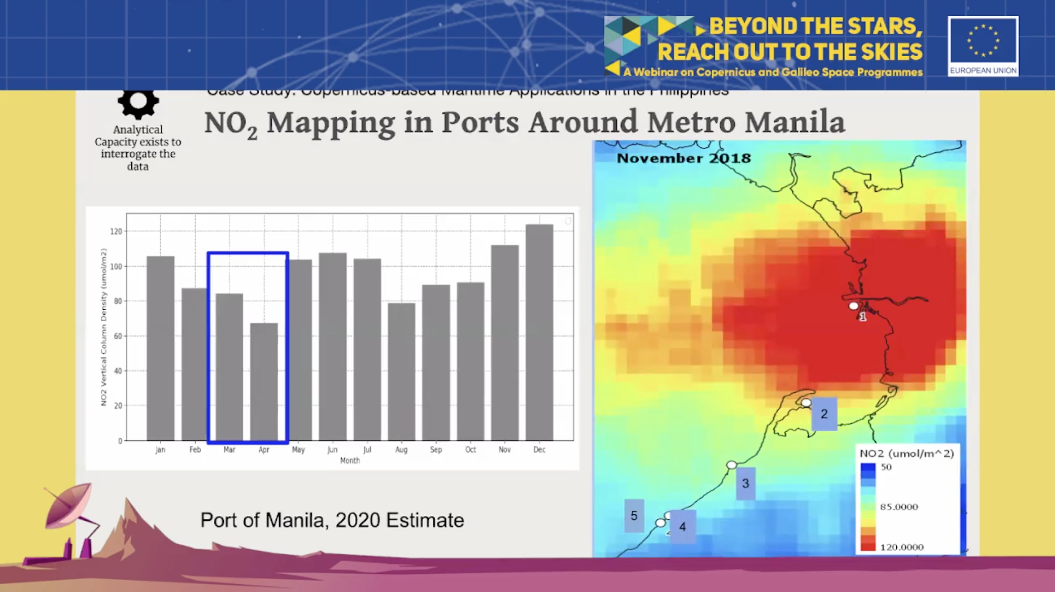
Air quality measurements are also used in tandem with traffic monitoring datasets to observe the movement of vehicles on the ground. For example, Copernicus data was used to detect the presence of ships or boats in Manila Bay from January 2019 to September 2020, which covers the onset of the COVID-19 pandemic.
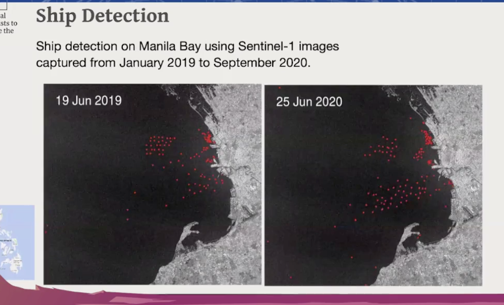
Experts found that despite the increase of boats at the bay, the level of nitrogen dioxide – an air pollutant caused by fossil fuel consumption – stayed down, suggesting that the ships were either docked or stranded during this time period.
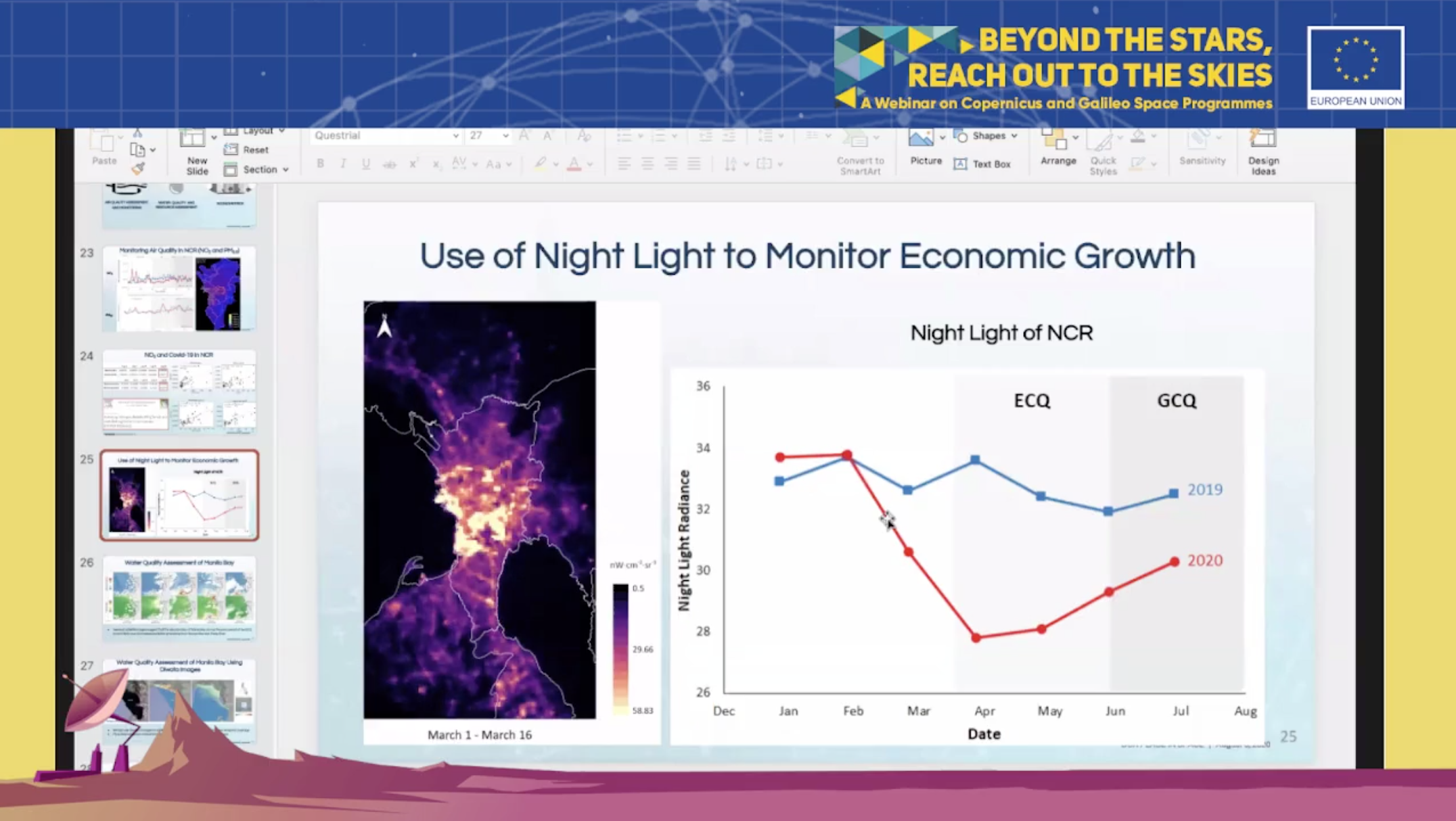
Proxy indicator for the economy
Experts can also make inferences about the economy based on satellite data. During the pandemic, data from NASA’s Visible Infrared Imaging Radiometer Suite satellite indicated through a decrease in night light that there was less economic activity during the imposed community quarantines.
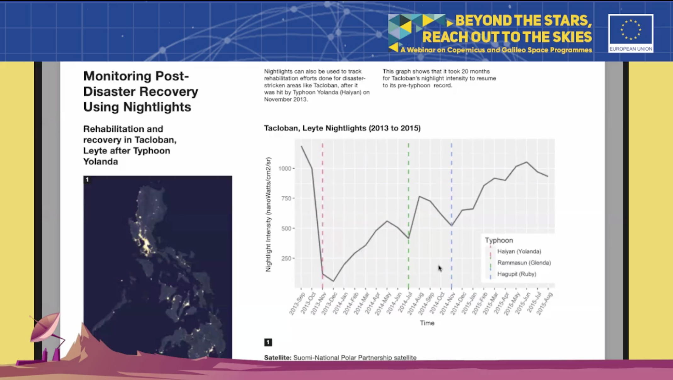
Monitoring disaster recovery
Monitoring night lights can also be used as an indicator of how far along an area has recovered from a natural disaster. The graph below, which uses satellite data from NASA’s Suomi National Polar-orbiting Partnership, shows the drop in night lights in Tacloban after Super Typhoon Yolanda (Haiyan) hit in 2013. In the succeeding years, the amount of night lights increased, though setbacks were encountered every time another typhoon hit the area.
“It’s a proxy indicator, it does not directly measure things like resilience or other factors, but we can use it to gain some immediate insight into an event that was very close to the actual behavior,” said Marciano. A survey on the ground might provide more accurate data later on, but information from satellites could help provide quick information.
Filipino scientists and engineers have already been using data and user products from Copernicus satellites through the Sentinel Australasia Regional Access for years. However, the EU and the Philippines launched the National Copernicus Capacity Support Action Programme for the Philippines (CopPhil) in July in order to strengthen disaster risk preparedness and climate change adaptation in the Philippines.
CopPhil is the first space cooperation program in the Asian region. The Philippines has also signed an agreement with Japan to promote space cooperation. Philippine satellites like Diwata-1, Diwata-2, and Maya-1 were developed and completed with Japanese universities and the Japan Aerospace Exploration Agency. – Rappler.com
Add a comment
How does this make you feel?


![[Under 3 Minutes] Kumusta na ang Yolanda housing projects?](https://www.rappler.com/tachyon/2023/11/title-card-ls-3.jpg?resize=257%2C257&crop_strategy=attention)

There are no comments yet. Add your comment to start the conversation.