SUMMARY
This is AI generated summarization, which may have errors. For context, always refer to the full article.
MANILA, Philippines – The oil spill from the sunken MT Princess Empress in Oriental Mindoro could reach as far as Palawan, threatening the livelihood of those in coastal communities as well as ruining the area’s rich marine biodiversity.
Coastal communities in the area should brace for the possibility of the oil spill reaching their shores, warned experts from the Department of Natural Resources (DENR) and University of the Philippines Marine Science Institute (UP MSI).
Those on the eastern and southern sides of Oriental Mindoro, Caluya Island in Northwestern Antique, and even Cuyo Island of Palawan are especially at risk.
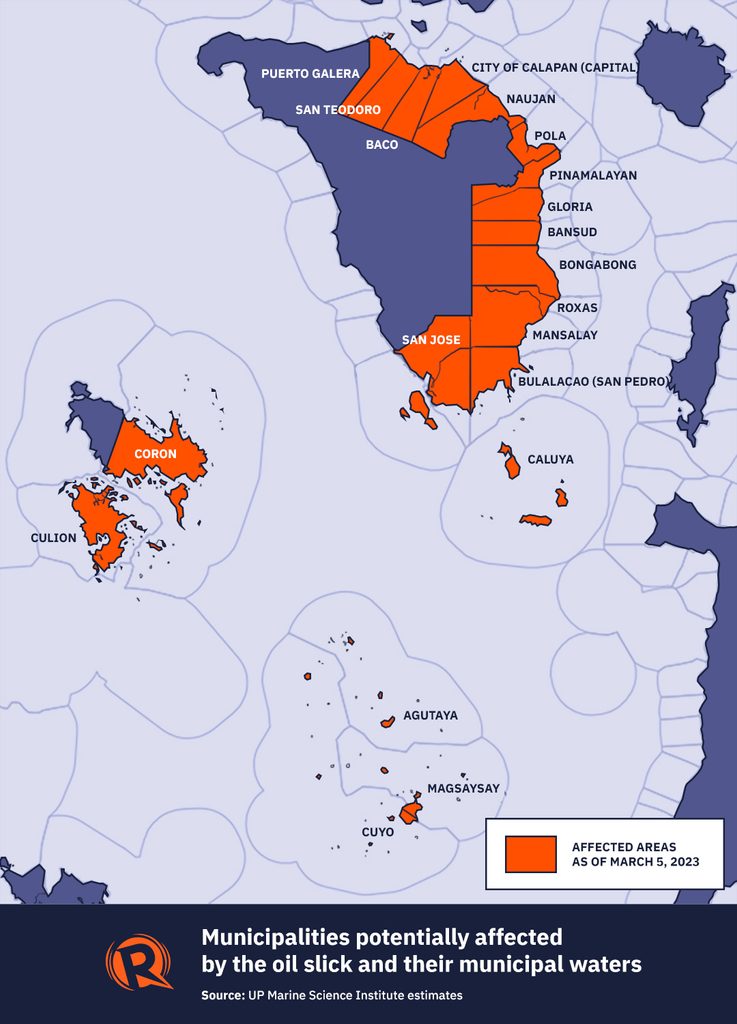
An oil spill trajectory model developed by UP MSI oceanographer Cesor Villanoy and his team forecasted three possible scenarios for the oil slick’s spread from March 3 to March 7 based on prevailing weather conditions.
The first scenario showed that Calapan and Puerto Galera could be affected if the oil slick spread northwards toward the Verde Island Passage.
The second scenario found that if oil continued to leak from the suspected seepage location, most of the slick would end up in Pola Bay. Pola is already one of the worst-hit towns in Oriental Mindoro as more than 4,000 families have already been evacuated to higher ground.
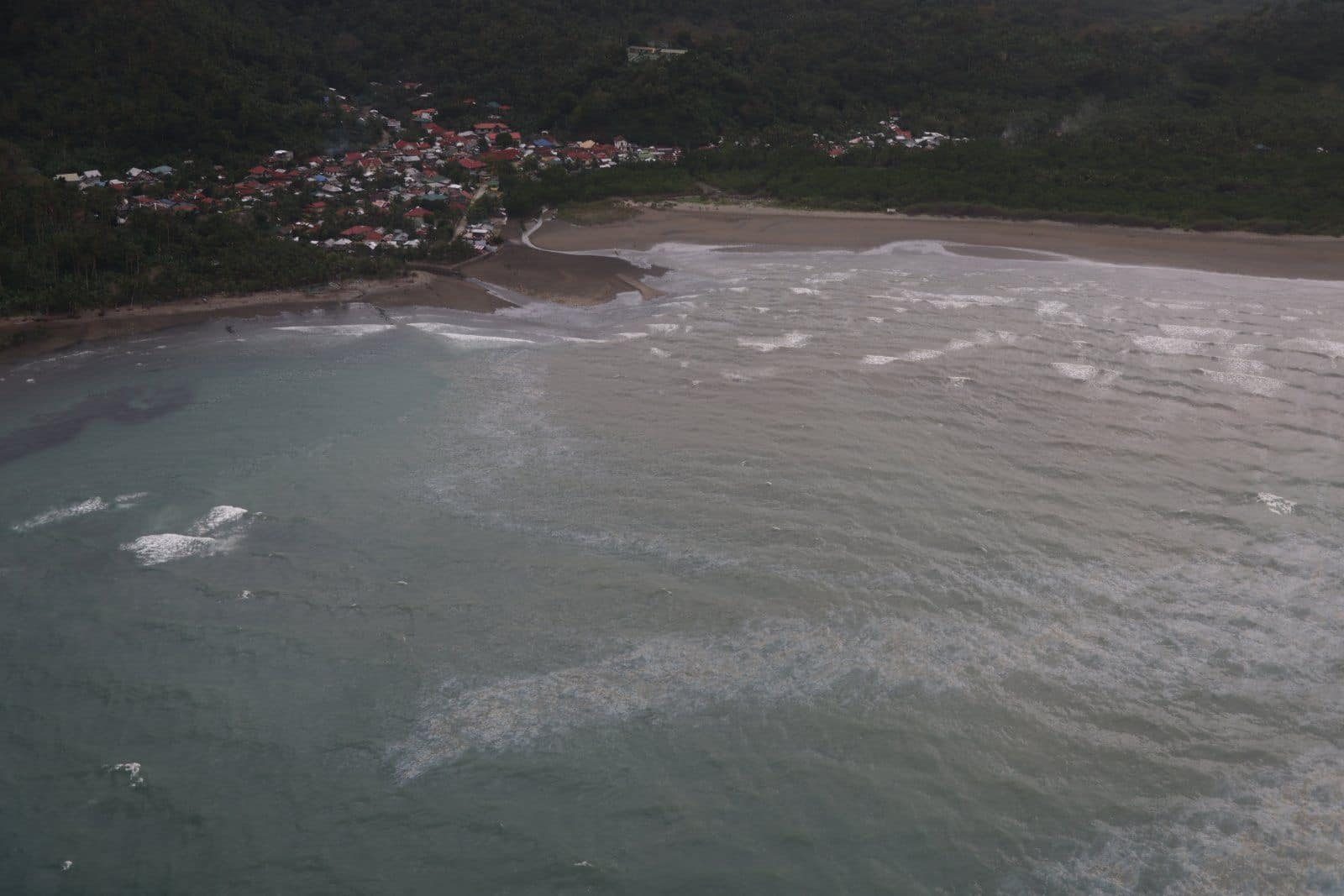
The third scenario considered the effect of the oil slick continuing to spread southwards, which has already reached the coasts of Pinamalayan and Bongabong. Over the next four days, it may continue spreading to Caluya Island and may eventually reach Cuyo Island in the Sulu Sea.
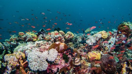
“All of us should be alarmed at the devastation and damage of this ongoing tragedy on fisheries resources and coastal marine ecosystems, particularly mangroves, seagrass, and coral reefs in this ecologically sensitive area, which likewise impact the livelihoods of artisanal fisherfolk and coastal communities including tourism,” said Gloria Ramos, vice president of international environment group Oceana.
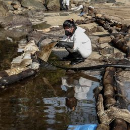
Once the oil spill spreads to these areas, Oceana warned that they could coat the marine habitats and animals, clogging the gills of fish and soiling the features of birds. Humans who consume contaminated seafood could also be exposed to toxic materials.
In Oriental Mindoro alone, nearly 18,000 persons rely on municipal fishing for their livelihood, according to the Integrated Coastal Area Management Plan 2019-2023.
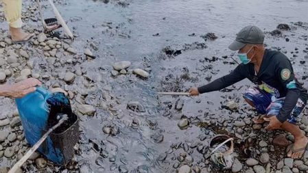
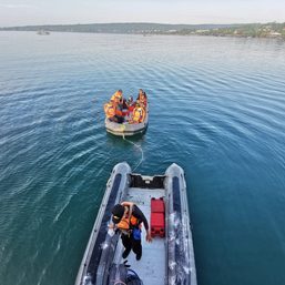
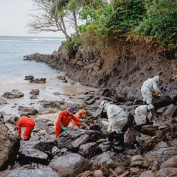
Racing to contain the Oriental Mindoro oil spill, authorities have considered deploying booms to keep oil within their barriers, but the Philippine Coast Guard determined that the strong waves from the prevailing amihan winds might make these ineffective.
Environmental effects
The oil spill may also ruin some of the country’s biodiversity hotspots, like the Verde Island Passage, which has been described as “the center of the center of marine biodiversity in the world.”
Using the oil spill trajectory model, experts from the DENR and UP MSI estimated that over 36,000 hectares of coral reefs, mangroves, and sea grass are at risk.
Around 20,000 hectares of coral reefs, 9,900 hectares of mangroves, and 6,000 hectares of seagrass could be hit by the oil slick across 21 municipalities in Oriental Mindoro, Occidental Mindoro, Palawan, and Antique.
Caluya Island in northwestern Antique alone – which is at high risk of being affected based on the model – has 29,000 hectares of coral reefs, 350 hectares of mangroves, and 850 hectares of seagrass meadows.
More than half of the coral reefs at risk are found in the Cuyo Islands in Palawan. Meanwhile, marine protected areas in Bulalacao, Oriental Mindoro, could also be affected.
“Those responsible should pay for damages that include Payment for Ecosystem Services to the affected areas and the sectors concerned. Oil spill, such as the Exxon Valdez and Deepwater Horizon cases in the United States and in Guimaras and Cordova in the Philippines, has lasting effects and can take decades before the benefits of the marine ecosystem are restored although not fully,” Ramos said.
Under Republic Act No. 9483 or the oil pollution law, ship owners are liable for damages, which include “reasonable expenses actually incurred in cleanup operations at sea or on shore.” They may be held liable for the economic and property losses suffered by those affected, along with further damage to human health and the environment.
The DENR and UP MSCI estimated that the oil slick already reached 25 kilometers long and between 300 to 500 meters wide on the morning of Friday, March 3. – Rappler.com
Add a comment
How does this make you feel?


There are no comments yet. Add your comment to start the conversation.