SUMMARY
This is AI generated summarization, which may have errors. For context, always refer to the full article.
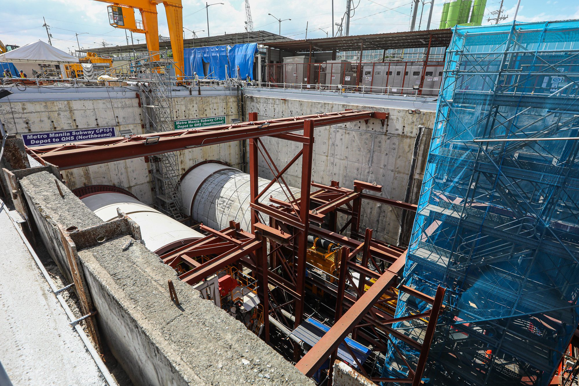
MANILA, Philippines – With the construction of the Metro Manila Subway picking up speed, you might be wondering where exactly are the stations of the country’s first underground train system.
As of March 7, 2024, the Metro Manila Subway will have 17 stations, which will stretch from East Valenzuela in the north to Bicutan in the south. (READ: FAST FACTS: What’s the Metro Manila Subway?)
The 33-kilometer subway will also have spur line that connects to NAIA Terminal 3, meaning the country’s main airport will finally be connected to a railway.
Here is the map showing all the planned stations:

Here is a list of all the subway’s stations and the approximate locations where they will be constructed:
| Station | Location | City |
|---|---|---|
| East Valenzuela | Beside the Northbound side of Mindanao Avenue near P. Dela Cruz Street | Valenzuela City |
| Quirino Highway | Corner of Mindanao Avenue and Quirino Highway | Quezon City |
| Tandang Sora | Along Mindanao Avenue, near the intersection of Mindanao Avenue and Tandang Sora Avenue | Quezon City |
| North Avenue | Within the property of Veterans Memorial Medical Center (DND property), on the corner of Mindanao Avenue and North Avenue | Quezon City |
| Quezon Avenue | Corner of EDSA and Quezon Avenue, at the Manila Seedlings (NHA property) | Quezon City |
| East Avenue | Along V. Luna Street, near East Avenue and Kalayaan Avenue | Quezon City |
| Anonas | On the property of LBL Prime, near the LRT2 Anonas Station | Quezon City |
| Camp Aguinaldo | Within the property of E. Camp Aguinaldo, near the corner of Col. Boni Serrano and Katipunan Avenue | Quezon City |
| Ortigas | Within Metrowalk, near Meralco Avenue and Unimart (PCGG, Blemp property) | Pasig City |
| Shaw Boulevard | Along Meralco Avenue, in front of Estancia Mall (OCLP property) | Pasig City |
| Kalayaan Avenue | Along the intersection of 11th Avenue and 38th Street of BGC Area | Taguig City |
| BGC | Along the rotunda, between the Market! Market! and Serendra buildings | Taguig City |
| Lawton Avenue | Within NAMRIA property and Megaworld Property in McKinley | Taguig City |
| Senate-DepEd | Within the DepEd property near Chino Roces Road, and NSCR Nichols Station | Taguig City |
| NAIA Terminal 3 | Within the parking area of NAIA Terminal 3 | Pasay City |
| FTI/Arca South | Integrated with NSCR FTI Station | Parañaque City |
| Bicutan | Common Station with NSCR Extension | Parañaque City |
Full operations for the subway is targeted for 2029. Once it opens, commuters will be able to travel end to end – from Valenzuela to Bicutan – in just 46 minutes. – Rappler.com

Add a comment
How does this make you feel?


There are no comments yet. Add your comment to start the conversation.