SUMMARY
This is AI generated summarization, which may have errors. For context, always refer to the full article.
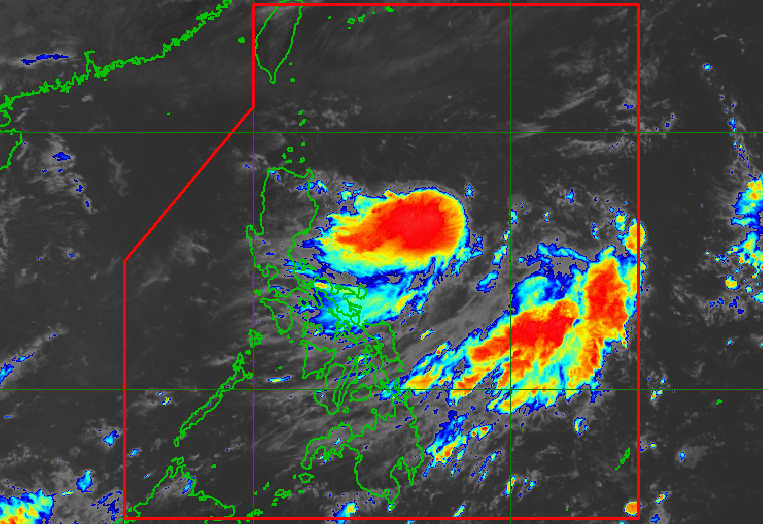
MANILA, Philippines – The low pressure area east of Cagayan province developed into a tropical depression at 8 am on Sunday, August 21, just a day before the reopening of thousands of schools for face-to-face classes.
The tropical depression was given the local name Florita, as the Philippines’ sixth tropical cyclone for 2022.
In a briefing at 1 pm on Sunday, the Philippine Atmospheric, Geophysical, and Astronomical Services Administration (PAGASA) said Tropical Depression Florita was located 655 kilometers east of Aparri, Cagayan, or 630 kilometers east of Tuguegarao City, Cagayan.
Florita is moving southwest toward Northern Luzon at 25 kilometers per hour (km/h).
At that pace, it is expected to make landfall either in Cagayan or the northern part of Isabela on Tuesday morning or afternoon, August 23, according to PAGASA.
Then it may cross several provinces in Northern Luzon before emerging over the West Philippine Sea by Tuesday evening or early Wednesday morning, August 24.
As of Sunday morning, Florita’s maximum sustained winds were at 45 km/h, with gustiness of up to 55 km/h.
PAGASA said Florita could strengthen into a tropical storm within 36 hours and reach a peak intensity of 75 km/h before landfall. While crossing Northern Luzon, it may slightly weaken, but it is likely to remain a tropical storm.
Florita was not yet directly affecting the Philippines as of Sunday morning. But PAGASA provided the following rainfall forecast for the next two days:
Early Monday morning to afternoon, August 22
- light to moderate rain, with at times heavy rain, in eastern parts of Northern Luzon and Central Luzon
Monday evening, August 22, to Tuesday evening, August 23
- heavy to intense rain in Northern Luzon and Central Luzon
The weather bureau warned that Florita could trigger scattered to widespread floods and landslides.
As for tropical cyclone wind signals, Signal No. 1 could be raised as early as Sunday afternoon, beginning with areas in the eastern part of Northern Luzon. Other areas in Northern Luzon and Central Luzon are likely to be placed under tropical cyclone wind signals later on.
PAGASA said the highest possible wind signal due to Florita would be Signal No. 2.
The weather bureau added that the tropical depression will cause moderate to rough seas in the eastern seaboard of Northern Luzon. Waves will be 1.2 to 2.8 meters high, making conditions risky for small vessels.
Florita is expected to leave the Philippine Area of Responsibility on Wednesday.

– Rappler.com
Add a comment
How does this make you feel?


There are no comments yet. Add your comment to start the conversation.