SUMMARY
This is AI generated summarization, which may have errors. For context, always refer to the full article.
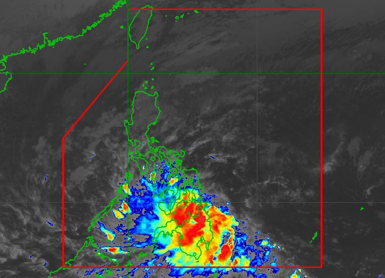
MANILA, Philippines – Kabayan (Jelawat) weakened from a tropical depression into a low pressure area (LPA) at 2:30 pm on Monday, December 18, while crossing Mindanao.
As of 4 pm on Monday, the LPA that used to be Kabayan was already in the vicinity of Impasug-ong, Bukidnon.
Kabayan earlier made landfall in Manay, Davao Oriental, at 9:30 am.
There are no more areas under tropical cyclone wind signals, but rain from the LPA will persist in the next 48 hours.
The Philippine Atmospheric, Geophysical, and Astronomical Services Administration (PAGASA) warned the following areas to stay on alert for floods and landslides, given heavy rain:
Monday afternoon, December 18, to Tuesday afternoon, December 19
- 100-200 millimeters (mm): Surigao del Sur, Surigao del Norte, Dinagat Islands, Agusan del Sur, Davao del Norte, Davao de Oro, Davao Oriental
- 50-100 mm: Central Visayas, Biliran, Leyte, Southern Leyte, Zamboanga del Norte, Northern Mindanao, Davao City, Cotabato, Lanao del Sur, southern parts of Samar and Eastern Samar, rest of Caraga
Tuesday afternoon, December 19, to Wednesday afternoon, December 20
- 50-100 mm: mainland Palawan, Cuyo Islands, Cagayancillo Islands, Kalayaan Islands
The shear line is also bringing rain to Camarines Norte, Quezon, Aurora, Cagayan, and Isabela on Monday. Floods and landslides remain possible in these provinces.
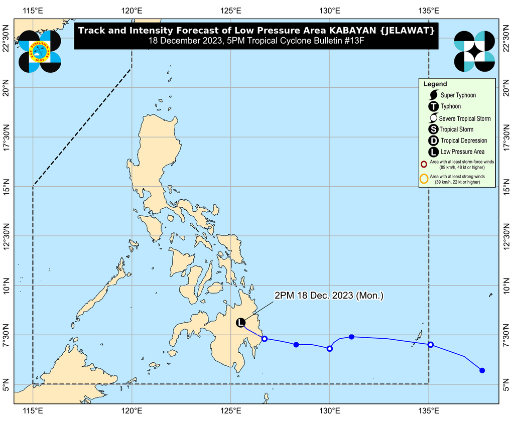
PAGASA expects the LPA to emerge over the Sulu Sea by Monday evening, where it could “reorganize and redevelop into a tropical depression.”
Then the weather system is projected to move across the Sulu Sea, south of Palawan’s Cagayancillo Islands, before crossing the central or southern part of Palawan by Tuesday morning or afternoon, December 19.
Afterwards, it may emerge over the West Philippine Sea, then pass near or over Kalayaan Islands between Tuesday evening and Wednesday morning, December 20.
ALSO ON RAPPLER
- [EDITORIAL] Shining the light on the Transpac mess in DepEd
- Gen Z Filipinos struggling to make ends meet because of the economy
- [Under 3 Minutes] TikTok flexes its influence at Creators Night 2023
- A guide to the 10 entries for MMFF 2023
Meanwhile, the surge of the northeast monsoon or amihan will continue to bring gusty conditions to most of Luzon and the Visayas until Tuesday.
Also due to the surge of the northeast monsoon, a new gale warning was issued at 5 pm on Monday. Travel remains risky for small vessels in these seaboards:
- seaboard of Northern Luzon – rough to very rough seas, waves 2.8 to 5 meters high
- eastern and central seaboards of the Visayas – rough to very rough seas, waves 2.8 to 4.5 meters high
- eastern seaboards of Central Luzon, Southern Luzon, and Mindanao – rough to very rough seas, waves 2.8 to 4.5 meters high
Moderate to rough seas will also persist in the western seaboards of Central Luzon and Southern Luzon, western and northern seaboards of Mindanao, and remaining seaboard of the Visayas. PAGASA advised small vessels to take precautionary measures.
Kabayan was the Philippines’ 11th tropical cyclone for 2023 and the first for December.
PAGASA previously estimated that one or two tropical cyclones could form within or enter the Philippine Area of Responsibility in December. – Rappler.com
Add a comment
How does this make you feel?


There are no comments yet. Add your comment to start the conversation.