SUMMARY
This is AI generated summarization, which may have errors. For context, always refer to the full article.
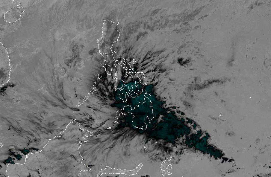
MANILA, Philippines – Kabayan (Jelawat) weakened from a tropical storm into a tropical depression on Monday morning, December 18, then made landfall in Manay, Davao Oriental, at 9:30 am.
By 10 am, Kabayan was located in the vicinity of Caraga, Davao Oriental, almost stationary or hardly moving in that area.
Its maximum sustained winds decreased from 65 kilometers per hour to 55 km/h, but its gustiness is now up to 90 km/h from the previous 80 km/h.
Although Kabayan has weakened, the Philippine Atmospheric, Geophysical, and Astronomical Services Administration (PAGASA) warned that floods and landslides are still likely in these areas seeing rain from the tropical depression:
Monday noon, December 18, to Tuesday noon, December 19
- 100-200 millimeters (mm): Surigao del Sur, Surigao del Norte, Dinagat Islands, Agusan del Sur, Davao del Norte, Davao de Oro, Davao Oriental
- 50-100 mm: Central Visayas, Biliran, Leyte, Southern Leyte, Zamboanga del Norte, Northern Mindanao, Davao City, Cotabato, Lanao del Sur, southern parts of Samar and Eastern Samar, rest of Caraga
Tuesday noon, December 19, to Wednesday noon, December 20
- 50-100 mm: mainland Palawan, Cuyo Islands, Cagayancillo Islands, Kalayaan Islands
The shear line is also bringing rain to Camarines Norte, Quezon, Aurora, Cagayan, and Isabela on Monday. Floods and landslides remain possible in these provinces.
ALSO ON RAPPLER
- LIST: Train schedules for Christmas 2023
- Not just a Jacob Cortez team: San Beda coach highlights silent workers after title win
- AP.Bren extends PH’s Mobile Legends dominance, outlasts Onic Esports to capture M5 crown
Since Kabayan is back to tropical depression status, Signal No. 2 has been lifted as of 11 am on Monday. But the following areas are still under Signal No. 1, with strong winds expected:
- southern part of Palawan (Sofronio Española, Brooke’s Point, Bataraza, Balabac, Rizal, Quezon, Narra) including Cagayancillo Islands
- Southern Leyte
- Leyte
- southern part of Samar (Basey, Santa Rita, Marabut, Talalora, Villareal, Pinabacdao)
- southern part of Eastern Samar (Maydolong, Borongan City, Quinapondan, Guiuan, Lawaan, Balangiga, Llorente, Giporlos, Salcedo, Balangkayan, General MacArthur, Hernani, Mercedes)
- Cebu including Camotes and Bantayan Islands
- Bohol
- Siquijor
- Negros Oriental
- Negros Occidental
- Guimaras
- Misamis Oriental
- Camiguin
- Bukidnon
- Davao de Oro
- northern part of Davao Oriental (Baganga, Manay, Caraga, Tarragona, Lupon, Banaybanay, Boston, Cateel)
- Misamis Occidental
- Lanao del Norte
- Lanao del Sur
- Davao del Norte
- Davao City
- northern part of Cotabato (Arakan, Carmen, Banisilan, Alamada, President Roxas, Kabacan, Matalam, Antipas, Magpet, Libungan, Pigkawayan)
- northern part of Maguindanao (Buldon, Barira, Matanog, Parang, Sultan Kudarat, Sultan Mastura)
- western and central parts of Zamboanga del Norte (Siayan, Sindangan, Jose Dalman, Manukan, President Manuel A. Roxas, Sergio Osmeña Sr., Katipunan, Dipolog City, Polanco, Mutia, Piñan, Dapitan City, Sibutad, La Libertad, Rizal, Siocon, Baliguian, Gutalac, Labason, Kalawit, Tampilisan, Liloy, Salug, Godod, Bacungan)
- western and central parts of Zamboanga del Sur (Midsalip, Labangan, Tukuran, Aurora, Sominot, Ramon Magsaysay, Tambulig, Dumingag, Mahayag, Josefina, Molave, Vincenzo A. Sagun, Guipos, Dimataling, Dumalinao, Lakewood, Dinas, San Pablo, Tigbao, Tabina, Kumalarang, Lapuyan, Pitogo, Margosatubig, San Miguel, Bayog, Pagadian City)
- Zamboanga Sibugay
- Dinagat Islands
- Surigao del Norte
- Agusan del Norte
- Surigao del Sur
- Agusan del Sur
The surge of the northeast monsoon or amihan is also causing gusty conditions in areas not under Signal No. 1, generally in most of Luzon and the Visayas, from Monday to Tuesday, December 19.

For coastal waters, a gale warning remains in effect due to Kabayan and the surge of the northeast monsoon. Travel is risky for small vessels in these seaboards:
- seaboard of Northern Luzon – rough to very rough seas, waves 2.8 to 5 meters high
- eastern and central seaboards of the Visayas – rough to very rough seas, waves 2.8 to 4.5 meters high
- eastern seaboards of Central Luzon, Southern Luzon, and Mindanao – rough to very rough seas, waves 2.8 to 4.5 meters high
Moderate to rough seas are also seen in the western seaboards of Central Luzon and Southern Luzon, western and northern seaboards of Mindanao, and remaining seaboard of the Visayas. PAGASA advised small vessels to take precautionary measures.

Following its landfall in Davao Oriental, Kabayan is projected to cross Mindanao’s “rugged terrain,” then emerge over the Sulu Sea between Monday afternoon and evening.
During that period, Kabayan might weaken further into a low pressure area. But it may still redevelop into a tropical cyclone over the Sulu Sea, according to PAGASA.
Kabayan will proceed to cross the Sulu Sea, south of Palawan’s Cagayancillo Islands, then possibly make another landfall in the central or southern part of Palawan – as a tropical depression – by Tuesday morning or afternoon.
Afterwards, it is expected to emerge over the West Philippine Sea, then pass near or over Kalayaan Islands between Tuesday evening and Wednesday morning, December 20.
“The current track and intensity forecast may still change given the nature and strength of this tropical
cyclone,” the weather bureau said.
Kabayan is the Philippines’ 11th tropical cyclone for 2023 and the first for December.
PAGASA previously estimated that one or two tropical cyclones could form within or enter the Philippine Area of Responsibility in December. – Rappler.com
Add a comment
How does this make you feel?


There are no comments yet. Add your comment to start the conversation.