SUMMARY
This is AI generated summarization, which may have errors. For context, always refer to the full article.
MANILA, Philippines – The Philippines is bracing for the arrival of a potential super typhoon which could spare the country from landfall but remains likely to trigger rain and enhance the impending southwest monsoon or habagat.
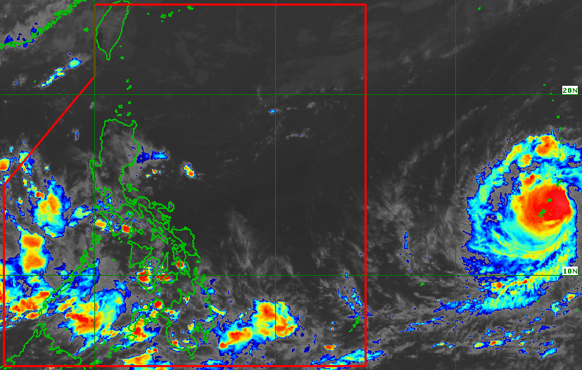
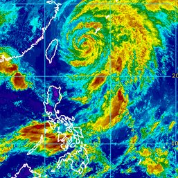
Mawar, still located outside the Philippine Area of Responsibility (PAR), was downgraded from a super typhoon to a typhoon on Wednesday, May 24, following an eyewall replacement cycle. This occurs “when a second concentric eyewall forms around the original and eventually overtakes it,” according to the World Meteorological Organization.
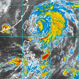
In a press briefing early Wednesday afternoon, the Philippine Atmospheric, Geophysical, and Astronomical Services Administration (PAGASA) said Mawar is expected to remain a typhoon within the next 12 hours. But it is projected to re-intensify into a super typhoon on Thursday, May 25.
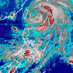
Mawar was last spotted 2,305 kilometers east of the Visayas, moving north northwest at 10 kilometers per hour on Wednesday. It has maximum sustained winds of 175 km/h and gustiness of up to 215 km/h.
PAGASA sees Mawar reaching a peak intensity of 205 km/h during the weekend.
The tropical cyclone is expected to enter PAR on Friday evening, May 26, or Saturday morning, May 27. It would be given the local name Betty once inside PAR.
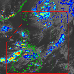
By Sunday, May 28, Mawar would already be east of Northern Luzon, over the Philippine Sea. Initial forecasts show it might recurve away from landmass.
While the chances of landfall appear slim, so far, PAGASA noted that Mawar’s rainbands could still affect Cagayan Valley between Sunday and Tuesday, May 30. This depends on “the proximity of Mawar to Northern Luzon during the recurvature period.”
Due to Mawar’s size, too, the weather bureau is not ruling out the possibility of tropical cyclone wind signals being raised. Its radius was over 300 kilometers as of Wednesday.
Mawar may also enhance the southwest monsoon, which would bring rain to the western parts of Mimaropa, the Visayas, and Mindanao from Friday to Saturday and to the western parts of Southern Luzon and the Visayas beginning Sunday.
PAGASA advised the public to continue monitoring updates on Mawar since the scenarios may still change.
The weather bureau could also declare the start of the rainy season in the coming days.
The criteria for the onset of the rainy season may be satisfied “during or after the passage” of Mawar, said PAGASA’s Climate Monitoring and Prediction Section chief Analiza Solis. For now, the volume of rainfall recorded is still insufficient. – Rappler.com
Add a comment
How does this make you feel?

There are no comments yet. Add your comment to start the conversation.