SUMMARY
This is AI generated summarization, which may have errors. For context, always refer to the full article.
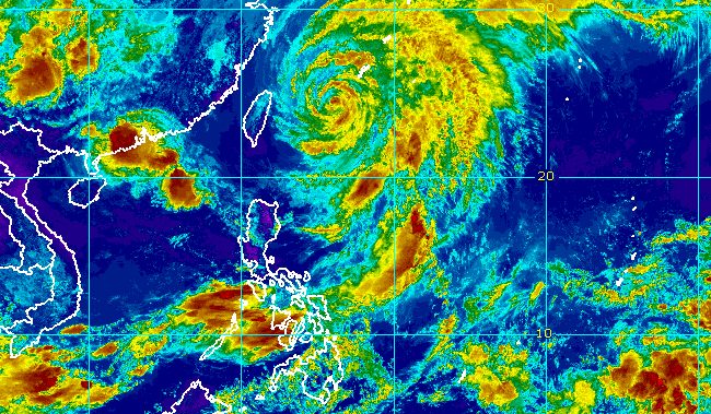
MANILA, Philippines – Severe Tropical Storm Betty (Mawar) weakened further while continuing to make its way out of the Philippine Area of Responsibility (PAR) on Thursday morning, June 1.
As of 10 am, Betty was already 570 kilometers northeast of Itbayat, Batanes. It slightly slowed down, moving north northeast at 10 kilometers per hour from the previous 15 km/h.
The severe tropical storm is expected to leave PAR on Thursday afternoon.
In the morning, Betty’s maximum sustained winds decreased from 110 km/h to 100 km/h and its gustiness went down from 135 km/h to 125 km/h.
The Philippine Atmospheric, Geophysical, and Astronomical Services Administration (PAGASA) has lifted Signal No. 1 for Batanes, so there are no more areas under a tropical cyclone wind signal as of 11 am on Thursday.
Betty is no longer bringing rain as well, so the southwest monsoon or habagat “will become the dominant rain-causing system in the country within the day.”
The regions of Western Visayas and Mimaropa are still getting the heaviest rain from the southwest monsoon.
Heavy rainfall warnings were raised on Thursday morning for Antique, Iloilo, Guimaras, parts of Negros Occidental, and parts of Aklan.
Occidental Mindoro and parts of Palawan were also under heavy rainfall warnings.
Affected areas must stay on alert for floods and landslides.
The southwest monsoon will also bring occasional to frequent gusts to the northern part of Cagayan including Babuyan Islands, Ilocos Region, Cordillera Administrative Region, Central Luzon, Metro Manila, Calabarzon, Bicol, Mimaropa, Western Visayas, Northern Samar, and the northern part of Samar.
Still due to the southwest monsoon, the gale warning issued at 5 am on Thursday remains in effect:
- northern seaboard of Northern Luzon (Batanes, Babuyan Islands) – rough to very rough seas, with waves 3.1 to 5 meters high
- other northern seaboards of Luzon, eastern seaboard of Luzon, western seaboard of Southern Luzon – rough to very rough seas, with waves 2.8 to 4.5 meters high
The weather bureau advised small vessels not to sail and larger vessels to be on alert for big waves.
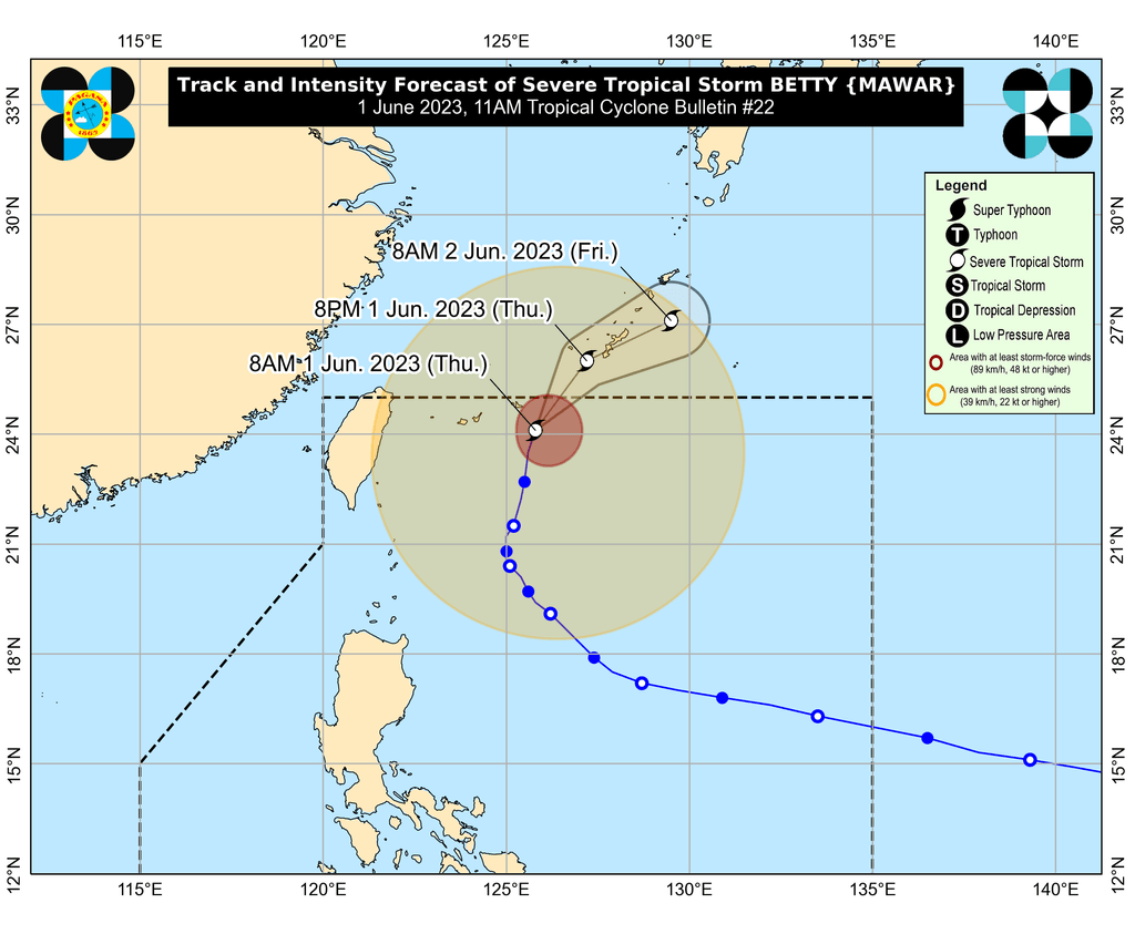
Outside PAR, Betty may make landfall in or pass very close to Japan’s Okinawa Island on Thursday evening or early Friday morning, June 2, according to PAGASA.
Betty may also weaken further “due to lower sea surface temperature of the sea surrounding the Ryukyu Islands” in Japan. It could be downgraded to a tropical storm on Saturday, June 3, or earlier.
Betty entered PAR as a super typhoon early Saturday, May 27, and before its entry, had reached a peak intensity of 215 km/h. It is the country’s second tropical cyclone for 2023 and the first super typhoon of the year.
For June, PAGASA expects one or two tropical cyclones. – Rappler.com
Add a comment
How does this make you feel?


There are no comments yet. Add your comment to start the conversation.