SUMMARY
This is AI generated summarization, which may have errors. For context, always refer to the full article.
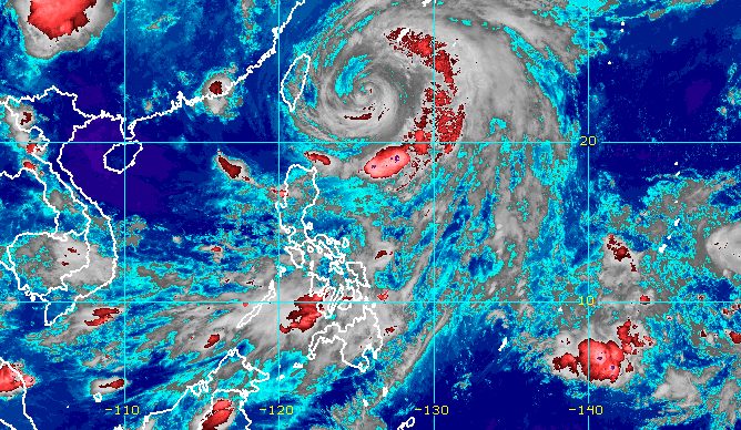
MANILA, Philippines – The southwest monsoon or habagat, which is being enhanced by Typhoon Betty (Mawar), is expected to cause more rain in the coming days.
The Philippine Atmospheric, Geophysical, and Astronomical Services Administration (PAGASA) said in an advisory for the southwest monsoon at 11 pm on Wednesday, May 31, that the following provinces should expect rain:
Wednesday evening, May 31, to Thursday evening, June 1
- 100-200 millimeters (mm): Occidental Mindoro
- 50-100 mm: Ilocos Sur, La Union, Abra, Benguet, Oriental Mindoro, Romblon, Aklan, Antique, northern part of mainland Palawan, Cuyo Islands, Calamian Islands
Thursday evening, June 1, to Friday evening, June 2
- 100-200 mm: Occidental Mindoro
- 50-100 mm: Zambales, Bataan, Oriental Mindoro, Romblon, Antique, northern part of mainland Palawan, Cuyo Islands, Calamian Islands
Friday evening, June 2, to Saturday evening, June 3
- 50-100 mm: Occidental Mindoro, northern part of mainland Palawan, Calamian Islands
The southwest monsoon may also bring occasional to frequent gusts to the northern part of Cagayan including Babuyan Islands, Ilocos Region, Cordillera Administrative Region, Central Luzon, Metro Manila, Calabarzon, Bicol, Mimaropa, Western Visayas, Northern Samar, and the northern part of Samar.
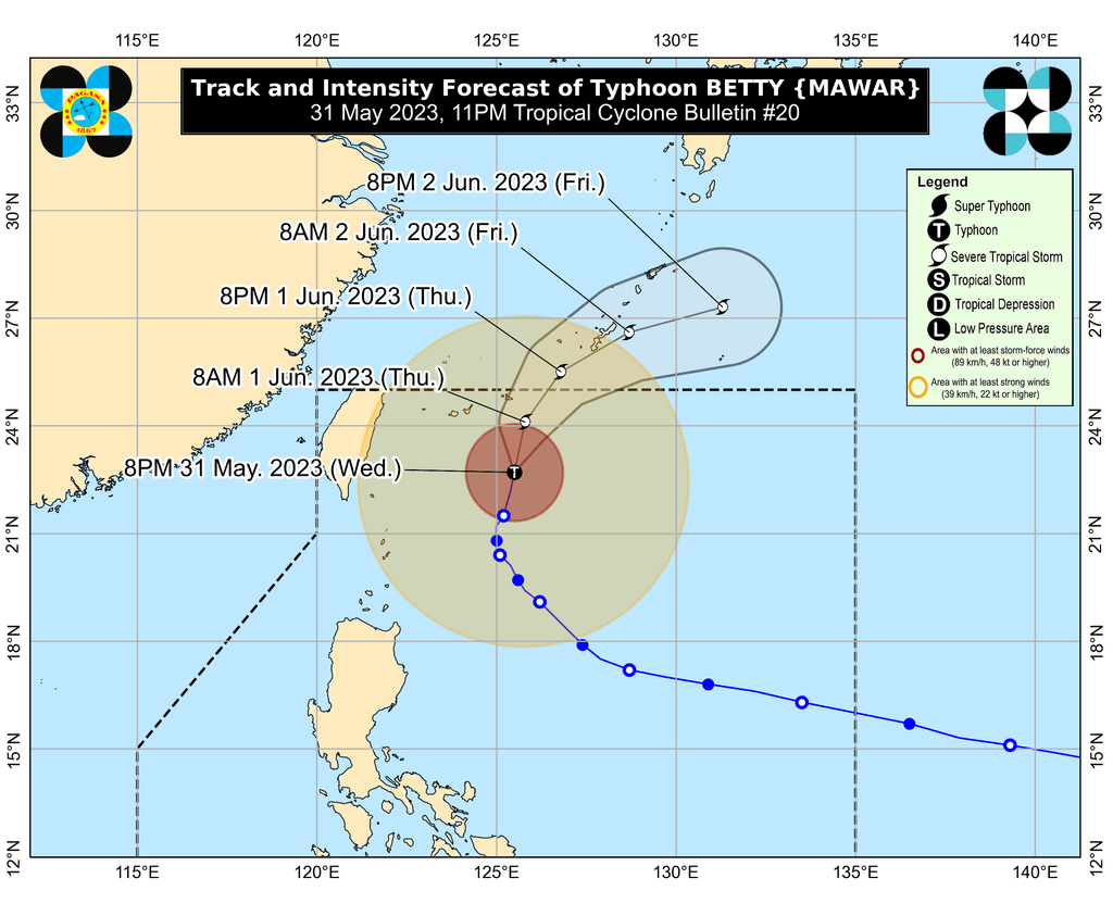
As for Betty, it was last spotted 450 kilometers east northeast of Itbayat, Batanes – or over the sea east of Taiwan – on Wednesday evening. Taiwan is inside the Philippine Area of Responsibility (PAR) given its proximity to Batanes.
The typhoon continues to move north or away from Luzon, but it slightly slowed down, moving at only 10 kilometers per hour from 15 km/h.
It maintained its strength, with maximum sustained winds of 120 km/h and gustiness of up to 150 km/h.
Betty did not make landfall in the Philippines, but it has still affected Northern Luzon.
As of 11 pm on Wednesday, Batanes is the only area remaining under a tropical cyclone wind signal – Signal No. 1. Strong winds from Betty persist in the province.
“Should there be no significant changes in the track or extent” of tropical cyclone winds, the Signal No. 1 for Batanes could be lifted by Thursday, June 1.
Betty and the southwest monsoon both continue to affect coastal waters. The gale warning issued at 5 pm on Wednesday is still in effect:
- northern seaboards of Northern Luzon – rough to high seas, with waves 3.1 to 6.5 meters high
- western seaboard of Southern Luzon as well as eastern seaboards of Luzon and of Visayas – rough to very rough seas, with waves 2.8 to 4.5 meters high
PAGASA warned that rough to high seas are risky for all vessels. In areas with rough to very rough seas, small vessels should not sail while larger vessels must be on alert for big waves.
The weather bureau expects Betty to gradually accelerate until Friday, June 2.
It may keep heading north or north northeast between Wednesday evening and Thursday, then turn east northeast as it passes close to or makes landfall in Japan’s central Ryukyu Islands, possibly in Okinawa Island.
Betty is projected to leave PAR on Thursday evening or early Friday morning.
Betty could also weaken into a severe tropical storm on Thursday and into a tropical storm on Saturday, “although a faster weakening rate remains a possibility,” PAGASA said. “Cooler ocean waters, dry air intrusion, and increasing vertical wind shear” would cause Betty to weaken.
Betty entered PAR as a super typhoon early Saturday, May 27, and before its entry, had reached a peak intensity of 215 km/h. It is the country’s second tropical cyclone for 2023 and the first super typhoon of the year. – Rappler.com
Add a comment
How does this make you feel?


There are no comments yet. Add your comment to start the conversation.