SUMMARY
This is AI generated summarization, which may have errors. For context, always refer to the full article.
MANILA, Philippines – The western part of Luzon is expected to have a rainy first weekend of September due to the enhanced southwest monsoon or habagat.
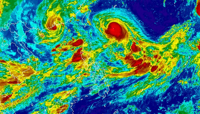
The southwest monsoon continues to be enhanced by Typhoon Hanna (Haikui) inside the Philippine Area of Responsibility, and two other tropical cyclones which are outside PAR – Typhoon Goring (Saola) and Severe Tropical Storm Kirogi.
Below is the latest rainfall forecast of the Philippine Atmospheric, Geophysical, and Astronomical Services Administration (PAGASA), issued at 11 pm on Friday, September 1.
Friday night, September 1, to Saturday night, September 2
- 100-200 millimeters (mm): Metro Manila, Ilocos Region, Zambales, Bataan, Occidental Mindoro
- 50-100 mm: Abra, Benguet, Tarlac, Nueva Ecija, Pampanga, Bulacan, Rizal, Cavite, Batangas
Saturday night, September 2, to Sunday night, September 3
- 100-200 mm: Metro Manila, Ilocos Region, Zambales, Bataan, Occidental Mindoro
- 50-100 mm: Abra, Benguet, Tarlac, Nueva Ecija, Pampanga, Bulacan, Rizal, Cavite, Batangas
Sunday night, September 3, to Monday night, September 4
- 100-200 mm: Zambales, Bataan
- 50-100 mm: Metro Manila, Ilocos Region, Abra, Benguet, Tarlac, Nueva Ecija, Pampanga, Bulacan, Rizal, Cavite, Batangas, Occidental Mindoro, northern part of Palawan including Cuyo and Calamian islands, Antique
“Under these conditions, flooding and rain-induced landslides are expected,” PAGASA warned.
Gusty conditions will also persist in these areas due to the enhanced southwest monsoon:
Saturday, September 2, to Sunday, September 3
- Batanes, Babuyan Islands, Ilocos Region, Cordillera Administrative Region, Nueva Vizcaya, Zambales, Pampanga, Bataan, Aurora, Bulacan, Metro Manila, Calabarzon, Mimaropa, Bicol, Western Visayas, northern part of Eastern Visayas
Monday, September 4
- Batanes, Babuyan Islands, Ilocos Region, Cordillera Administrative Region, Nueva Vizcaya, Zambales, Pampanga, Bataan, Aurora, Bulacan, Metro Manila, Calabarzon, most of Mimaropa, most of Bicol, most of Western Visayas
ALSO ON RAPPLER
- Marcos sets price cap on rice nationwide
- One last push: Gilas Pilipinas fights for pride vs China to end FIBA World Cup
- Kyle Anderson, China hit stride before Gilas duel
- South Sudan star Jones tips hat to solid Abando play
- Taylor Swift’s ‘Eras Tour’ concert film headed to movie theaters
Meanwhile, Hanna maintained its strength while moving over the Philippine Sea on Friday evening.
The typhoon was located 600 kilometers east northeast of Itbayat, Batanes, moving west at 15 kilometers per hour (km/h).
It still has maximum sustained winds of 120 km/h and gustiness of up to 150 km/h, although it may gradually intensify during the weekend.
Hanna is not expected to make landfall in the Philippines, and due to its distance, it is “less likely” to directly bring rain, winds, or rough sea conditions to the country.
But PAGASA noted that the typhoon’s track has been shifting southward or downward. If its track shifts further toward the south, Signal No. 1 could be raised for the province of Batanes.
The weather bureau now sees Hanna possibly making landfall along the east coast of Taiwan on Sunday morning or afternoon, September 3, while “at or near its peak intensity.” Taiwan is within PAR.
As Hanna crosses Taiwan’s rugged terrain, there may be “considerable weakening,” PAGASA said.
Finally, Hanna could leave PAR and emerge over the Taiwan Strait between Sunday evening and Monday morning, September 4, either as a severe tropical storm or a “minimal” typhoon.
Outside PAR, it may “move erratically and may even become almost stationary over the Taiwan Strait while continuously weakening due to land interaction and [an] increasingly unfavorable environment.”
Hanna is the Philippines’ eighth tropical cyclone for 2023.

The two tropical cyclones outside PAR – Goring and Kirogi – have no direct effect on the country and are only enhancing the southwest monsoon.
Goring, which left PAR last Wednesday evening, August 30, was located 695 kilometers west northwest of Itbayat, Batanes, on Friday afternoon. It continues to move away.
Kirogi was 3,000 kilometers east of extreme Northern Luzon, moving north northwest or away from PAR.
For the next 6 months, PAGASA estimated that 6 to 9 tropical cyclones may form within or enter PAR:
- September 2023 – 2 or 3
- October 2023 – 2 or 3
- November 2023 – 1 or 2
- December 2023 – 1 or 2
- January 2024 – 0 or 1
- February 2024 – 0 or 1
– Rappler.com
Add a comment
How does this make you feel?


There are no comments yet. Add your comment to start the conversation.