SUMMARY
This is AI generated summarization, which may have errors. For context, always refer to the full article.
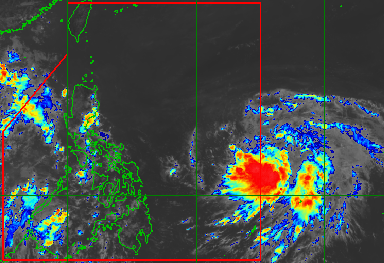
MANILA, Philippines – The low pressure area inside the Philippine Area of Responsibility (PAR) developed into a tropical depression while located east of Eastern Visayas at 8 am on Tuesday, June 6.
It was given the local name Chedeng as the country’s third tropical cyclone for 2023.
It is also the first tropical cyclone for the month of June.
As of 10 am on Tuesday, Tropical Depression Chedeng was already 1,170 kilometers east of southeastern Luzon, almost stationary or barely moving.
Chedeng has maximum sustained winds of 45 kilometers per hour and gustiness of up to 55 km/h.
The Philippine Atmospheric, Geophysical, and Astronomical Services Administration (PAGASA) said in a noontime press briefing that Chedeng is expected to stay far from Philippine landmass.
That means the tropical cyclone is “unlikely to directly bring heavy rainfall” to any part of the country in the next three to five days.
The raising of tropical cyclone wind signals is also unlikely.
For coastal waters – at least in the next 24 hours – Chedeng won’t be causing rough sea conditions, too.
PAGASA, however, will monitor Chedeng’s possible enhancement of the southwest monsoon or habagat.
“The areas that will be affected, timing, and intensity” of monsoon rain and gusts, especially in the western part of the Philippines, will depend on how Chedeng would enhance the southwest monsoon. The tropical cyclone’s movement and intensity are the key factors to be considered.
PAGASA said it would issue a weather advisory “should there be an increasing chance” of heavy monsoon rain in the next three days.

PAGASA expects Chedeng to gradually speed up and move generally northwest on Tuesday, before heading west northwest on Wednesday, June 7, and Thursday, June 8.
Then it could turn toward the northwest on Friday, June 9, and to the north during the weekend, according to the weather bureau.
While remaining over the Philippine Sea, Chedeng is projected to intensify in the next four days.
It could strengthen into a tropical storm by Wednesday, then into a severe tropical storm and subsequently a typhoon by Thursday.
PAGASA said Chedeng might reach its peak intensity during the weekend while east of Northern Luzon.
The weather bureau earlier estimated that the Philippines might have one or two tropical cyclones in June.
PAGASA announced the start of the rainy season last Friday, June 2. – Rappler.com
Add a comment
How does this make you feel?


There are no comments yet. Add your comment to start the conversation.