SUMMARY
This is AI generated summarization, which may have errors. For context, always refer to the full article.
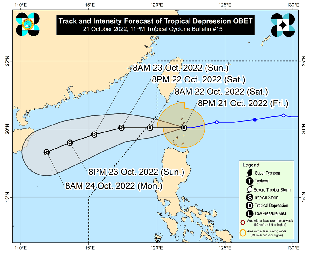
MANILA, Philippines – Tropical Depression Obet passed very close to Batanes on Friday evening, October 21, but it did not make landfall in the province.
By late Friday evening, Obet was already over the coastal waters of Basco, Batanes, said the Philippine Atmospheric, Geophysical, and Astronomical Services Administration (PAGASA) in a briefing past 11 pm.
It is moving west at 20 kilometers per hour (km/h), and is expected to maintain that direction until it leaves the Philippine Area of Responsibility (PAR) on Saturday morning, October 22.
The tropical depression slightly weakened on Friday evening, with its maximum sustained winds decreasing from 55 km/h to 45 km/h. Its gustiness went down to 55 km/h from 70 km/h.
But Obet is projected to gradually intensify and become a tropical storm on Saturday morning, possibly when it is already outside PAR.
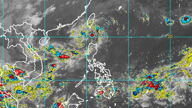
PAGASA said light to moderate rain, with at times heavy rain, may continue in Batanes and Babuyan Islands until early Saturday morning. Floods and landslides could still occur.
Batanes and Babuyan Islands also remain under Signal No. 1 as of 11 pm on Friday. These areas are seeing strong winds from Obet.
Also due to the northeast monsoon or hanging amihan and Obet, PAGASA issued a new gale warning at 5 pm on Friday. Rough to very rough seas will persist in these seaboards:
- northern and eastern seaboards of Northern Luzon (Batanes, Cagayan including Babuyan Islands, northern coast of Ilocos Norte) – waves 3.4 to 5.5 meters high
- western seaboard of Northern Luzon (Ilocos Sur, western coast of Ilocos Norte) – waves 2.8 to 4.5 meters high
PAGASA advised fishing boats and other small vessels not to sail, and larger vessels to watch out for big waves.
Moderate to rough seas, with waves 1.5 to 3 meters high, are also expected in the seaboards of Central Luzon and the eastern seaboard of Southern Luzon. This may be risky for small vessels.
Obet is the country’s 15th tropical cyclone for 2022 and the third for October.
PAGASA expects 5 to 9 tropical cyclones to enter or develop inside PAR from October 2022 to March 2023. Per month, these are the weather bureau’s estimates:
- October 2022 – 2 to 4
- November 2022 – 2 or 3
- December 2022 – 1 or 2
- January 2023 – 0 or 1
- February 2023 – 0 or 1
- March 2023 – 0 or 1
PAGASA Weather Specialist Benison Estareja said in the briefing on Friday evening that a low pressure area (LPA) formed over the Pacific Ocean, outside PAR.
The LPA was last spotted over 1,800 kilometers east of Mindanao, embedded along the intertropical convergence zone.
Estareja said the LPA may enter PAR within 48 hours and is likely to develop into a tropical depression next week. Further updates are expected in the coming days. – Rappler.com
Add a comment
How does this make you feel?


There are no comments yet. Add your comment to start the conversation.