SUMMARY
This is AI generated summarization, which may have errors. For context, always refer to the full article.
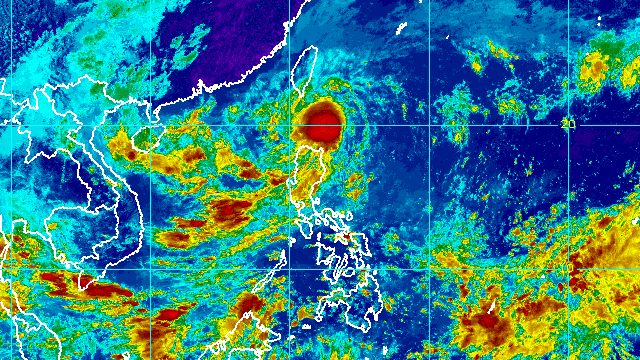
MANILA, Philippines – Tropical Depression Obet slightly intensified while moving toward the Luzon Strait early Friday afternoon, October 21.
Obet’s maximum sustained winds increased from 45 kilometers per hour to 55 km/h, said the Philippine Atmospheric, Geophysical, and Astronomical Services Administration (PAGASA) in a bulletin issued at 2 pm on Friday. Its gustiness is now up to 70 km/h from the previous 55 km/h.
Obet may strengthen into a tropical storm between Friday evening and Saturday morning, October 22, or possibly a bit earlier than that.
The tropical depression was located 140 kilometers east of Basco, Batanes, early Friday afternoon, still moving west at 20 km/h.
It is still projected to pass over or very close to Batanes between Friday afternoon and evening, then exit the Philippine Area of Responsibility (PAR) on Saturday morning or afternoon.
PAGASA maintained its rainfall forecast for Obet, covering Friday until early Saturday morning. Floods and landslides are likely.
Moderate to heavy rain, with at times intense rain
- Batanes
- Babuyan Islands
- northern part of Ilocos Norte
- northern part of Apayao
- northern part of mainland Cagayan
Light to moderate rain, with at times heavy rain
- rest of Cagayan
- rest of Apayao
- rest of Ilocos Norte
Obet is also bringing strong winds to these areas still under Signal No. 1 as of 2 pm on Friday:
- Batanes
- Babuyan Islands
- northeastern part of mainland Cagayan (Santa Ana, Gonzaga)
If Obet strengthens into a tropical storm before or during its passage through the Luzon Strait, Signal No. 2 could be raised.
PAGASA added that the northeast monsoon or hanging amihan will continue bringing strong to gale-force winds to the northern parts of Apayao and Ilocos Norte.
A gale warning has also been in effect due to the northeast monsoon and Obet since 5 am on Friday. Rough to very rough seas are expected in these seaboards:
- northern and eastern seaboards of Northern Luzon (Batanes, Cagayan including Babuyan Islands, northern coast of Ilocos Norte) – waves 3.4 to 5 meters high
- western seaboard of Northern Luzon (Ilocos Sur, western coast of Ilocos Norte) – waves 2.8 to 4.5 meters high
PAGASA advised fishing boats and other small vessels not to sail, and larger vessels to watch out for big waves.
Moderate to rough seas, which could be risky for small vessels, are also likely in the following seaboards:
- seaboards of Central Luzon – waves 1.5 to 3.5 meters high
- western and eastern seaboards of Southern Luzon – waves 1.2 to 3 meters high

Obet is the country’s 15th tropical cyclone for 2022 and the third for October.
PAGASA expects 5 to 9 tropical cyclones to enter or develop inside PAR from October 2022 to March 2023. Per month, these are the weather bureau’s estimates:
- October 2022 – 2 to 4
- November 2022 – 2 or 3
- December 2022 – 1 or 2
- January 2023 – 0 or 1
- February 2023 – 0 or 1
- March 2023 – 0 or 1
– Rappler.com
Add a comment
How does this make you feel?


There are no comments yet. Add your comment to start the conversation.