SUMMARY
This is AI generated summarization, which may have errors. For context, always refer to the full article.
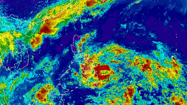
MANILA, Philippines – More areas were placed under Signal No. 1 at 11 am on Friday, May 24, as Tropical Depression Aghon maintained its strength.
In a briefing past 11 am, the Philippine Atmospheric, Geophysical, and Astronomical Services Administration (PAGASA) said Aghon still has maximum sustained winds of 45 kilometers per hour and gustiness of up to 55 km/h.
The tropical depression was located 240 kilometers east of Hinatuan, Surigao del Sur, as of 10 am. It continues to move west northwest, but slowed down to 10 km/h from the previous 30 km/h.
Here are the areas in Luzon, the Visayas, and Mindanao under Signal No. 1, where strong winds are expected:
- Sorsogon
- Albay (Manito, Legazpi City, Tabaco City, Rapu-Rapu, Santo Domingo, Malilipot, Bacacay, Malinao, Tiwi)
- Catanduanes
- Camarines Sur (Caramoan, Garchitorena, Presentacion, Sagñay, San Jose, Lagonoy, Tigaon)
- Eastern Samar
- Samar
- Northern Samar
- Leyte (Babatngon, Tacloban City, Palo, Tanauan, Tolosa, Dulag, Mayorga, MacArthur, Abuyog, Javier)
- Southern Leyte (Silago, Hinunangan, Hinundayan, Anahawan, San Juan, Liloan, Saint Bernard, San Ricardo, Pintuyan, San Francisco)
- Dinagat Islands
- Surigao del Norte including Siargao and Bucas Grande islands
- Surigao del Sur (Carrascal, Cantilan, Madrid, Carmen, Lanuza, Cortes, Tandag City)
PAGASA said more areas in Bicol, Eastern Visayas, and Caraga may be placed under Signal No. 1 by 2 pm on Friday.
The highest possible wind signal due to Aghon is Signal No. 2.
The weather bureau also updated its rainfall forecast for the tropical depression. Floods and landslides are possible in the affected areas.
Friday noon, May 24, to Saturday noon, May 25
- 100-200 millimeters (mm): Eastern Samar, Southern Leyte, Surigao del Norte, Dinagat Islands
- 50-100 mm: Surigao del Sur, rest of Eastern Visayas, Albay, Sorsogon, Masbate including Ticao and Burias islands, Catanduanes, eastern part of Camarines Sur
Saturday noon, May 25, to Sunday noon, May 26
- 100-200 mm: Northern Samar, Albay, Sorsogon, Masbate including Ticao and Burias islands, Catanduanes, Camarines Sur
- 50-100 mm: Camarines Norte, rest of Eastern Visayas, southern part of Quezon including Polillo Islands
Sunday noon, May 26, to Monday noon, May 27
- 50-100 mm: Catanduanes, Camarines Norte, Camarines Sur
PAGASA added that Aghon will cause moderate to rough seas, with waves 1.5 to 3 meters high, in the northern and eastern seaboards of Eastern Visayas and the eastern seaboard of Caraga on Friday. It advised small boats to take precautionary measures, or if possible, to avoid sailing altogether.
ALSO ON RAPPLER
- Misuari convicted of graft over P77-M ARMM ghost projects
- FULL TEXT: Maria Ressa’s speech at the 2024 Harvard commencement ceremony
- [Judgment Call] Google’s SGE – and why it matters to you
The weather bureau now sees Aghon moving west northwest or northwest from Friday to Saturday, May 25, “while slowly intensifying.”
It could either make a close approach to Eastern Visayas or make landfall within the region on Saturday morning as a tropical storm.
Then it may pass north northwest over Eastern Visayas, and emerge over the waters off Bicol’s eastern coast on Saturday evening, still as a tropical storm.
But PAGASA is not ruling out “a slightly earlier landfall” in Eastern Visayas and “direct passage” in the vicinity of Bicol since it has observed a westward shift in Aghon’s possible track.
On Sunday, May 26, Aghon may start recurving northeast or north northeast over the waters east of Luzon “while starting to continuously intensify.”
It could strengthen into a severe tropical storm by Sunday morning and into a typhoon by Tuesday, May 28.
Also on Tuesday, Aghon might leave the Philippine Area of Responsibility (PAR).

Aghon is the Philippines’ first tropical cyclone for 2024. (READ: LIST: Philippine tropical cyclone names in 2024)
PAGASA previously estimated that one or two tropical cyclones could form within or enter PAR in May. – Rappler.com
Add a comment
How does this make you feel?


There are no comments yet. Add your comment to start the conversation.