SUMMARY
This is AI generated summarization, which may have errors. For context, always refer to the full article.
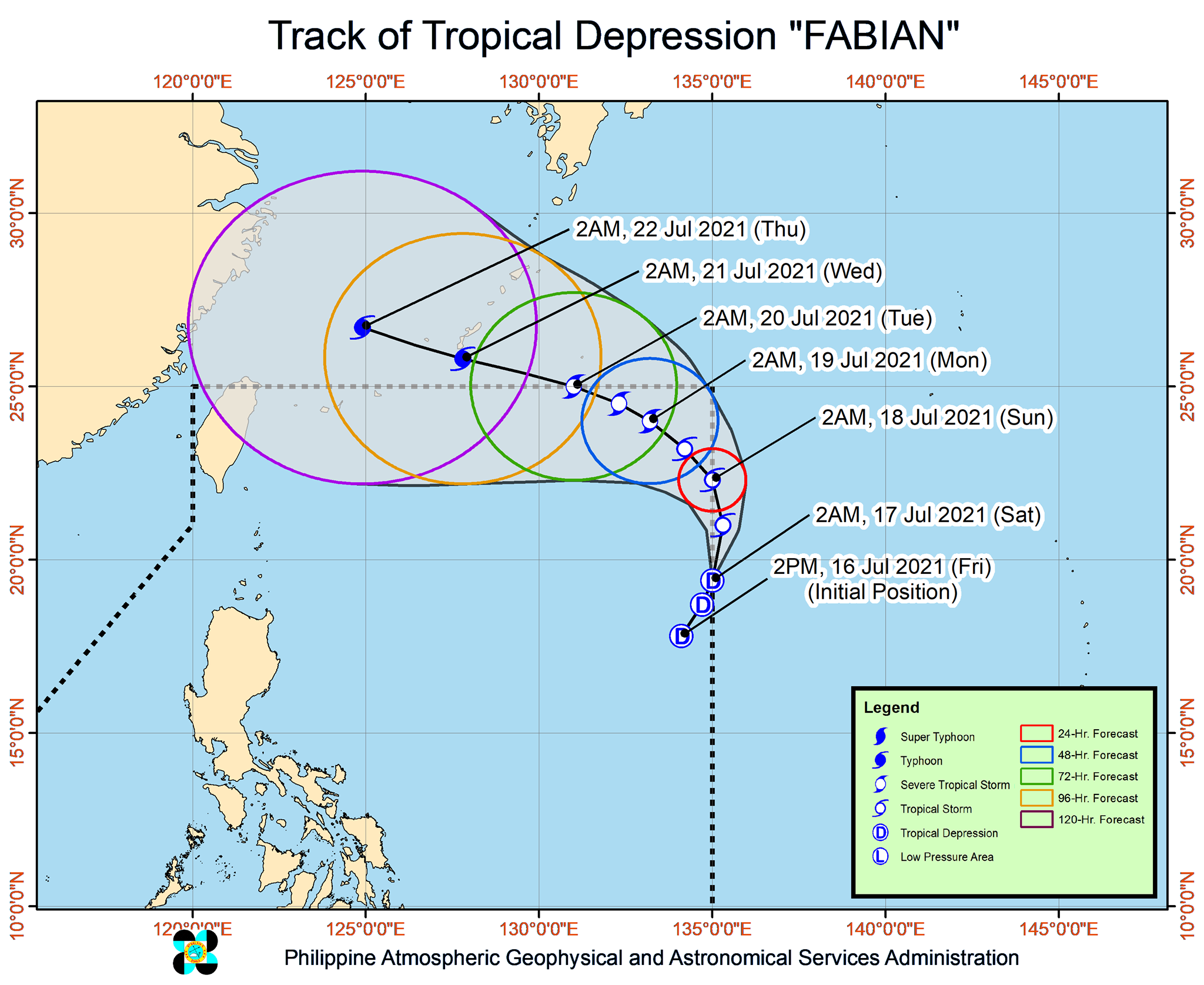
Tropical Depression Fabian strengthened a bit as it moved toward the eastern limit of the Philippine Area of Responsibility (PAR), the state weather bureau said before dawn on Saturday, July 17.
The Philippine Atmospheric, Geophysical, and Astronomical Services Administration (PAGASA) said in its 5 am bulletin that Fabian was 1,365 kilometers east of extreme Northern Luzon.
The tropical depression is moving north northeast at a relatively slow 15 kilometers per hour (km/h).
It now has maximum sustained winds of 55 km/h from the previous 45 km/h and gustiness of up to 70 km/h from the previous 55 km/h.
PAGASA said Fabian is expected to continue intensifying, and may reach tropical storm category within 12 hours, or still on Saturday. By Wednesday evening, July 21, or Thursday morning, July 22, it could already be a typhoon. (READ: FAST FACTS: Tropical cyclones, rainfall advisories)
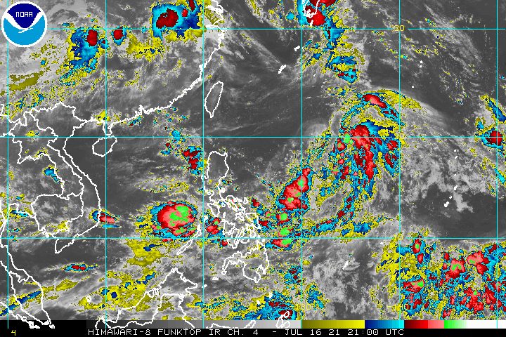
Since Fabian is expected to remain far from Philippine landmass, there are no areas under under tropical cyclone wind signals and it is not causing risky conditions in the country’s coastal waters.
The tropical depression is also unlikely to bring heavy rain. But it is enhancing the southwest monsoon or hanging habagat, which will trigger light to heavy rain in the following parts of Mimaropa and Western Visayas on Saturday:
- northern part of Palawan
- Occidental Mindoro
- Antique
- Aklan
PAGASA warned areas affected by the southwest monsoon to be on alert for possible flash floods and landslides.
As for Fabian, it is projected to head north or north northwest until early Sunday morning, July 18. This could bring the tropical depression’s center outside PAR “for a brief period,” according to the state weather bureau.
Fabian would then reenter PAR, then move northwest or west northwest.
It could again exit PAR through the northern boundary between Monday evening, July 19, and Tuesday morning, July 20, and head for the southern part of Japan’s Ryukyu Islands.
“However, due to the uncertainty in model guidance at this portion of the track forecast, there remains a possibility that Fabian may still be inside the PAR beyond Monday,” added PAGASA.
Fabian is the Philippines’ sixth tropical cyclone for 2021 and the second for July.
Around 20 tropical cyclones form within or enter PAR each year. (READ: LIST: PAGASA’s names for tropical cyclones in 2021)
For the rest of 2021, these are PAGASA’s estimates per month:
- July – 1 to 3
- August – 2 or 3
- September – 2 or 3
- October – 2 or 3
- November – 2 or 3
- December – 1 or 2
The rainy season has been underway since early June. – Rappler.com
Add a comment
How does this make you feel?


There are no comments yet. Add your comment to start the conversation.