SUMMARY
This is AI generated summarization, which may have errors. For context, always refer to the full article.
There is an “increasing possibility” of Tropical Storm Fabian (In-fa) staying longer inside the Philippine Area of Responsibility (PAR) or reentering after a looming first exit.
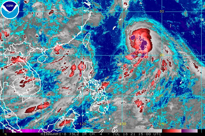
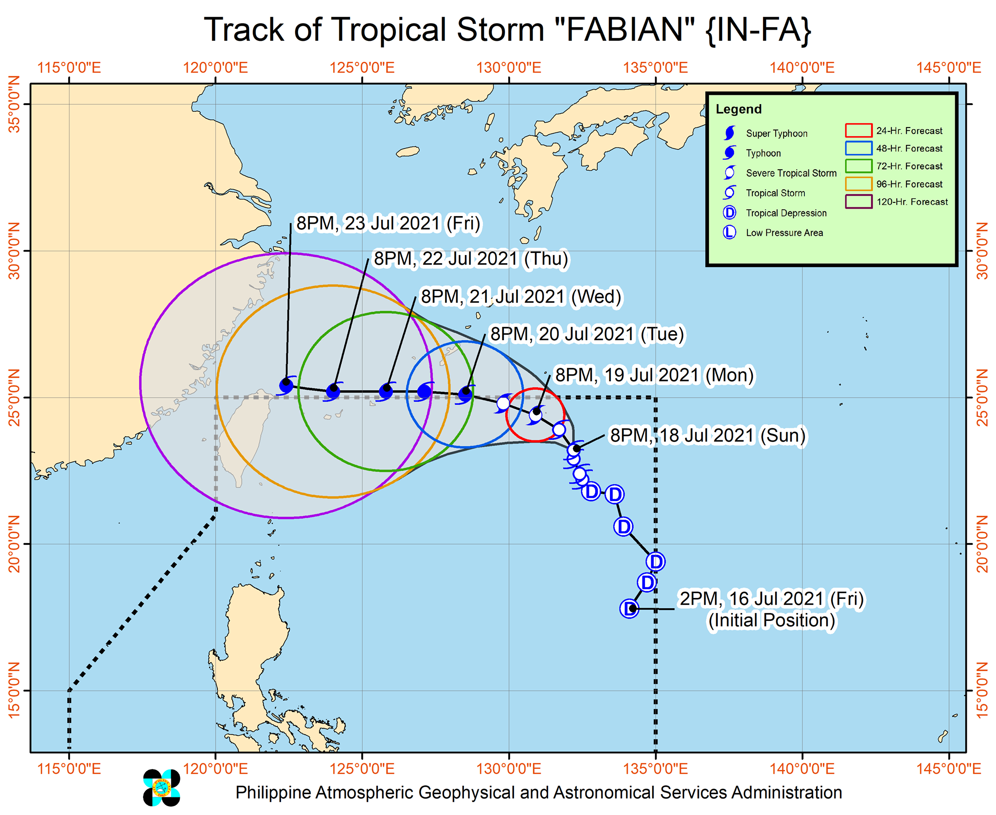
Fabian was last spotted 1,085 kilometers east northeast of extreme Northern Luzon late Sunday evening, July 18, still far from land. It is not expected to make landfall in the Philippines.
The tropical storm continued to move north northwest at only 10 kilometers per hour (km/h).
In a bulletin released past 11 pm on Sunday, the Philippine Atmospheric, Geophysical, and Astronomical Services Administration (PAGASA) said Fabian is projected to maintain a north northwest or northwest direction until Monday evening, July 19.
The forecast shows Fabian would leave PAR on Tuesday afternoon or evening, July 20. Then it may move west and pass close to Japan’s Miyako and Senkaku Islands on Wednesday evening, July 21, until Thursday morning, July 22.
But PAGASA noted that “a southward shift in the orientation” of Fabian’s track was observed on Sunday.
“If the trend continues, there is an increasing possibility that Fabian will reenter the PAR beyond Tuesday or not exit the PAR at all during the forecast period,” the state weather bureau said.
As of Sunday evening, Fabian maintained its strength, with maximum sustained winds of 75 km/h and gustiness of up to 90 km/h.
But it could intensify in the next two days, becoming a severe tropical storm by Monday afternoon and a typhoon by Tuesday afternoon. PAGASA also raised its forecast for Fabian’s peak intensity from 140 km/h earlier to 150 km/h, which may be reached on Thursday evening. (READ: FAST FACTS: Tropical cyclones, rainfall advisories)
Since Fabian remains far from Philippine landmass, it is not bringing rain to the country. But Fabian and the tropical depression outside PAR – located 830 kilometers west of extreme Northern Luzon on Sunday evening – continue to enhance the southwest monsoon or hanging habagat.
Moderate to heavy monsoon rain will affect the following areas on Monday:
- Ilocos Region
- Zambales
- Bataan
- Occidental Mindoro
- Palawan
PAGASA warned that flash floods and landslides are possible.
The enhanced southwest monsoon will also cause moderate to rough seas in the western seaboard of Palawan. Small vessels must take precautionary measures as waves will be 1.2 to 2.8 meters high, while “inexperienced mariners should avoid navigating in these conditions.”
Meanwhile, there are still no tropical cyclone wind signals raised due to Fabian.
But the state weather bureau already sees the possibility of Signal No. 1 being raised in Batanes and the Babuyan Islands, in the event that Fabian further shifts southward.
PAGASA advised disaster management officials and residents of the two areas to regularly monitor updates on the tropical storm.
Fabian is the Philippines’ sixth tropical cyclone for 2021 and the second for July.
Around 20 tropical cyclones form within or enter PAR each year. (READ: LIST: PAGASA’s names for tropical cyclones in 2021)
For the rest of 2021, these are PAGASA’s estimates per month:
- July – 1 to 3
- August – 2 or 3
- September – 2 or 3
- October – 2 or 3
- November – 2 or 3
- December – 1 or 2
The rainy season has been underway since early June. – Rappler.com
Add a comment
How does this make you feel?


There are no comments yet. Add your comment to start the conversation.