SUMMARY
This is AI generated summarization, which may have errors. For context, always refer to the full article.
The southwest monsoon or hanging habagat enhanced by Typhoon Fabian (In-fa) continued to dump intense rain in parts of Luzon on Friday, July 23.
In a bulletin issued at 11 am on Friday, the Philippine Atmospheric, Geophysical, and Astronomical Services Administration (PAGASA) provided the following rainfall forecast for the southwest monsoon:
Moderate to heavy rain, with at times intense rain
- Zambales
- Bataan
- Occidental Mindoro
Moderate to heavy rain
- Ilocos Region
- Abra
- Benguet
- Tarlac
- Pampanga
- Cavite
- Batangas
Light to moderate rain, with at times heavy rain
- Metro Manila
- rest of Cordillera Administrative Region
- Bulacan
- Oriental Mindoro
- Marinduque
- Romblon
- northern part of Palawan including Calamian and Kalayaan Islands
PAGASA said areas affected by the southwest monsoon should still watch out for scattered to widespread floods and possible landslides. This is especially crucial since many areas have experienced rainfall all week long and the soil may already be saturated. (READ: FAST FACTS: Tropical cyclones, rainfall advisories)
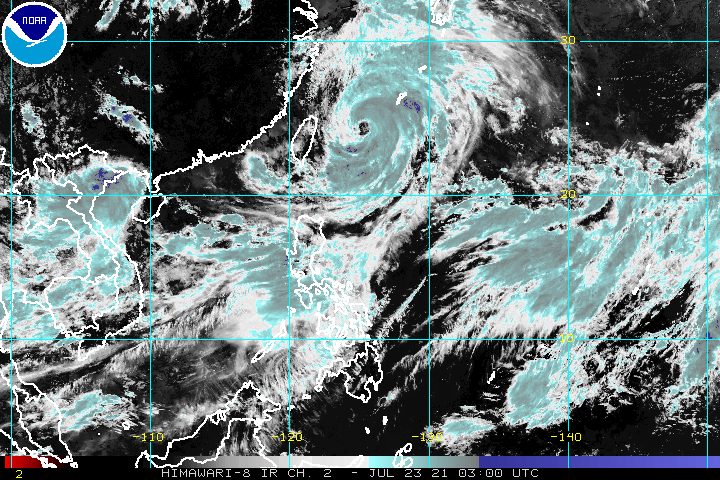
As for Fabian, it was last spotted 530 kilometers northeast of Itbayat, Batanes, moving north at only 10 kilometers per hour (km/h).
The typhoon continues to have maximum sustained winds of 150 km/h and gustiness of up to 185 km/h.
Batanes and Babuyan Islands remain under Signal No. 1, as strong winds extend up to 630 kilometers from Fabian’s center. (READ: Why is it now called tropical cyclone ‘wind’ – and not ‘warning’ – signals?)
PAGASA also said there may be occasional gusty conditions in the Visayas and the rest of Luzon, especially in coastal and upland areas, due to the enhanced southwest monsoon.
Meanwhile, the southwest monsoon and Fabian are both affecting the Philippines’ coastal waters.
The state weather bureau warned of rough to very rough seas in the seaboards of Luzon and Western Visayas. Travel is risky for small vessels.
The remaining seaboards of the country have moderate to rough seas. PAGASA advised small vessels to take precautionary measures.
In the next 48 hours, Fabian is expected to move north northwest toward the eastern part of China.
By Friday afternoon, the typhoon will pass close to or make landfall in Japan’s Miyako and Yaeyama Islands.
Between Friday afternoon and evening, Fabian could finally leave the Philippine Area of Responsibility (PAR).
The typhoon may also reach its peak intensity of up to 155 km/h on Friday evening or Saturday morning, July 24.
After its exit, Fabian would cross the East China Sea and possibly make another landfall in the eastern part of China on Sunday afternoon, July 25, or early Monday morning, July 26.
The typhoon could start to weaken on Sunday and may just be a tropical depression by Wednesday morning, July 28.
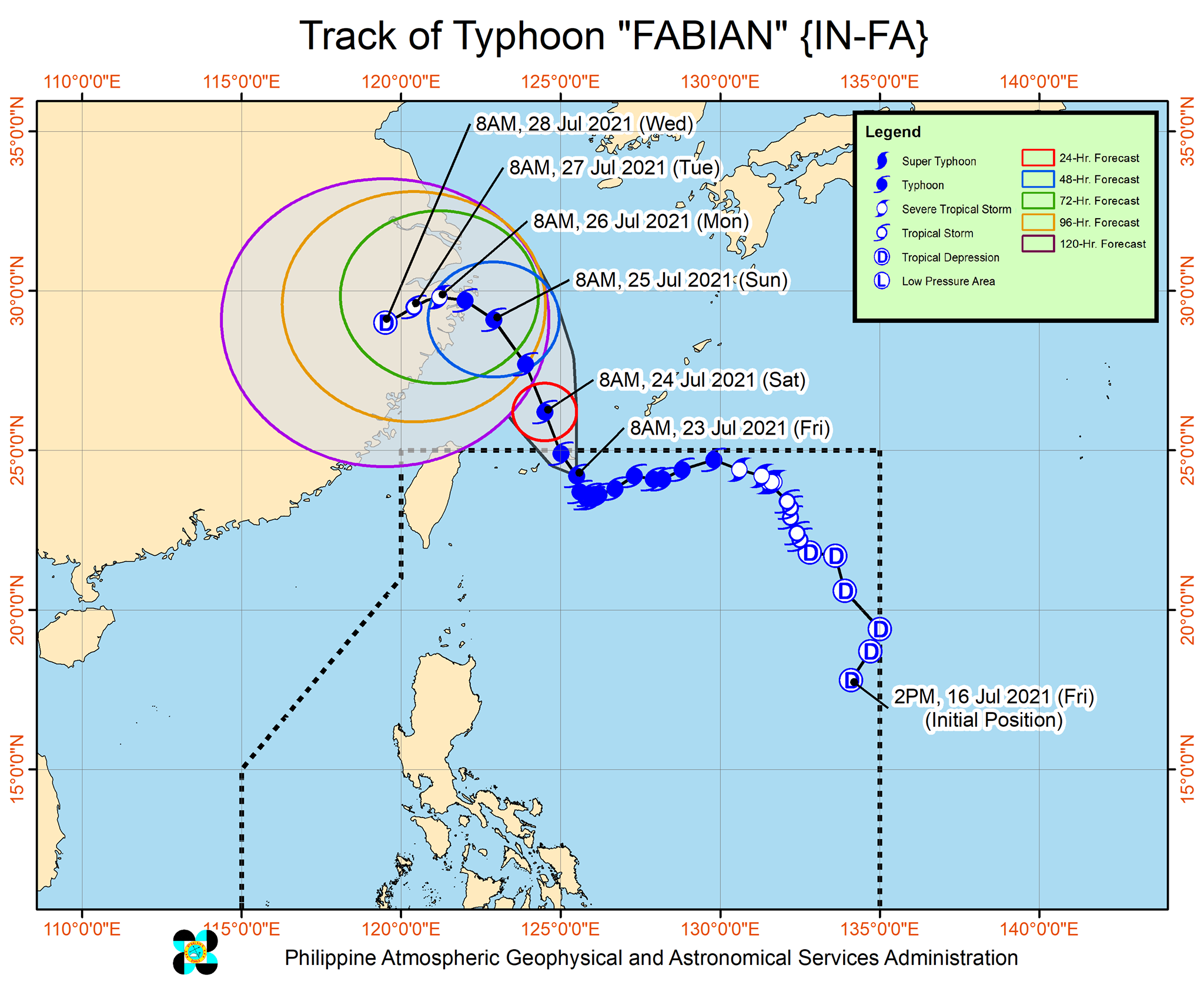
Fabian is the Philippines’ sixth tropical cyclone for 2021 and the second for July.
Meanwhile, in a briefing past noon, PAGASA announced that a new tropical depression was seen outside PAR, at 2,665 kilometers east of Itbayat, Batanes.
It is moving north northeast at 15 km/h, with maximum sustained winds of 45 km/h and gustiness of up to 55 km/h.
PAGASA said the tropical depression is heading for Japan and it is unlikely to enter PAR.
An average of 20 tropical cyclones form within or enter PAR each year. (READ: LIST: PAGASA’s names for tropical cyclones in 2021)
These are PAGASA’s latest available estimates per month:
2021
- July – 1 to 3
- August – 2 or 3
- September – 2 or 3
- October – 2 or 3
- November – 2 or 3
- December – 1 or 2
2022
- January – 0 or 1
The rainy season has been underway since early June. – Rappler.com
Add a comment
How does this make you feel?


There are no comments yet. Add your comment to start the conversation.