SUMMARY
This is AI generated summarization, which may have errors. For context, always refer to the full article.
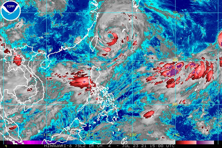
Typhoon Fabian (In-fa) weakened on Friday evening, July 23, but the impact of the enhanced southwest monsoon or hanging habagat was still very much felt in parts of Luzon.
Fabian now has maximum sustained winds of 140 kilometers per hour from the previous 150 km/h and gustiness of up to 170 km/h from the previous 185 km/h, said the Philippine Atmospheric, Geophysical, and Astronomical Services Administration (PAGASA) in a briefing past 11 pm on Friday.
The typhoon was located 560 kilometers northeast of Itbayat, Batanes, inching north northwest at only 10 km/h.
It is still bringing strong winds to Batanes, which remains under Signal No. 1.
The southwest monsoon enhanced by Fabian, meanwhile, will trigger more rain on Saturday, July 24. Below is PAGASA’s updated rainfall forecast for the next 24 hours.
Heavy to intense rain, with at times torrential rain
- Zambales
- Bataan
Moderate to heavy rain, with at times intense rain
- Metro Manila
- Ilocos Region
- Abra
- Benguet
- Tarlac
- Pampanga
- Cavite
- Batangas
Light to moderate rain, with at times heavy rain
- Laguna
- rest of Cordillera Administrative Region
- Bulacan
- Occidental Mindoro
- Oriental Mindoro
- Marinduque
- Romblon
- northern part of Palawan including Calamian and Cuyo Islands
- Antique
- Aklan
Flash floods and landslides remain threats. (READ: FAST FACTS: Tropical cyclones, rainfall advisories)
Travel in the seaboards of Luzon as well as the western and central seaboards of the Visayas will stay risky for small vessels in the next 24 hours, as both Fabian and the southwest monsoon trigger rough to very rough seas.
The remaining seaboards of the country have moderate to rough seas. PAGASA advised small vessels to take precautionary measures.
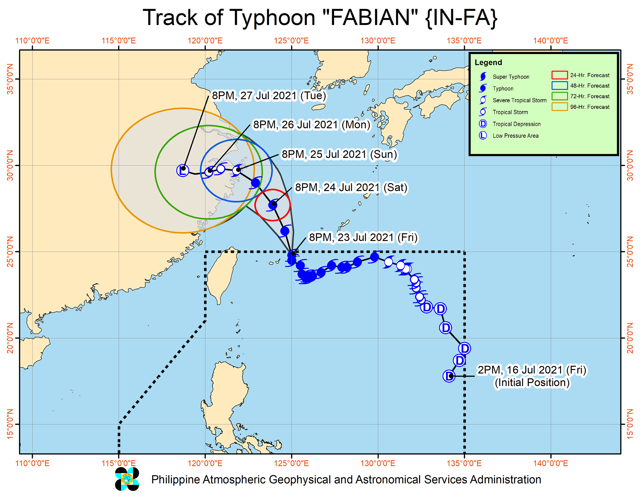
Fabian is expected to leave the Philippine Area of Responsibility (PAR) within three to six hours, or by early Saturday at the latest.
PAGASA warned, however, that the typhoon would keep influencing the southwest monsoon even after its exit from PAR.
Fabian is expected to gradually speed up while moving northwest over the East China Sea. It may make landfall in the eastern part of China on Sunday afternoon or evening, July 25.
PAGASA added that Fabian is likely to stay a typhoon until Sunday morning. But it could be downgraded to a severe tropical storm as it hits China, and rapidly weaken further after landfall.
It could just be a remnant low by Tuesday evening, July 27.
Meanwhile, the tropical depression outside PAR that is being monitored by PAGASA has intensified into a tropical storm. It was given the international name Nepartak.
Tropical Storm Nepartak was located 2,790 kilometers east of extreme Northern Luzon on Friday evening.
The latest forecast shows Nepartak is unlikely to enter PAR, but monitoring will continue.
An average of 20 tropical cyclones form within or enter PAR each year. (READ: LIST: PAGASA’s names for tropical cyclones in 2021)
Fabian is the Philippines’ sixth tropical cyclone for 2021 and the second for July.
These are PAGASA’s latest available estimates per month:
2021
- July – 1 to 3
- August – 2 or 3
- September – 2 or 3
- October – 2 or 3
- November – 2 or 3
- December – 1 or 2
2022
- January – 0 or 1
The rainy season has been underway since early June. – Rappler.com
Add a comment
How does this make you feel?


There are no comments yet. Add your comment to start the conversation.