SUMMARY
This is AI generated summarization, which may have errors. For context, always refer to the full article.
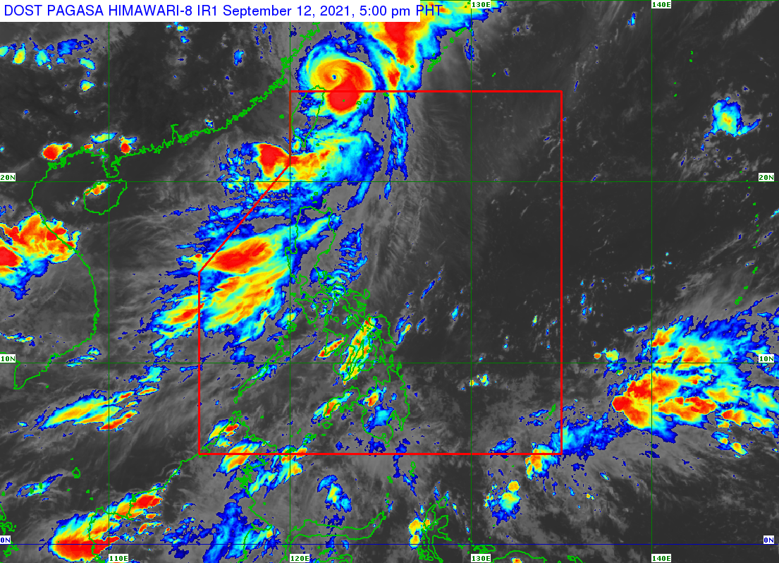
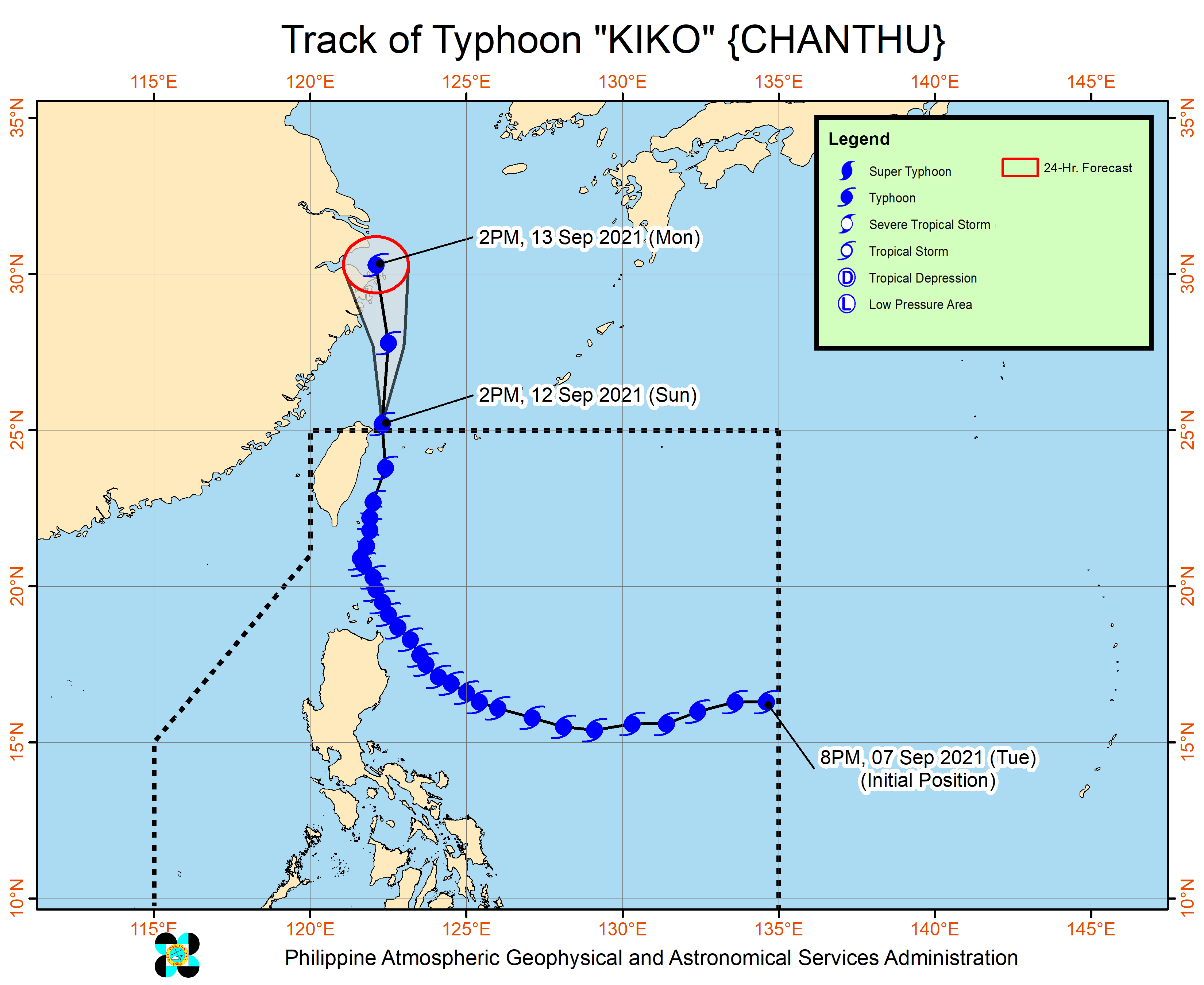
Typhoon Kiko (Chanthu) left the Philippine Area of Responsibility (PAR) at 1:10 pm on Sunday, September 12, a day after making landfall in Batanes.
Kiko was already 525 kilometers north of Itbayat, Batanes, said the Philippine Atmospheric, Geophysical, and Astronomical Services Administration (PAGASA) in its 5 pm bulletin on Sunday.
The typhoon was moving north at 25 kilometers per hour (km/h), heading for the eastern part of China.
It slightly weakened as its left, with maximum sustained winds decreasing from 175 km/h to 165 km/h and its gustiness down from 215 km/h to 205 km/h.
At its peak, Kiko had maximum sustained winds of 215 km/h – almost a super typhoon. A super typhoon has maximum sustained winds exceeding 220 km/h. (READ: FAST FACTS: Tropical cyclones, rainfall advisories)
Kiko had made landfall in Ivana, Batanes, at 8:30 am on Saturday, September 11.
With the typhoon’s exit, the remaining Signal No. 1 in effect for Batanes since 11 am on Sunday has been lifted. It is no longer bringing rain to Northern Luzon as well.
The National Disaster Risk Reduction and Management Council (NDRRMC) said on Sunday that Kiko affected 11,145 persons or 2,780 families in Cagayan Valley, the Ilocos Region, Cordillera Administrative Region, and Central Luzon.
A total of 1,647 families or 5,112 persons were preemptively evacuated, almost all of them in Cagayan Valley, based on the NDRRMC’s report.
As of Sunday afternoon, no casualties have been reported.
Kiko, however, will still enhance the southwest monsoon or hanging habagat, which continues to affect Luzon.
PAGASA reiterated that rain from the enhanced southwest monsoon could trigger flash floods or landslides.
Monsoon rain
- Ilocos Region
- Cordillera Administrative Region
- Zambales
- Bataan
- Batanes
- Babuyan Islands
Scattered rain showers and thunderstorms
- Metro Manila
- Calabarzon
- Occidental Mindoro
- Palawan
- rest of Cagayan Valley
- rest of Central Luzon
The enhanced southwest monsoon will also bring occasional gusts to the coastal and upland areas of these regions:
- Northern Luzon
- Central Luzon
- Metro Manila
- Calabarzon
- Mimaropa

Kiko was the Philippines’ 11th tropical cyclone for 2021.
An average of 20 tropical cyclones form within or enter PAR each year. (READ: LIST: PAGASA’s names for tropical cyclones in 2021)
For the next six months, these are PAGASA’s estimates for the number of tropical cyclones inside PAR:
2021
- September – 2 or 3
- October – 2 or 3
- November – 2 or 3
- December – 1 or 2
2022
- January – 0 or 1
- February – 0 or 1
– Rappler.com
Add a comment
How does this make you feel?


There are no comments yet. Add your comment to start the conversation.