SUMMARY
This is AI generated summarization, which may have errors. For context, always refer to the full article.
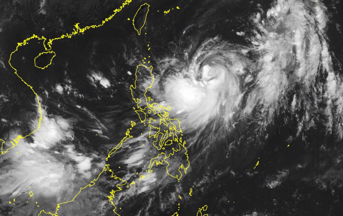
MANILA, Philippines – Jenny (Koinu) strengthened from a tropical storm into a severe tropical storm on Sunday morning, October 1, as it remained over the Philippine Sea.
Its maximum sustained winds increased from 85 kilometers per hour to 95 km/h, said the Philippine Atmospheric, Geophysical, and Astronomical Services Administration (PAGASA) in a briefing past 11 am on Sunday.
Jenny’s gustiness also rose from 105 km/h to 115 km/h.
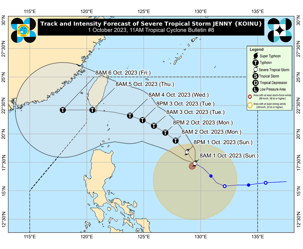
The severe tropical storm was already 790 kilometers east of Tuguegarao City, Cagayan, as of 10 am. It is moving west northwest at a slightly slower 15 km/h from the previous 20 km/h.
PAGASA updated its rainfall forecast for Jenny, now warning that the severe tropical storm’s trough or extension will affect the eastern parts of Luzon and the Visayas on Sunday. Here are the affected areas in the next three days:
Sunday, October 1, to Monday noon, October 2
- Up to 25 millimeters (mm): mainland Cagayan, Isabela, Quezon including Polillo Islands, Camarines Norte, Camarines Sur, Catanduanes, Albay, Sorsogon, Northern Samar, Eastern Samar
Monday noon, October 2, to Tuesday noon, October 3
- 50-100 mm: Batanes, Babuyan Islands, mainland Cagayan, Isabela
Tuesday noon, October 3, to Wednesday noon, October 4
- 50-100 mm: Batanes, Babuyan Islands, mainland Cagayan, Isabela, Ilocos Norte, Apayao
Floods and landslides are possible.
The weather bureau also said it may raise tropical cyclone wind signals for extreme Northern Luzon on Sunday afternoon or evening. Wind signals are raised in advance to give the public time to prepare for severe winds.
ALSO ON RAPPLER
- Carlos Yulo falls twice in nightmarish World Championships start, misses all-around final
- The future of Filipino art: Meet an organization that champions young Filipino artists, cultural workers
- Growing pains? 5 books to go with your teenage angst
- TRACKER: Minimum wages in the Philippines
PAGASA sees Jenny moving generally northwest until Monday, October 2, before turning west northwest toward the Luzon Strait on Tuesday, October 3, and west on Thursday, October 5.
It is expected to pass between Batanes and the southern part of Taiwan on Wednesday evening, October 4. Taiwan is within the Philippine Area of Responsibility (PAR).
PAGASA, however, is not ruling out landfall in extreme Northern Luzon.
Also on Monday, Jenny could intensify into a typhoon. It may reach a peak intensity of 150 km/h – referring to maximum sustained winds – by Tuesday.
Jenny is also enhancing the southwest monsoon or habagat, which will cause rain in the following areas:
Sunday, October 1
- 50-100 mm: southern part of Palawan, Zamboanga Peninsula, Basilan, Sulu, Tawi-Tawi
Monday, October 2
- 50-100 mm: Occidental Mindoro, Palawan, Western Visayas
Tuesday, October 3
- 50-100 mm: Occidental Mindoro, northern part of Palawan including Calamian, Cuyo, and Kalayaan Islands, Antique
There could be floods and landslides, too.
Gusty conditions due to the enhanced southwest monsoon are also seen in these regions:
Sunday, October 1, to Monday, October 2
- Mimaropa, Western Visayas
Tuesday, October 3
- Western Visayas, Mimaropa, Bicol, most of Calabarzon
For coastal waters, moderate to rough seas are expected in extreme Northern Luzon and the northern part of mainland Cagayan on Monday due to Jenny. PAGASA advised small vessels to take precautionary measures or avoid sailing altogether since waves could be 2 to 4 meters high.
The weather bureau added that there is a “high possibility” of a gale warning being issued in the coming days.
Jenny is the Philippines’ 10th tropical cyclone for 2023 and the second for September, having developed last Friday, September 29.
PAGASA expects four to seven tropical cyclones to form within or enter PAR from October 2023 to March 2024. For October alone, there may be two or three tropical cyclones. – Rappler.com
Add a comment
How does this make you feel?


There are no comments yet. Add your comment to start the conversation.