SUMMARY
This is AI generated summarization, which may have errors. For context, always refer to the full article.
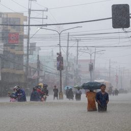
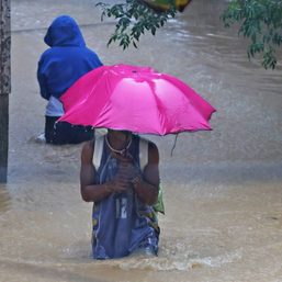
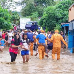
MANILA, Philippines – The southwest monsoon or habagat being enhanced by Super Typhoon Goring (Saola) and Severe Tropical Storm Hanna (Haikui) could bring a “significant amount” of rain in the next three days, the weather bureau warned on Thursday morning, August 31.
The Philippine Atmospheric, Geophysical, and Astronomical Services Administration (PAGASA) said in its 11 am advisory on Thursday that the enhanced southwest monsoon is affecting the following areas:
Thursday, August 31
- 100-200 millimeters (mm): Zambales, Bataan, Occidental Mindoro
- 50-100 mm: Metro Manila, La Union, Pangasinan, Benguet, Tarlac, Pampanga, Bulacan, Calamian Islands
Friday, September 1
- 100-200 mm: Zambales, Bataan, Occidental Mindoro
- 50-100 mm: Metro Manila, Ilocos Region, Abra, Benguet, Tarlac, Nueva Ecija, Pampanga, Bulacan, Rizal, Cavite, Calamian Islands
Saturday, September 2
- 100-200 mm: Zambales, Bataan, Occidental Mindoro
- 50-100 mm: Metro Manila, Ilocos Region, Tarlac, Nueva Ecija, Pampanga, Bulacan, Rizal, Cavite, Batangas, Calamian Islands
The moderate to intense rain may trigger floods and landslides.

The enhanced southwest monsoon is also bringing gusty conditions to these areas:
Thursday, August 31, and Friday, September 1
- Ilocos Region, Cordillera Administrative Region, Zambales, Bataan, Aurora, Bulacan, Metro Manila, Calabarzon, Mimaropa, Bicol, Western Visayas, northern part of Eastern Visayas
Saturday, September 2
- Zambales, Bataan, Aurora, Bulacan, Metro Manila, Calabarzon, Mimaropa, Bicol, Western Visayas, northern part of Eastern Visayas
For coastal waters, most seaboards of Luzon and the Visayas remain under a gale warning.
ALSO ON RAPPLER
- Bad weather prompts suspension of COC filing in NCR, Ilocos Norte, Abra
- Newsbreak Chats: How, why diplomats get away with exploiting migrant workers
- SCHEDULE: Gilas Pilipinas at 2023 FIBA World Cup
- World Cup top scorers Jones, Clarkson on collision course as classifications tip off
- No pressure, all fun: USA looks to stay perfect in 2nd round
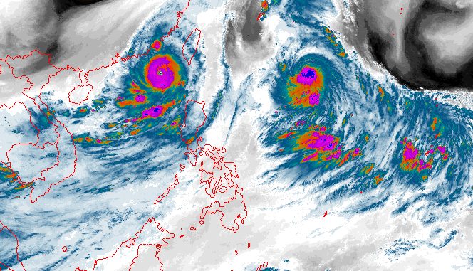
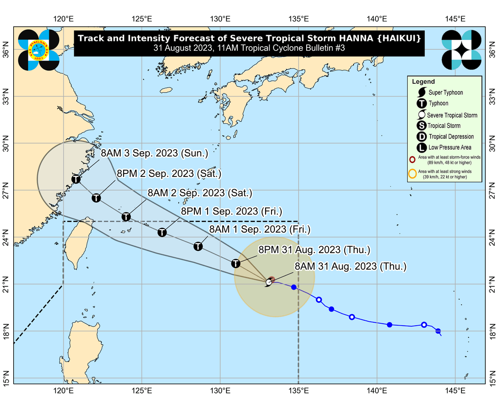
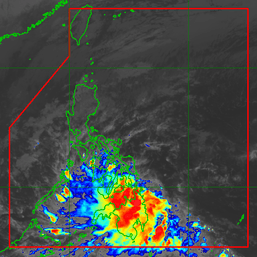
Meanwhile, Hanna intensified while slowing down over the Philippine Sea on Thursday morning.
The severe tropical storm’s maximum sustained winds increased from 95 kilometers per hour to 110 km/h. Its gustiness is now up to 135 km/h from 115 km/h.
PAGASA said Hanna may strengthen further until late Saturday, September 2, or early Sunday, September 3, when it could reach its peak intensity. It could become a typhoon as early as Thursday.
Hanna was last spotted 1,160 kilometers east of extreme Northern Luzon as of 10 am on Thursday, moving west at only 10 km/h from 20 km/h.
It is likely to stay far from Philippine landmass, so it is not expected to bring rain, winds, or rough sea conditions to the country. But its effect on the southwest monsoon is being monitored.
Hanna could leave the Philippine Area of Responsibility (PAR) on Friday, September 1, then make landfall in mainland China on Sunday. “Rapid weakening will ensue following its landfall over mainland China,” the weather bureau said.
Goring, which left PAR on Wednesday evening, August 30, continues to move away. Earlier at 3 am on Thursday, the super typhoon was already 335 kilometers west of Itbayat, Batanes.
Goring and Hanna are the Philippines’ seventh and eighth tropical cyclones for 2023, respectively.
For the next 6 months, PAGASA estimated that 6 to 9 tropical cyclones may form within or enter PAR:
- September 2023 – 2 or 3
- October 2023 – 2 or 3
- November 2023 – 1 or 2
- December 2023 – 1 or 2
- January 2024 – 0 or 1
- February 2024 – 0 or 1
– Rappler.com
Add a comment
How does this make you feel?


There are no comments yet. Add your comment to start the conversation.